The UK's winter 'weather bomb' in maps
- Published
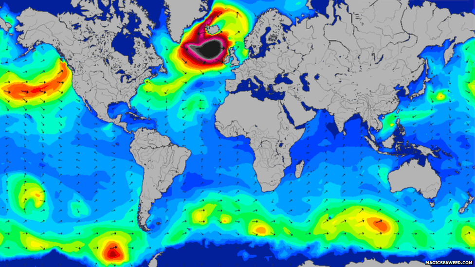
It started with a surf report. On Monday Devon-based website Magicseaweed.com began to warn of swells of up to 40ft (12m).
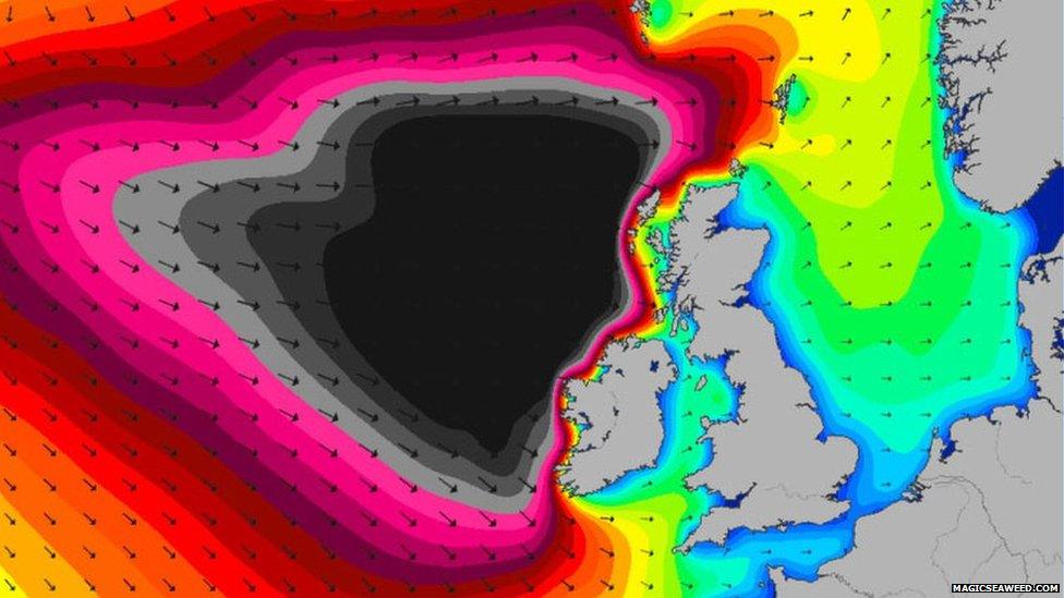
Dubbed "Black Wednesday", as the storm approached it was identified as a explosive cyclogenesis, known as a "weather bomb".
What is a weather bomb? BBC weather's Peter Gibbs explains
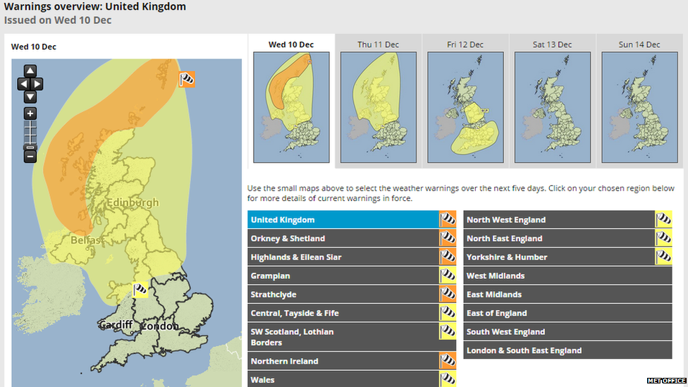
Throughout Tuesday, Met Office alerts were issued, with amber warnings put in place, external for parts of Scotland and Northern Ireland.
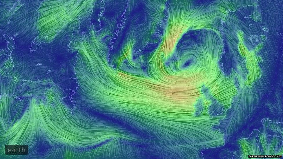
The swirling low pressure funnelled high winds across the North Atlantic, as wind modelling website earth.nullschool.net, external showed.
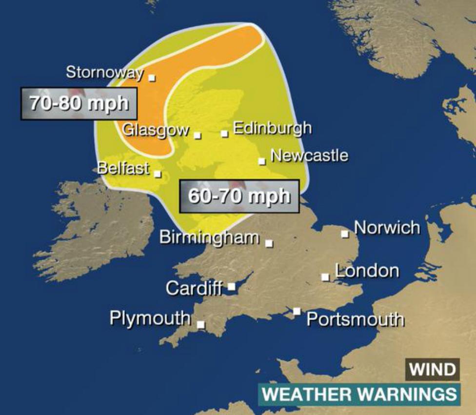
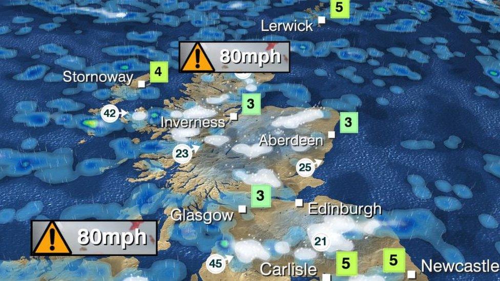
With the winds came gusts topping more than 80mph in some areas and huge waves crashing against the coast.
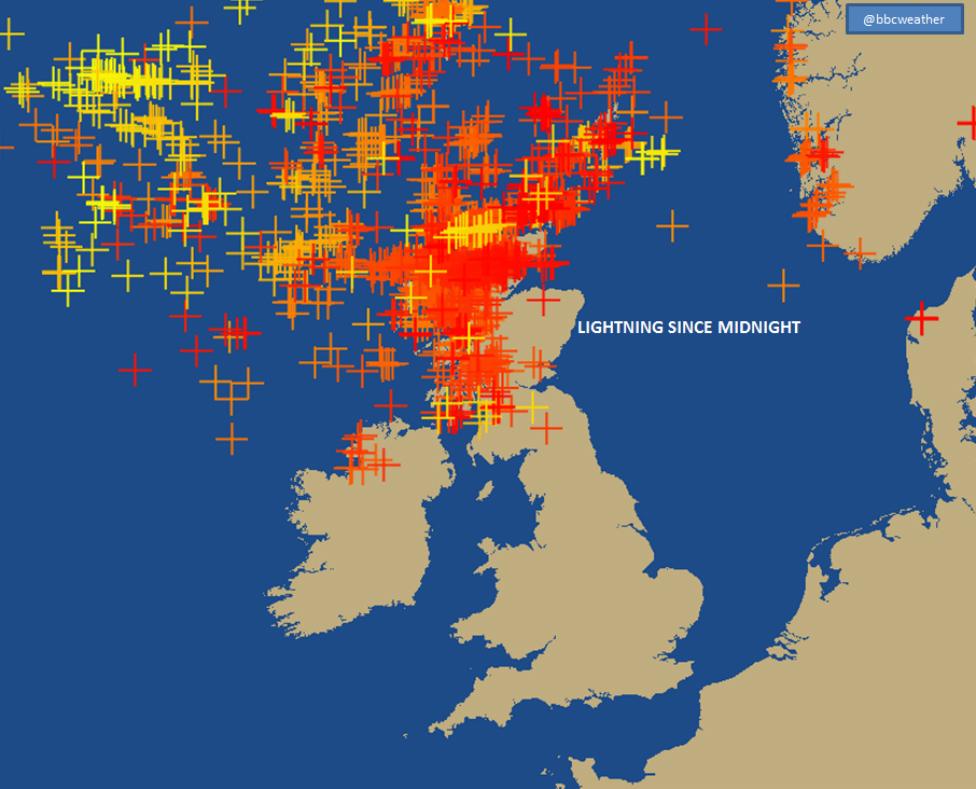
And meteorologists also recorded intense strikes of lightning across the west.
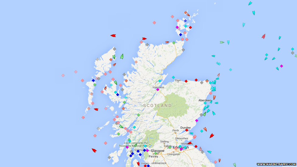
Despite ferry cancellations and a fishing boat rescue off the north coast, marinetraffic.com, external showed commercial traffic was still sailing.
Forecasters had plenty to keep across and warned of wintry and blustery conditions throughout "Black Wednesday" and on into Thursday.
Along with the wind and waves and rain comes the danger of flooding. So here's an interactive map of flood warnings.
Note: the Environment Agency and the Scottish Environment Protection Agency display their flood alert data differently. While the Environment Agency highlights individual rivers only, in Scotland the entire region is coloured to indicate the level of alert.
And back to the bigger picture, the west of Scotland remains in the wake of a "weather bomb" producing the most intense waves on the planet.

Are you affected by the severe weather in the UK? You can send us your pictures or videos to yourpics@bbc.co.uk and your experiences to haveyoursay@bbc.co.uk, external
Alternatively, you can text them to 61124 (UK) or +44 7624 800 100 (International). If you have a large file you can upload here, external.
Read our terms and conditions, external.
