Flood warnings as Storm Frank due across parts of Scotland
- Published

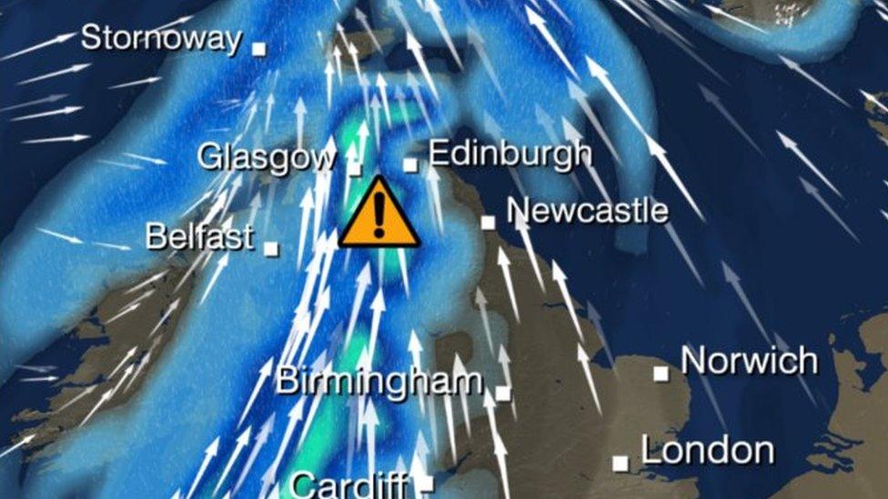
Scots have been advised to prepare for a wet and windy end to the year with Storm Frank due to sweep across much of the country on Tuesday into Wednesday.
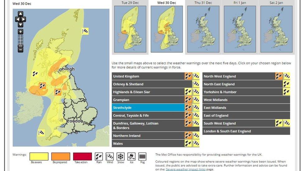
The Met Office has issued weather warnings for wind, followed by heavy rain.
The Scottish Environment Protection Agency (Sepa) said parts of the country should prepare for flooding.
Transport Minister Derek Mackay urged motorists to plan their journeys in advance and take extra care.
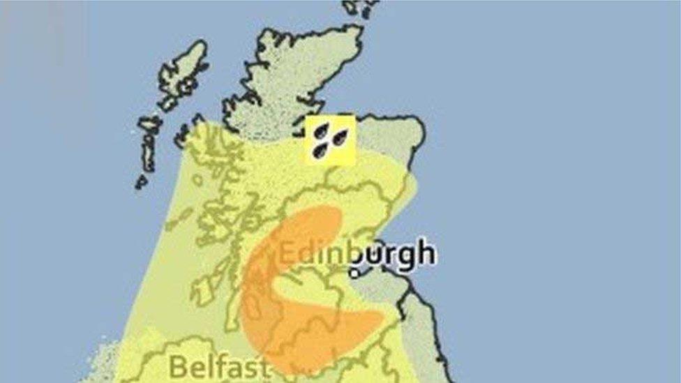
Forecasters said persistent rain was expected in central and southern areas for Tuesday into Wednesday, with an amber "be prepared" warning, external in place.
Dumfries and Galloway, the Scottish Borders, and parts of Strathclyde and Tayside could be badly affected with potential for flooding.
The amber warning of rain has now been extended eastwards into Angus, Aberdeenshire and the Borders.
A yellow "be aware" warning for wind on Tuesday night into Wednesday was also extended to cover much of Scotland.

The Met Office said: "A waving cold front is expected to become slow moving over western Britain during Tuesday night and for much of Wednesday, associated with a strong, moist south-westerly airflow.
"Rainfall accumulations through this period are expected to be widely 20-40mm (0.8-1.6in), with 80mm (3.2in) over some higher ground within the area, and the potential for some exposed locations in south-west Scotland to receive 100-150mm (4-5.9in)."
Mr Mackay said: "Surface water and spray could make driving conditions difficult and there may be some localised flooding.
"We will have patrols on the main routes to do all they can to keep the roads running and our teams out on the network to clear drainage systems in advance of the heavy rain.
"Drivers should travel with extra care and drive to the conditions. We strongly advise all road users plan their journeys in advance by checking the Traffic Scotland website and Twitter feed for the latest information before setting off on your journey and factor in extra time as travel may take longer than usual."
Sandbag stores
Sepa said high tide on Monday could bring some isolated instances of spray and wave overtopping which may lead to minor flooding of coastal roads in the Solway Firth.
Scottish Borders Council held an emergency meeting on Monday morning to plan and prepare for "potentially significant rainfall and flooding".
It said the area of most concern was Peebles and the Upper Tweed.
Sandbag stores across the region were full and about 20,000 empty bags held by the council were being filled.
Jim Fraser, Scottish Borders Council's Emergency Planning Officer, said: "In addition to filling all sandbags, the council is putting in place plans for resources and equipment to be available at key locations from Tuesday evening.
"To minimise the potential for flooding in vulnerable areas of Selkirk, we have been given permission from Sepa release water stored in St Mary's Loch over the next 24 hours to enable the greatest possible amount to be stored in the loch once the rain starts to fall on Tuesday evening.
"Staff from the Selkirk Flood Protection Scheme will also be on the ground throughout Tuesday night and Wednesday to act if necessary, as they did successfully during Storm Desmond."
- Published27 December 2015
