Brechin: Hundreds evacuated as torrential rain threatens flood defences
- Published

Residents of Brechin are doing what they can to protect their homes as rain continues to fall in the town
Hundreds of people in Brechin are being evacuated as exceptional rainfall from Storm Babet threatens to breach flood defences in the town.
Angus Council said residents in about 400 homes are being told to leave.
It comes as a red alert for rain and wind has been extended to a wider area of Scotland.
The warning came into effect at 18:00 and now covers an area from southern Aberdeenshire and Angus to the outskirts of Dundee and Perth.
Amber and yellow warnings are also in place in other areas of the UK.
The Met Office red weather warning runs from 18:00 on Thursday until noon on Friday, with the storm predicted to bring about 220mm (8.5in) of rain in some areas of eastern Scotland, an amount close to the highest ever 24-hour total for a "rainfall day".
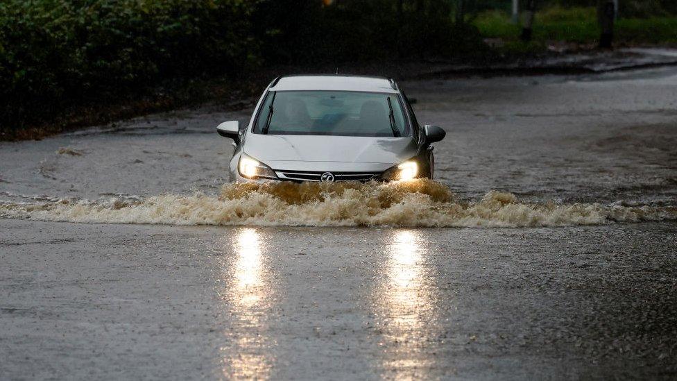
Residents have been warned of a danger to life from fast flowing or deep floodwater, with extensive flooding to homes and businesses and landslips also possible.
There have also been reports of high winds bringing down trees on several roads.
Angus Council said that as well as about 335 properties in Brechin, an additional 87 households in the nearby villages of Tannadice and Finavon had been told to evacuate "for their own safety".
Rest centres were opened from 15:00 at Montrose Sports Centre and Brechin and Forfar community campuses.
People were asked to bring their own sleeping bags and any supplies and medications they will need.
Police Scotland's advice is to avoid any form of travel in the areas covered by the red warning.
Assistant Chief Constable Stuart Houston said: "Driving conditions will be extremely dangerous with disruption expected.
"It's important that everyone considers the amber warnings that still remain in place for rain and wind. This will present a particular challenge to high-sided vehicles - so please consider whether these journeys are essential."

Waves have been crashing over Stonehaven Harbour, where the pier has been closed
It said it was working to identify vulnerable residents who will need additional support.
SSEN, which provides electricity to homes in the north of Scotland, reported widespread power outages, external on Thursday afternoon.
Train and bus services in the affected areas have been cancelled and driving conditions are likely to be treacherous because of spray and flooded roads.
Gas, water and mobile phone services could also be affected, with some communities potentially being completely cut off for several days.
The Met Office issues a rare red warning for rain

Michael Hunter, BBC Scotland News producer in Brechin
The rain and wind is heavy and persistent and the town's river is already getting very high. But there's no sense of panic just yet in the area of the town where many homes are set to receive evacuation orders from Angus Council.
We've spoken to a handful of residents still in their homes in and around River Street. They say they're awaiting orders from the authorities.
Locals who've seen this area alongside the River South Esk flooded many times over they years told us they expect the banks to burst at about 17:00.
There's still plenty of traffic on the roads. And even a few hardy souls out walking. Though things could look very different here come 18:00, when that rare red weather warning comes into force.
The areas at the centre of the storm were already heavily saturated after heavy flooding earlier this month.
Scottish Environment Protection Agency flood unit manager Pascal Lardet said there was a specific focus on the Brechin area, which has suffered bad flooding in the past.
He said the water level around the Angus town, which has a population of about 7,000 people, was expected to be "close to the top" of the flood defences, with a significant risk that water going over the top would lead to a "rapid inundation" to surrounding areas.
Mr Lardet said he was particularly concerned this could happen overnight into Friday.
He added: "Take action now to protect yourself and your property.
"Hazards can be hidden, so please don't walk or drive into flood water.
"Remember that not only is flood water likely to be dirty, 30cm of fast flowing water can move an average family sized car, and just 15cm of fast flowing water could be enough to knock you off your feet."

Christopher McGuire feared his home would be flooded during the storm
Christopher McGuire was among the many Brechin residents in the town doing what they could to safeguard their homes as heavy rain fell on the town on Thursday afternoon.
He said his back garden was badly flooded just two weeks ago, and he now fears the water could come over his back wall.
Mr McGuire added: "If it's up river and comes down to the catchment area, that's the problem. We've got plenty of ground still fairly wet from two weeks ago and I think it'll come over."

What is a red weather warning?

John Stewart with his flood defence outside his home on River Street, Brechin
Red is the most severe of the Met Office's three coloured weather warnings.
It means that dangerous weather is expected and, if you have not already done so, you should take action now to keep yourself and others safe from the impact of the severe weather.
It is very likely that there will be a risk to life, with substantial disruption to travel, energy supplies and possibly widespread damage to property and infrastructure.
You should avoid travelling, where possible, and follow the advice of the emergency services and local authorities.
You can read more about the weather warning system here, external.
A Met Office spokesperson said affected areas could see more than a month's worth of average rainfall within 24 hours.
They said the ground in many affected areas was still saturated following the wettest two-day period on record, external earlier this month.
Some 238mm of rain was measured at Sloy Main Adit in Argyll and Bute between 09:00 on 17 January 1974 and 09:00 the following day - the highest total on record in Scotland for what the Met Office calls a "rainfall day".
Related topics
- Published19 October 2023