Flood work to affect Inverness city centre streets
- Published

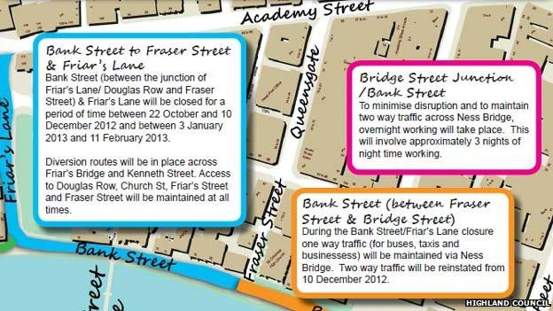
Highland Council has produced a map showing the restrictions
Details on how traffic will be diverted during the first stage of constructing the £21m River Ness Flood Alleviation Scheme in Inverness have been set out.
Some streets will temporarily become one way systems and others will have parking restrictions.
Affected areas will include Bank Street, Huntly Street and Friar's Street.
The work will include the building of walls on both sides of the river between Ness Bridge and Friar's Bridge.
Construction for the first stage will start next month.
The full scheme - which has been designed to protect about 800 homes and 200 businesses in the city centre - is likely to take until April 2015 to complete.
The Scottish government will fund 80% of the cost of the building work.
Some of the diversions and parking restrictions will be in place until the end of the year, but others will remain until the project is finished.
Highland Council has produced a map showing the restrictions.
- Published13 August 2012
- Published17 March 2012
- Published2 November 2011