Winds of up to 100mph forecast for northern Scotland
- Published

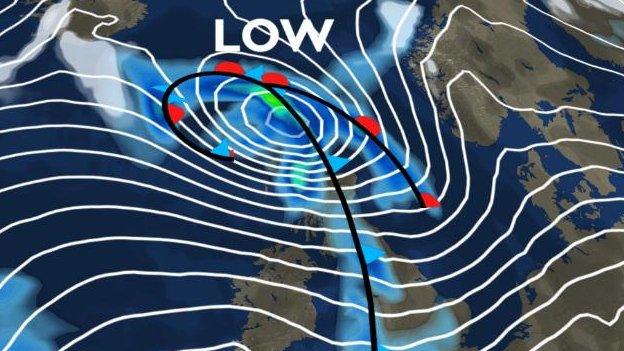
A low pressure will sit over Scotland on Thursday night
Two Atlantic storms are expected to batter northern Scotland, with winds gusting to speeds of up to 100mph, forecasters have warned.
The Met Office has issued amber 'be prepared' warnings, external for the Highlands, Western Isles and Orkney for Thursday and Friday.
A yellow 'be aware' warning of high winds for the rest of Scotland and north England has also been issued.
It warns of high winds from Thursday through to Saturday.
Police Scotland has urged people, particularly motorists, to take sensible precautions during the bad weather.
Supt Stewart Carle said: "During this period of extreme weather, Police Scotland Road Policing crews will be patrolling the road network in order to keep people safe.
"Please be aware of the advice being issued, and drive with extra caution and use common sense in challenging situations."
The warnings came as BT continued to repair phone lines damaged by bad weather last month.
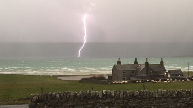
A spokesman for the communications giant said electrical storms that affected phone services in the Hebrides, Argyll and Orkney were the worst seen in almost 50 years.
The lightning came during a storm that started in the Arctic where it had rapidly developed in strength in a process known as explosive cyclogenesis, or what some scientists and forecasters referred to as a "weather bomb".
Lightning struck 5,000 times across the Western Isles and northern Scotland during Wednesday 10 December and the following day, according to Scottish Hydro Electric Power Distribution (SHEPD).
As well as affecting phone lines, tens of thousands of people lost power.
Hailstones as big as pickled onions also fell over Ness in the north of Lewis during thunderstorms.
The Met Office issues an amber be prepared warning for heavy rain and strong winds for much of Scotland on Friday

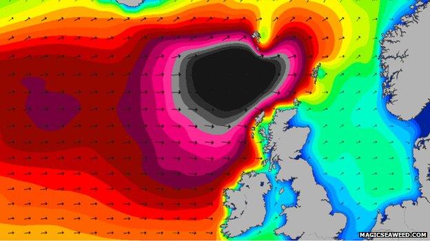
Large sea swells have been forecast for the sea off Scotland on Friday and Saturday
The Met Office said this week's bad weather was likely to begin on Wednesday, with strong winds affecting the north of Scotland.
Later in the week, exposed places in parts of northern Scotland could experience winds gusting to 100mph.
The Met Office said the jet stream, a narrow band of fast-moving winds high up in the atmosphere, was playing a role in the development of the two Atlantic storms.
Chief meteorologist Frank Saunders said: "The jet stream is going to be particularly strong later this week and this effectively fuels the low pressure systems moving across the Atlantic, causing them to deepen rapidly as they pass to the north of the UK.
"This will bring some very strong winds across the UK, but they will most likely be strongest in northern Scotland - which is expected to see the greatest impacts from the weather.
"This is likely to cause disruption in places and people should stay up to date with our forecasts and warnings to get the latest information as we move closer to the end of the week."
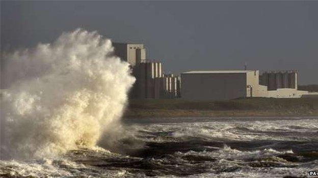
Last month's bad weather created huge swells in the sea off Scotland leading to warnings from the Coastguard and RNLI.
South Devon-based website Magicseaweed.com, which provides surfers with swell charts and surf forecasts, forecasted swell of up to 40ft off Scotland.
The site has forecast large swell again for Friday and Saturday off northern Scotland.
Check out the latest travel news for Scotland

Around the country
For the latest on the roads visit the BBC's travel news page and keep up to date with incidents and roadworks on the motorways here.
Around the country you can check for updates from:
Alternatively, for regular travel bulletins listen live to BBC Radio Scotland and follow @BBCTravelScot, external.
In times of severe disruption you can also follow the BBC Scotland severe weather Twitter list, external of key sources.
Below are a number of other traffic information sources.
Other links
- Published19 December 2014

- Published11 December 2014

- Published12 December 2014

- Published11 December 2014
