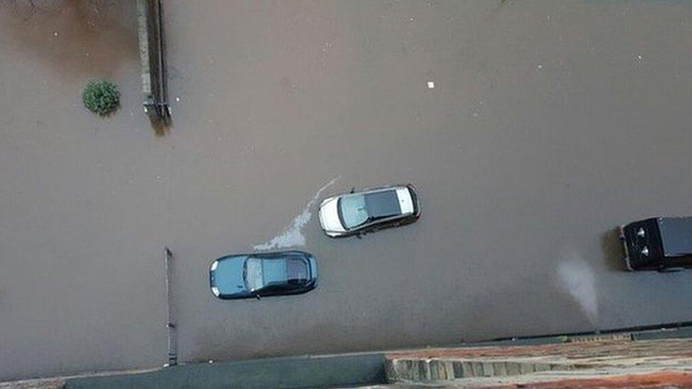
Scotland has second wettest February on record
- Published
- comments

February in Scotland was not a month for sun worshippers
Scotland had its second wettest February on record - although the north east of the country managed to find shelter from the worst of the weather.
Met Office figures showed only the February of 1990 had more rainfall.
This February's 275.6mm figure was 213% above a 1981-2010 climate baseline. Only Wales was wetter in the UK.
The Met Office blamed the wet weather on a succession of Atlantic storm systems crossing the UK, including Ciara, Dennis and Jorge.
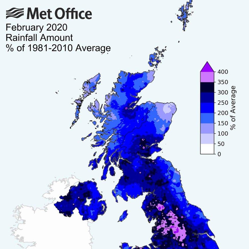
Many parts of Scotland suffered an unusually wet February

Central and southern Scotland bore much of the brunt of the worst of Scotland's wet February weather, with some areas experiencing more than three times the usual rainfall.
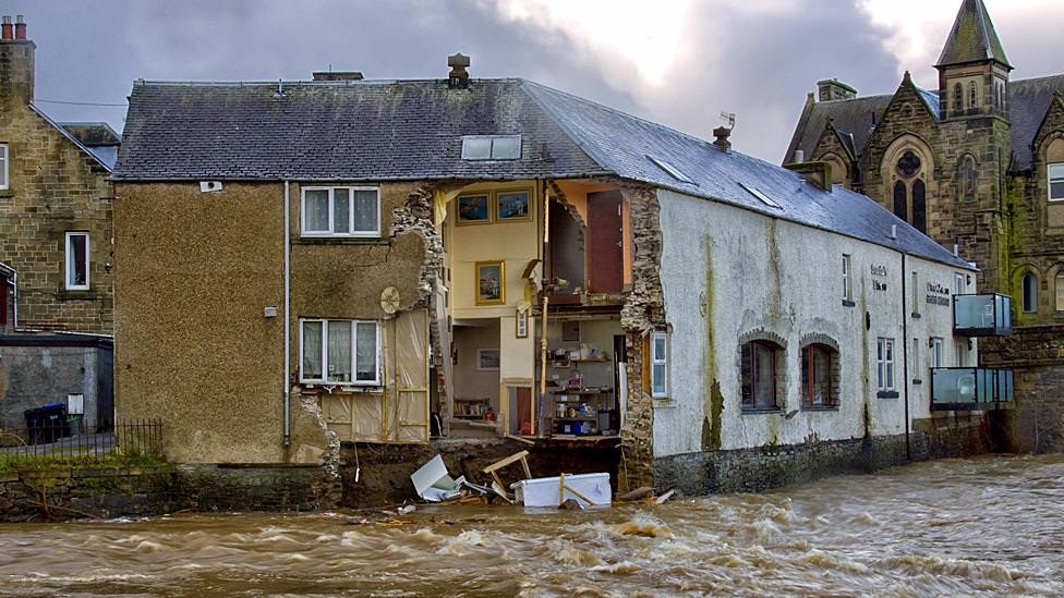
This included dramatic scenes in Hawick, when parts of a guest house and a neighbouring restaurant were caught on film being washed away in the River Teviot.
Ryan McGee captured the moment a building collapsed into the River Teviot
February was the wettest February on record for England, Wales and Northern Ireland.
Over the winter months of December, January and February as a whole, the picture for Scotland was replicated, with the eastern side of the country drier than on average.
It was the fifth wettest winter on record for the UK as a whole, going back to 1862.
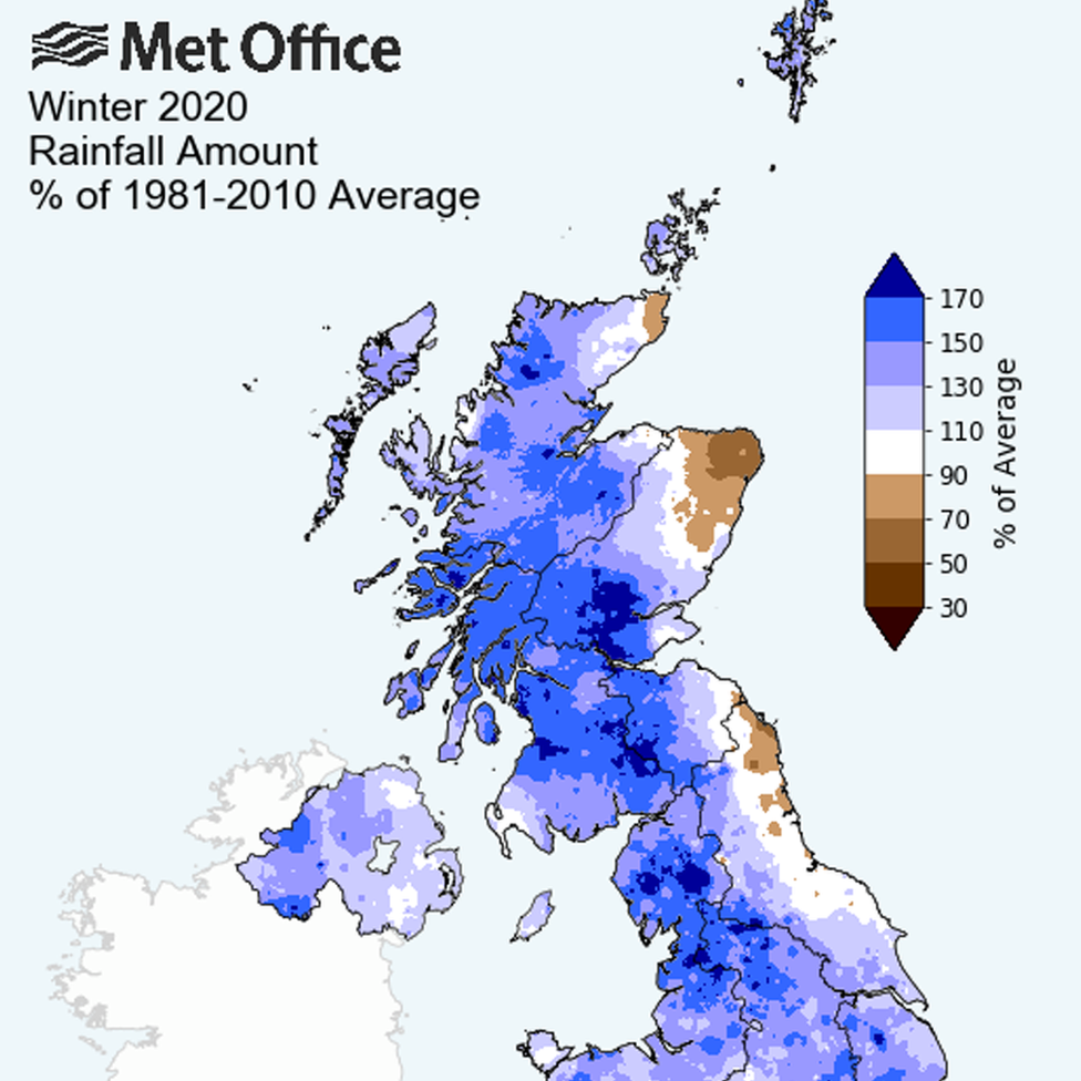
Winter as a whole was drier than normal for eastern Scotland

The Met Office said: "Since 1998, we have seen six of the 10 wettest years on record.
"However, rainfall patterns in the UK have always shown a large range of natural variation, which makes it more difficult to unambiguously identify long-term trends linked to climate change."


It was blue skies in Aberdeen and the north east for much of February
Analysis by Christopher Blanchett, BBC Scotland senior weather presenter
Whilst it's been Scotland's second wettest February on record, the country-wide statistics hide bigger numbers.
Edinburgh and Glasgow both saw more than three times their usual February rainfall. The Central Belt cities had their wettest Februarys on record, along with Eskdalemuir in Dumfriesshire, Strathallan in Perthshire and Tain Range near the Dornoch Firth.
Meanwhile, the north east of Scotland saw fairly average rainfall, with Aberdeen recording only a third more than normal and Fyvie Castle in Aberdeenshire seeing 97%. However, most of the rainfall recorded in the north east fell on just one day: 24 February. Until then, it had been very dry.
Well, for much of the past month we've seen a powerful jet stream raging in the skies above us. The jet is a fast-moving ribbon of wind way up in the atmosphere, running west to east here in the northern hemisphere. It influences the path of weather systems as well as the strength of them.
The static position and power of the jet has meant we've seen a series of storms moving across the UK, leaving little respite for areas that have had persistent rain.
It's also meant that the north east of Scotland has escaped the brunt of the impacts, due in a large part to the Grampian mountains.
When our weather is coming in from the west, the mountain range is perfectly placed to provide a rain shadow for parts of the north east, effectively acting like mother nature's road block, not allowing the rain past.

The Met Office added: "The weather looks likely to remain rather wet and windy into the middle of March, especially in the north."
John Curtin, executive director for flood risk management at the Environment Agency, said: "Record February rainfall and river levels have tested the nation's flood defences. However, we have been able to protect over 80,000 homes thanks to the action we have taken.
"Every flooded home is a personal tragedy, and with a changing climate we will need to become more resilient to flooding. I'd urge the public to be aware of their flood risk, sign up to flood warnings, and make a flood plan if they are at risk."
- Published1 March 2020
- Published17 February 2020
- Published10 February 2020
- Published9 August 2019
- Published5 January 2016
