Polluted Neath Road in Swansea to divert traffic away
- Published

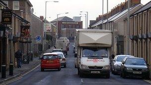
Neath Road in Hafod, Swansea, is a designated as an air quality management area
A main road into Swansea city centre is to have traffic diverted elsewhere to stop it breaking European pollution levels.
Neath Road in Hafod is long and narrow which means at busy times and in warmer weather, air cannot escape.
Air, traffic and weather monitoring equipment will send messages to electronic signs in the city telling traffic to use other routes when pollution reaches higher levels.
The system has been trialled in Sweden.
In the short term, motorists will be asked to use alternative routes, but plans are in place to create a relief road in the next few years.
John Hague, Swansea council's cabinet member for the environment: "We have been monitoring air quality in the Hafod part of the city for many years after declaring the area an air quality management area.
"The latest plan will enable us to monitor traffic flows on main routes into and out of the city through Hafod, along with monitoring air quality.
"The data collected will be used to inform motorists about alternative routes during their journey. This should help improve air quality along the routes."
Traffic problems
The section of Neath Road that is affected runs from the Liberty Stadium to the traffic lights at Dyfatty.
It is mostly a narrow street with terraced housing and shops running virtually all the way along it on both sides.
It has suffered for a number of years with traffic problems and Hafod has been designated as an air quality management area since 2001 because pollution in the air exceeds safe levels.
Heavy goods vehicles are already banned from driving on the road in 1999, and speed bumps were removed in 2007 to help ease traffic flow.
Buses have also been diverted from Neath Road to another road running alongside.
The new system, known as the "Swansea Nowcaster System" will be able to measure the traffic flow, air quality and weather in real time.
It will use all the information together to determine if the pollution levels are likely to break European restrictions within a few hours.
The software, which is being tailored for use in Swansea, will then be able to send messages to electronic road signs near to Neath Road which warn people to use other routes.
The whole project is costing around £100,000 and is expected to start in the next few weeks.
Swansea council says this is the first time in the UK that such a scheme has been used.
'Dangerous'
"The problem has got worse over the last few years," said councillor Rob Speht, who serves the Landore ward.
"Neath Road is a very built-up residential area. The houses are continuous along each side creating a canyon effect.
"As the cars go along the road, particularly going slowly at peak times and if it's not very breezy, a lot of the exhaust emissions cannot escape.
"It's quite dangerous for residents who live there."
The EU restricts emissions of nitrogen dioxide and other pollutants because of their health impacts. Very high levels can cause inflammation of the lungs.
In 1999, the EU set an objective for every member state to lower nitrogen dioxide levels to fewer than 40 micrograms per cubic metre of air by 2010.
But many EU countries, including the UK, had problems meeting this deadline and were granted extensions until 2015.
Mr Speht said "several times" a year the emissions along Neath Road break the law.
A relief road, known as the Morfa Distributor Road, is being planned and will run from the Liberty Stadium along the River Tawe to a new housing development behind phase two of Parc Tawe shopping outlet.
It is hoped the road, which is driven by private developments, would open in the next couple of years and act as an alternative route to Neath Road.
See an air quality webcam of Neath Road in Hafod, Swansea, external