Punggye-ri: What we know about North Korea's nuclear test site
- Published

North Korea has conducted six nuclear tests since 2006 and every time it has used the Punggye-ri test site.
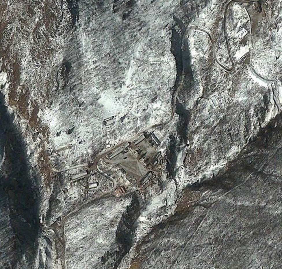
Situated in mountainous terrain in the north-east of the country, it is thought to be the North's main nuclear facility and the only active nuclear testing site in the world.
But scientists believe the site has partially collapsed and may be unusable.
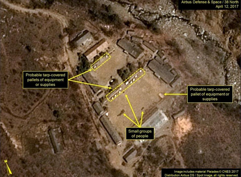
Much of what we know about it is gleaned from satellite imagery and tracking the movement of equipment at the location.
So what do we know?
The nuclear tests have taken place in a system of tunnels dug below Mount Mantap, near the Punggye-ri site.
North Korea watchers study the details of the excavation of these tunnels to get clues on whether the country is preparing for another nuclear test.
Ahead of its most recent nuclear test on 3 September 2017, some had pointed to satellite imagery from August, which showed that the site was in a standby state - indicating readiness for a test.

Earlier in the year more tunnelling or excavation work had been detected and unidentified equipment had been placed outside one of the tunnels.
The test devices are buried deep at the end of the tunnels, which end in a hook. The tunnel gets backfilled to prevent radioactive leakage and then the device is detonated.
What about the alleged collapse?
Scientists say part of the site collapsed eight and a half minutes after the test in September. It was a "near-vertical on-site collapse towards the nuclear test centre", Chinese researchers reported.
The US Geological Survey recorded a second seismic event about eight minutes after the test, which it assessed as a "collapse" of the cavity.
Two aftershocks were detected as late as December, prompting concerns about the stability of the surrounding mountains.
What is nearby?
We know more about Chinese cities and towns along the border with North Korea than we do about populations that might be closer to the test site inside North Korea.
People in several Chinese border cities reported feeling the tremors from the seismic activity at the time of the test.
School children ran out into the open in the city of Yanji, which is 10km (6.25 miles) from the border, when they felt the shaking, Global Times reported.
Very close to the site is Punngye-ri village and about 80km away is the North Korean city of Chongjin, but it is not known if these towns were evacuated or warned in any way.
Is there a real risk of radiation?
North Korea claimed that no radiation leaked when it conducted its latest test.
China's Nuclear Safety Administration and South Korea's Nuclear Safety and Security Commission do conduct emergency monitoring for radiation immediately after the tests.
Experts at the analysis group 38North, who closely track the North's nuclear activities, said that radionuclides, products of the nuclear reactions that are released into the atmosphere, were detected and traced back to a previous nuclear test, in February 2013.

They also pointed to the second seismic event. Minutes after the initial seismic event was picked up by sensors when the test occurred, there was another smaller one with a magnitude of 4.6.
After previous tests authorities have usually reported very small amounts of radioactive particles or gases in neighbouring countries, although there is no way to test for the amounts inside North Korea.
- Published4 September 2017

- Published3 September 2017
