India and China race to build along a disputed frontier
- Published

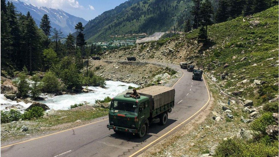
India is building a number of roads and bridges in the Ladakh region
India and China are trying to out-build each other along their disputed Himalayan border.
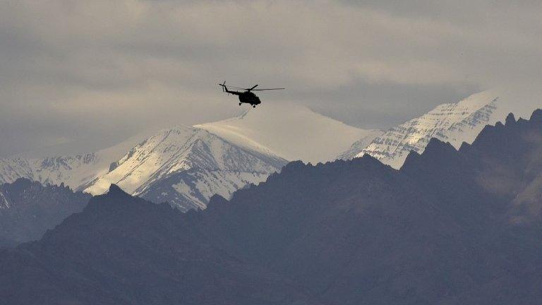
A new road to a high-altitude Indian forward air base is said to have been one of the main triggers for a clash with Chinese troops last month that left at least 20 Indian soldiers dead.
The 255km (140-mile) Darbuk-Shyok-Daulat Beg Oldi (DSDBO) road - which winds through mountain passes up to the world's highest airstrip more than 5,000m above sea level in the Ladakh region - was finished last year after nearly two decades of work. Its completion could increase India's ability to move men and materiel rapidly in a conflict.
The 15 June clash, in Ladakh's Galwan Valley, gave rise to concerns that tensions between the two nuclear powers could boil over. They have never agreed on the exact position of their 3,500km border, and their armies - two of the world's largest - come face-to-face at many points along the rough, inhospitable terrain.


Both India and China have devoted money and manpower to building roads, rail links and airfields along the Line of Actual Control (LAC) - the de facto boundary separating them - as well as modernising their military hardware in the region.
India's recent building work, including the DSDBO road, appears to have infuriated China - but China has been busy building along the border for years. Both sides tend to view the other's construction efforts as calculated moves to gain tactical advantage, and tensions flare when either announces a major project.
In the summer of 2017, the neighbours were brought to a stand-off at Doklam plateau, far to the east of Ladakh. That confrontation was also over construction - this time China attempting to extend a border road near a tri-junction between India, China and Bhutan.
India plays catch-up
The completion of the DSDBO road, which connects the crucial Daulat Beg Oldi airstrip - put back in use in 2008 - to the regional capital Leh, has strengthened India's ability to move equipment quickly. The all-weather road lies about 20km from the Karakoram Pass and runs parallel to the LAC in eastern Ladakh.
India has long stationed men at Daulat Beg Oldi but, before the reactivation of the airstrip and the completion of the road, the men there could get supplies only through helicopter drops, and nothing could be removed, turning the airstrip into a "graveyard for equipment".
Additional roads and bridges are now being built to link the road with inland supply bases and border outposts on the LAC, enabling Indian patrols to go further forward and shifting the tactical dynamics in the area.

India has landed heavy transport planes at the world's highest airstrip, Daulat Beg Oldi
Despite the recent clashes, India has signalled that it will continue improving its infrastructure. It is in the process of moving 12,000 workers from its eastern state of Jharkhand to build roads along the border in Ladakh, Himachal Pradesh and Uttarakhand, all areas which border China.
After years of letting its infrastructure fall into neglect, India is frantically trying to develop its borderlands to neutralise China's logistical advantage. It has begun a vast road and railway construction programme in the region.
Allow X content?
This article contains content provided by X. We ask for your permission before anything is loaded, as they may be using cookies and other technologies. You may want to read X’s cookie policy, external and privacy policy, external before accepting. To view this content choose ‘accept and continue’.
A total of 73 strategic roads and 125 bridges have been sanctioned along different sectors on the Indian side of the LAC. But progress has been slow. Only 35 roads have been finished so far - key among them are Ghatibagarh-Lipulekh in Uttarakhand state and Damping-Yangtze in Arunachal Pradesh. Another 11 are scheduled to be built by the end of this year.
Delhi has also approved nine "strategic" rail lines - including the Missamari-Tenga-Tawang and the Bilaspur-Mandi-Manali-Leh sections. These run along the border with China and would allow the Indian military to carry heavy armour into position.

India has expedited the construction of roads along its border with China
In terms of aviation facilities, India has about 25 airfields along the LAC but its recent focus has been on expanding its network of Advanced Landing Grounds (ALGs).
In 2018, India announced that it would modernise eight existing ALGs and also develop seven new ones close to the border. Sukhoi-30 advanced fighter jets and Chetak helicopters are deployed at Chabua - a key Indian Air Force base located in the state of Assam, along the eastern section of the border with China. That base has been recently renovated and modernised.
Although improved in recent years, India's building efforts continue to be hampered by rugged terrain, land acquisition problems, bureaucratic delays and budget constraints.
And it has a lot of catching up to do.
China's head-start
China has been putting its renowned construction abilities to use in recent years by building a network of air bases, cantonments and other physical infrastructure along the frontier.
Beijing began building roads in the Himalayan region as early as the 1950s, and now has an extensive road and rail network in Tibet and Yunnan Province.

Since 2016, China has upped the stakes by increasing connectivity to areas near its boundary with India, Bhutan and Nepal.
It is working on linking the old Xinjiang-Tibet Road to National Highway G219, which runs along almost the entire China-India border. A concrete road between Medog and Zayu near India's Arunachal Pradesh state - which China claims - will be completed by the end of this year.

You might also be interested in:
There is also a new rail line under construction connecting Shigatse - the second largest city in Tibet - to Chengdu via Nyingchi, close to the Indian border.
Another rail link is planned between Shigatse and Yadong, a trading centre next to Sikkim, a Himalayan state in north-east India, where a skirmish took place between Indian and Chinese troops in early May.

China has built high-speed rail lines in Tibet despite the treacherous terrain
China has around a dozen airfields facing India, with five of them being dual-use airports in Tibet, meaning for both civilian and military purposes.
It is building three new airports there and upgrading Shigatse, Ngari Gunsa and Lhasa's all-weather Gonggar airport by adding underground shelters and new runways.
A surface-to-air missile battery and advanced fighter jets are reportedly deployed at Ngari Gunsa airfield, which is located 4,274m (14,022) feet above sea level, about 200km from Pangong Lake.
In terms of air power, military experts say India has a relative advantage, as China's bases are generally further from the LAC and at higher altitudes, where the thinner air means jets can carry less fuel and payload.
Suspicions over border infrastructure
These infrastructure improvements on both sides are designed with one primary purpose - to allow the fast movement of troops and military hardware to the border in case of a full-scale conflict.
"When these ambitious infrastructure projects eventually are completed, large numbers of Indian forces will be able to move more freely within certain critical sub-theatres without fear of being crippled or physically blocked," noted a 2019 study by the Centre for a New American Security.
Allow X content?
This article contains content provided by X. We ask for your permission before anything is loaded, as they may be using cookies and other technologies. You may want to read X’s cookie policy, external and privacy policy, external before accepting. To view this content choose ‘accept and continue’.
India long held back from extensive development, believing that improving infrastructure on its side of the border would facilitate Chinese movement inside Indian territory in the event of a conflict. But it is moving away from that reasoning.
The two countries have fought only one war, in 1962, when India suffered a humiliating defeat.

China showcased its logistics capability during a recent military drill
Rajeswari Pillai, a fellow at Observer Research Foundation, described India's infrastructure building as "primarily a defensive response because China's infrastructure represents a threat, as it can permit the Chinese army to engage in offensive operations and allows it to rapidly concentrate forces at any point where there is a dispute".
"India's poor infrastructure has meant that it has always had difficulties in defending against China's encroachments," Ms Pillai said.
You might also be interested in:
China denies encroaching, as does India when it is accused of stepping over the line. Several rounds of talks in the last three decades have failed to resolve the boundary disputes.
Meanwhile, Chinese state media has highlighted how quickly the military was able to mobilise for a recent drill near the India border using their efficient transport networks.
Allow X content?
This article contains content provided by X. We ask for your permission before anything is loaded, as they may be using cookies and other technologies. You may want to read X’s cookie policy, external and privacy policy, external before accepting. To view this content choose ‘accept and continue’.
"The scale and short time it took to finish the mobilisation showed the army has the capability to project its power anywhere in China very quickly and send reinforcements to remote locations, including high elevation," an unnamed Chinese army veteran told the state-run Global Times.
As vast numbers of new roads, railways and bridges appear on both sides of the border, there is plenty of scope for more face-offs between Indian and Chinese troops in the future.
BBC Monitoring reports and analyses news from TV, radio, web and print media around the world. You can follow BBC Monitoring on Twitter and Facebook. Graphics by the BBC Visual Journalism team.
- Published25 June 2020
- Published16 June 2020
- Published17 June 2020
- Published25 June 2020