Mapping Australia’s dinosaur landscape
- Published

Scientists are using cutting-edge technology to map dinosaur tracks
Scientists are trying to reconstruct ancient Australian landscapes once roamed by some of the biggest dinosaurs to have ever walked the planet by surveying thousands of fossilised tracks in remote Western Australia.
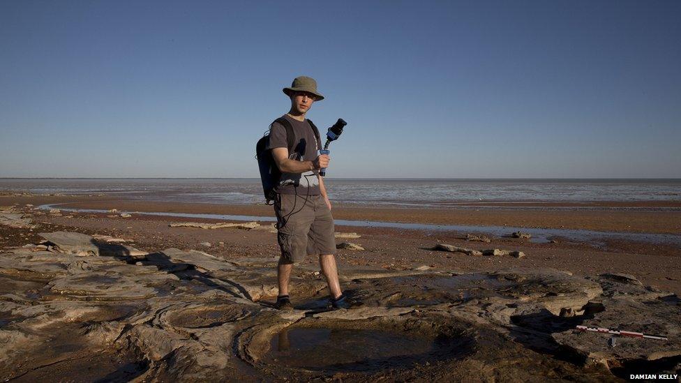
Along a 100km stretch (62 miles) of coast in Western Australia's Kimberley region, tens of thousands of dinosaur tracks are fossilised in sandstone.
The 130-million-year-old footprints are virtually the only record of dinosaurs in the western half of the continent.
They date to the Early Cretaceous Period when the continent was still connected by a land bridge to Antarctica and covered in towering conifer forests.
Unique snapshot
"These tracks are at least 15 to 20 million years older than the majority of dinosaur fossils that have been found at sites in eastern Australia," says Dr Steve Salisbury, a palaeontologist from the University of Queensland.
"They provide a very detailed snapshot of the dinosaur fauna from a time and place where there's almost nothing else," he told the BBC.

Drones and low-speed aircraft sweep over the prints on the rare times they are exposed by the sea
The fossils also hold immense cultural value for local indigenous communities.
Dr Salisbury says they feature in an Aboriginal "song cycle" that extends along the coastline, and that "knowledge of the tracks probably extends back thousands of years".
He was first invited to the region in 2011 by the Goolarabooloo people who were trying to halt the development of a proposed A$35bn ($24bn; £16bn) natural gas precinct at an area known as James Price Point, 50km north of Broome.
In 2013, two years after a section of the coast was granted National Heritage Status, the development was finally cancelled.
Dr Salisbury is now leading a project to digitally catalogue the fossils and reconstruct the landscapes these dinosaurs wandered through.
'We're talking huge, huge tracks'
To date, researchers have identified about 20 different types of tracks. The footprints include three-toed tracks belonging to carnivorous theropods that walked on two legs, as well as tracks believed to have been made by armoured dinosaurs like stegosaurs.
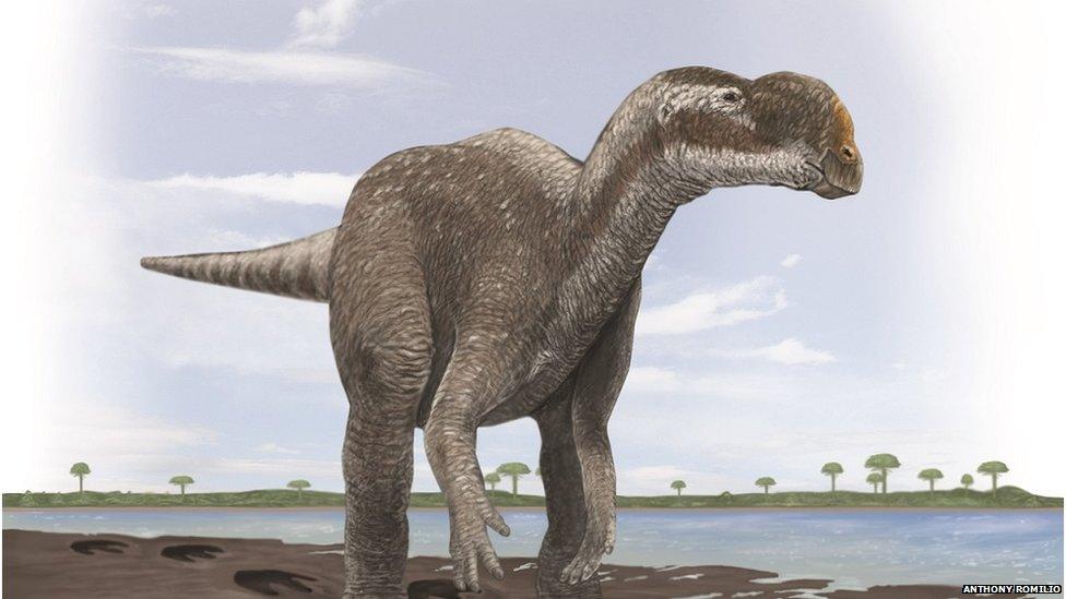
Some of the Broome dinosaur tracks are similar to those found at Lark Quarry in central-western Queensland, which the team recently determined were probably made by a large, two-legged plant-eating dinosaur similar to Muttaburrasaurus.

The Broome tracks are similar to those made elsewhere by Muttaburrasaurus
There are also large cylindrical depressions stamped into the earth by at least five different types of long-necked, long-tailed sauropods.
These are the only sauropod tracks in Australia and some of the depressions measure longer than 1.5m.
"They're beyond the size that you normally expect dinosaur tracks to be," says Dr Salisbury.
"We're talking huge, huge tracks, probably made by some of the biggest animals to ever walk the planet."
The tracks are found along coastal rock shelves and reefs, which are subject to some of the most extreme tides in Australia, with water levels rising 10 to 11m daily, he says.
Many are only exposed for a few hours each day, and only a few days each year, meaning the team has to work quickly.
"It's a dynamic landscape, and we've seen tracks disappear altogether in the time we've been working there. Some get buried by shifting sands, while others are destroyed by pounding surf," says Dr Salisbury.
To speed up the process of mapping and imaging the tracks, the team has adopted a range of new remote sensing technologies.
Remote-controlled drones
In addition to making physical moulds of the footprints using a rapid-setting silicon rubber and taking photographs on ground-mounted tripods, the team is now using a handheld LiDAR unit developed by Australia's national science organisation, the CSIRO.

Dr Salisbury and colleagues can work out how the dinosaurs were moving by using the drones to view them from the air
They are also taking aerial photographs of the track sites using a remote controlled drone and a specialised, low-speed aircraft, which is also fitted with LiDAR.
A LiDAR uses pulsating laser light coupled with a global positioning system. It records the points where the laser light reflects off hard surfaces, combining data from multiple passes to generate a detailed 3D map of the coastline, says Prof Jorg Hacker, director of Airborne Research Australia at Flinders University.
Prof Hacker, the other main investigator on the project, says that for a 3km stretch of beach he usually spends about 1.5 hours flying his motor glider, making roughly 30 passes at altitudes between 20 to 100 metres.
Dr Salisbury says his team can now contextualise the tracks over larger geographic areas, and can better understand which direction the dinosaurs were travelling, whether they were walking or running, and if they were interacting or crossing the landscape in groups, searching for food, or trying to escape predators.
"We can, to a degree, accurately reconstruct scenes that happened 130 million years ago. That's not imagination, that's piecing it together from the evidence found in the rocks," he says.
Best in the world?
"It's a powerful way of bringing these ancient worlds back to life."
Footprints require favourable circumstances to fossilise but when that happens a broad array of information is captured in the fossils, says Professor Anthony Martin, a palaeontologist from Emory University in the US specialising in animal tracks, who is not involved in the project.
"From a single, well-preserved dinosaur track way, we can determine the approximate type of dinosaur, its size, its speed, gait, and even how it was reacting to other dinosaurs or the landscape around it," says Prof Martin.
"Once these tracks are properly surveyed, I would not be surprised if this area turns out to be one of the best dinosaur track sites in the world," he says.
- Published26 August 2015

- Published19 December 2014
