Earthquake close to Irish border in County Donegal
- Published

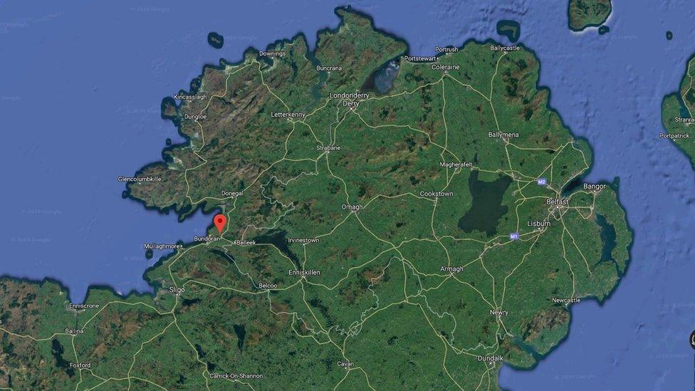
The epicentre was about 15km (nine miles) north-east from Ballyshannon in County Donegal
A minor earthquake has been recorded in County Donegal in the Republic of Ireland, according to Geological Survey Ireland.
The Irish government-backed research body confirmed that the quake occurred at 21:18 local time on Monday and that it had a magnitude of 2.1.
Earth tremors were heard across the border in Northern Ireland, including parts of County Fermanagh.
Geologists say earthquakes in Ireland are very rare.
Details of the quake were first reported by the Irish National Seismic Network, external, which is run by the Dublin Institute for Advanced Studies in co-operation with the Geological Survey of Ireland.
It said the epicentre was about 15km (nine miles) south-east of Donegal town and 15km north-east of Ballyshannon.
The network has asked members of the public who experienced the tremors to contact them with information.
Director Dr Martin Mollhoff said: "In 40 years we have only recorded around 200 earthquakes.
"The largest was a 2.4 magnitude in Buncrana. We have never recorded anything larger onshore."

'Covered in fault lines'

By Barra Best, BBC News NI
Earthquakes in Ireland are actually quite rare.
According to the Irish National Seismic Network, Ireland is the quietest place for seismic activity in Europe.
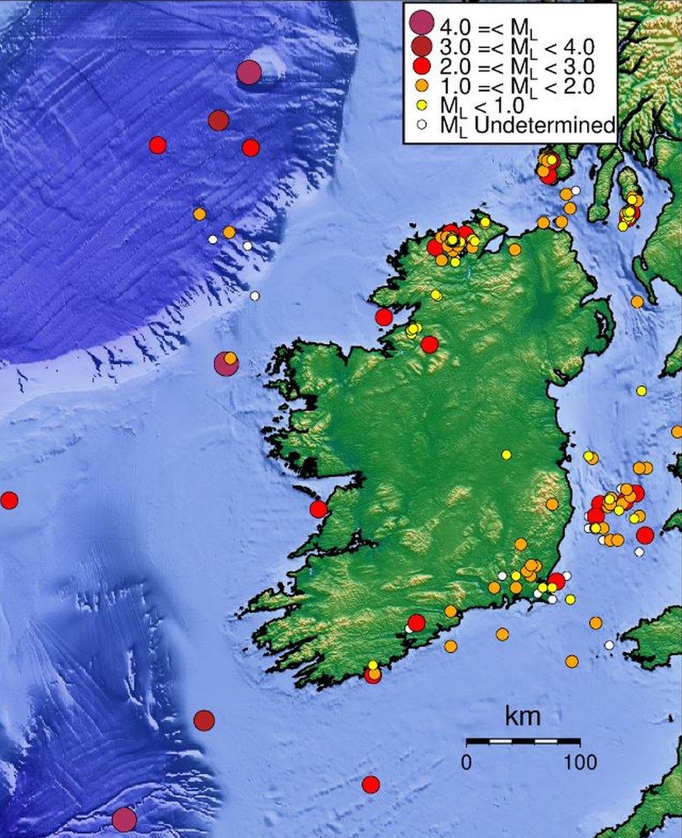
Most are recorded to the south-east or north-west of the island - mainly around Donegal and Wexford.
The island is covered in lots of fault lines, according to the Geological Survey of Ireland.
"Ireland started in two different continents and then merged. We've got a 1.8 billion year history," said geologist Dr Siobhan Power.
"The faults that are in Donegal are a continuation of a fault in Scotland."

He said there could be no earthquakes for a few years, and then there are "very small earthquakes that are just about being felt".
"That's why when something like this happens, people talk about it," he added.
Allow X content?
This article contains content provided by X. We ask for your permission before anything is loaded, as they may be using cookies and other technologies. You may want to read X’s cookie policy, external and privacy policy, external before accepting. To view this content choose ‘accept and continue’.
Geologist Dr Siobhan Power said normally an earthquake of this magnitude would not be felt.
"But in the quietness of the evening and close to epicentre, it can be," she said.
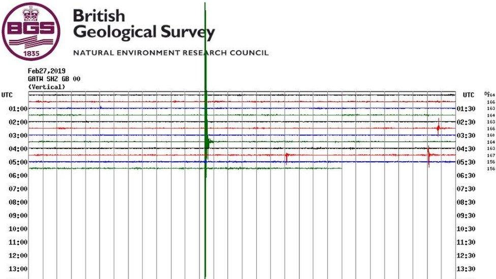
The earthquake was recorded by seismometers across the island.
Allow X content?
This article contains content provided by X. We ask for your permission before anything is loaded, as they may be using cookies and other technologies. You may want to read X’s cookie policy, external and privacy policy, external before accepting. To view this content choose ‘accept and continue’.
"There are six seismometers that make up the official network - Donegal, Louth, Galway, Dublin, Wexford and Kerry," said Dr Power.
"The earthquake was picked up in Donegal at 21:18:23 BST and it then filtered through to the others (in the above order) with a gradual reduction in the signal.
"The rest all recorded the earthquake in under a minute."
However, another explanation for the tremors has been suggested by the Irish border on Twitter.
@BorderIrish, external, which is more known for its musings on Brexit, said: "Sorry. Beans."

Map showing seismic activity in Ireland over the past 40 years - Fanad Head in north Donegal is a hotspot

- Published27 February 2019

- Published27 February 2019
