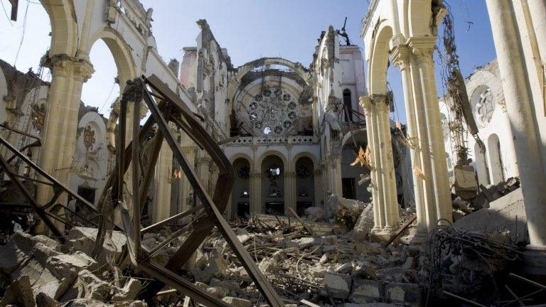
Complacency kills: Caribbean gears up for tsunamis
- Published
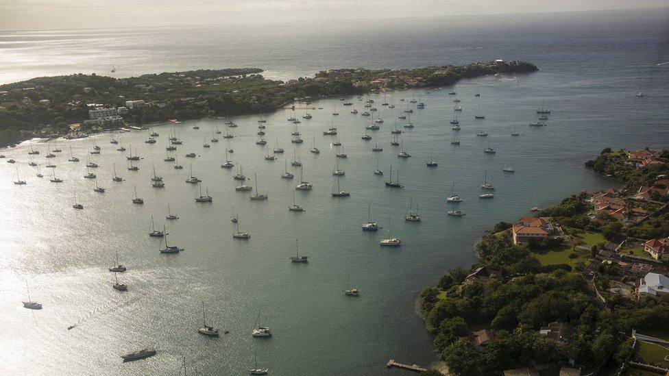
Island nations like Grenada hope to be tsunami-ready by 2020
The last time a major tsunami hit the Caribbean region was in 1946, after an 8.1-magnitude earthquake struck the Dominican Republic on the island of Hispaniola.
At Playa Rincón, the sea rushed 700m (2,300ft) inland, according to a man who clung to the top of an almond tree to survive. Waves were 5m high in places and 1,600 people died across the north-east coast. Small tsunami waves were also recorded in Puerto Rico, Bermuda and even New Jersey.
Since then, a handful of tsunamis have occurred - in Panama and Costa Rica in 1991 after an earthquake, and in Montserrat in 1997 after a landslide of volcanic debris. After the devastating earthquake in Haiti in 2010, sub-sea landslides generated waves that killed three people.
Over the same period, populations have more than doubled and tourist numbers on Caribbean beaches have soared, passing 30 million in 2017. In most places, infrastructure is concentrated in coastal areas.
Experts warn that the region runs the risk of complacency over the tsunami threat.
"The potential for tsunamis is significant and has to be taken seriously," says Christa von Hillebrandt-Andrade, who oversees the Puerto Rico-based Caribbean Tsunami Warning Program under the US National Weather Service.
"Within the Caribbean and bordering the Caribbean, there are major fault structures and also volcanoes that could generate a tsunami at any time."
Multiple risks
Key areas are along the north-eastern and eastern boundaries of the Caribbean where the North American and South American plates interact with the Caribbean plate.

Tsunamis in the Caribbean
Tsunamis can be regional (triggered by huge quakes in subduction zones) or local (from smaller quakes, quake-linked landslides or volcanic activity)
The Caribbean is vulnerable to both; some 3,500 people have died in tsunamis in the last 500 years, external
1n 1867, an offshore quake triggered 10m-high tsunami waves, external in the US Virgin Islands, with other deaths occurring in Guadeloupe and Puerto Rico

These boundaries include areas of subduction (where one plate is forced under another, as in the Indian Ocean in 2004) and strike-slip motion (where plates are side by side, like the San Andreas fault).
One area to watch is the subduction zone east of the Lesser Antilles, says Dr Robert Muir-Wood, chief research officer at RMS catastrophe risk modelling consultancy and the author of a 2015 report on mega-tsunamis. "We strongly suspect this area is potentially prone to these really large earthquakes, which would be associated with a major regional tsunami."
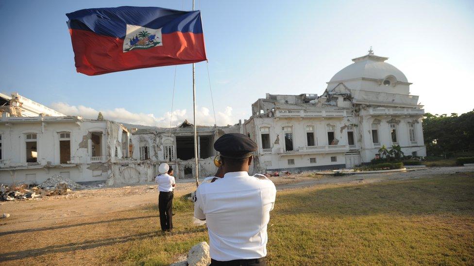
Haiti has struggled to recover from the damage caused by a devastating earthquake in 2010
Another series of faults lie north of Hispaniola, Puerto Rico and the Virgin Islands, and includes the 8,400m-deep Puerto Rico Trench. While this area is not a straightforward subduction zone and there has not been a really significant earthquake along this boundary, there is evidence of massive submarine landslides into the trench and historical reports of local tsunamis, says Dr Muir-Wood.
Big earthquakes have also occurred off the Caribbean coast of Central America and Venezuela.
"The Caribbean is clearly a place where both [regional and local] types of tsunamis can be anticipated, and the key is that simply because an event hasn't happened in the last 300 years of history doesn't mean it can't happen," says Dr Muir-Wood.
Warning time
Before 2004, Ms von Hillebrandt-Andrade says tsunami warning systems in the Caribbean were "basically non-existent". But the Indian Ocean disaster sparked action and a regional body on tsunami risk was established under Unesco in 2005.
Significant work has been done to increase the data flow to the Hawaii-based Pacific Tsunami Warning Centre (PTWC), which provides alerts to the region.
"Every single country has opened up its seismic data and that has been absolutely critical," says Ms von Hillebrandt-Andrade.
Today there are 80 sea-level stations and 125 seismic stations sending information, up from five and 10 respectively in 2004. "That has permitted us to reduce our lead time - the time it takes to issue the initial [tsunami warning] product - from 10-15 minutes to under 5 minutes."
Once PTWC has issued an advisory, responsibility for local alerts devolves to national governments. At this level, Ms von Hillebrandt-Andrade says, capabilities "vary greatly throughout the region".
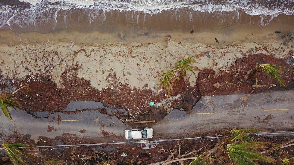
Hurricane Maria resulted in thousands of deaths on Puerto Rico after it hit in 2017
Some places, like Puerto Rico, have well-established protocols. Other places are less practised.
In January, when PTWC issued its first international tsunami threat message to the region after a 7.6 earthquake off Honduras, governments in the Cayman Islands and Jamaica, for example, faced questions over their response.
Some governments "had a little bit more difficulty deciding what product they should issue, if they should issue a product, if there really was a real threat", says Ms von Hillebrandt-Andrade. "Strengths and weaknesses were identified."
Funding vital
One early aim of the regional body was to establish a centre like PTWC in the Caribbean, but that has been sidelined in favour of improving education. Local tsunamis can potentially reach shore before an alert, and lives can be saved if residents know to seek high ground.
Central to this educational push is the annual tsunami exercise, Caribe Wave, and the Tsunami Ready programme, now adopted by Unesco, which sets out guidelines for communities to meet. So far Puerto Rico, Anguilla, St Kitts & Nevis and the Virgin Islands are certified as Tsunami Ready, while pilot projects have taken place in Haiti and Grenada.
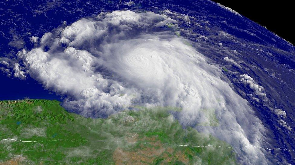
Hurricane Emily hit Grenada in 2005
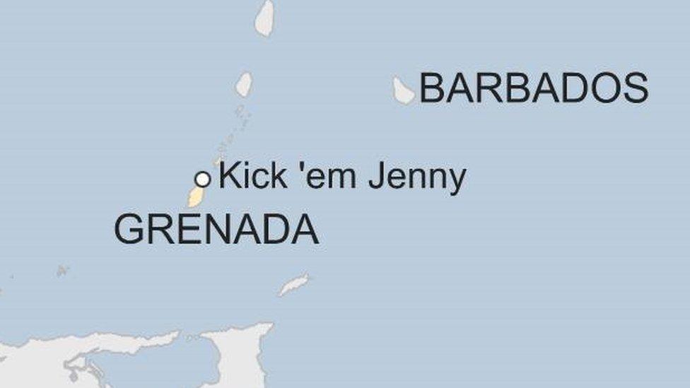
In Grenada the area chosen was St Patrick's Parish, 8km (5 miles) south of rumbling submarine volcano Kick 'Em Jenny. Educational billboards, evacuation maps and signs have been posted and an awareness programme carried out.
"We had to get down on the ground and interact with all of the community groups, we worked with the churches, the schools, the fisherfolk, the farmers," says Senator Winston Garraway, minister of state with oversight of disaster management and information. "From the senior people to the children, they have the information now and they know exactly what has to be done."
The government wants the whole island to be Tsunami Ready by 2020, starting with a southern parish potentially vulnerable to a tsunami generated off Venezuela. Mr Garraway also wants to establish a nationwide siren system to complement alerts disseminated via radio and TV.
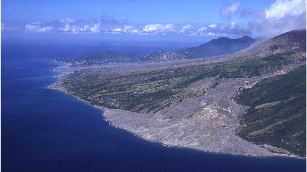
A tsunami hit Monserrat in 1997 after there was a landslide of volcanic debris
But resourcing is a major problem for small island nations like Grenada, which must also address twin challenges of hurricanes and the impact of climate change. "Most of what we have to do, we do not have the ready resources," says Mr Garraway. "Grant funding is extremely important for us at this time."
Regionally, work remains to be done. Scientists still do not have the data needed to accurately size very large earthquakes and their type of movement quickly. Tsunami protocols for cruise ships are needed. Better understanding of bathymetry (water depth and shore height) would enable better scenario modelling, but some nations do not have that information.
"Every single country and territory in the region has room for improvement," says Ms von Hillebrandt-Andrade.
"Tsunamis don't occur that frequently, so it's very easy to become desensitised. But the reality is that a tsunami could kill many more people than any hurricane could."
- Published27 November 2018
- Published7 October 2018
- Published2 October 2018
- Published14 March 2018
- Published17 February 2018
- Published12 January 2015
