Amber warning as Storm Floris brings damage and disruption
Damage and disruption as Storm Floris crashes into UK
- Published
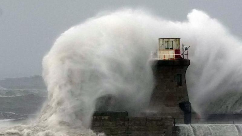
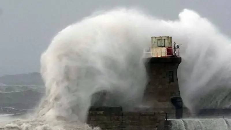
An amber weather warning is in place for most of Scotland as Storm Floris batters the country with winds of up to 85mph.
About 50,000 homes lost power, trains and ferries were suspended and people were urged to avoid travel in mainland Scotland, the Western Isles and Orkney until 23:00.
Vehicles have blown over in Glasgow and Skye, while the Royal Edinburgh Military Tattoo and other major events were cancelled.
Justice Secretary Angela Constance said the storm had brought "significant disruption" from unseasonably strong winds.
She said the Scottish government's resilience room had been activated and contingency plans were in place to deal with longer-term disruption.
Scottish and Southern Electricity Networks (SSEN) said thousands of properties had lost power in the Highlands, Moray and Aberdeenshire during "the most damaging summer storm in recent memory".
It said 9,000 homes had been reconnected and it was working to restore power to 43,500 more.
Scottish Power said about 1,000 customers were cut off in Ayrshire, Berwickshire, Dumfriesshire and Fife.

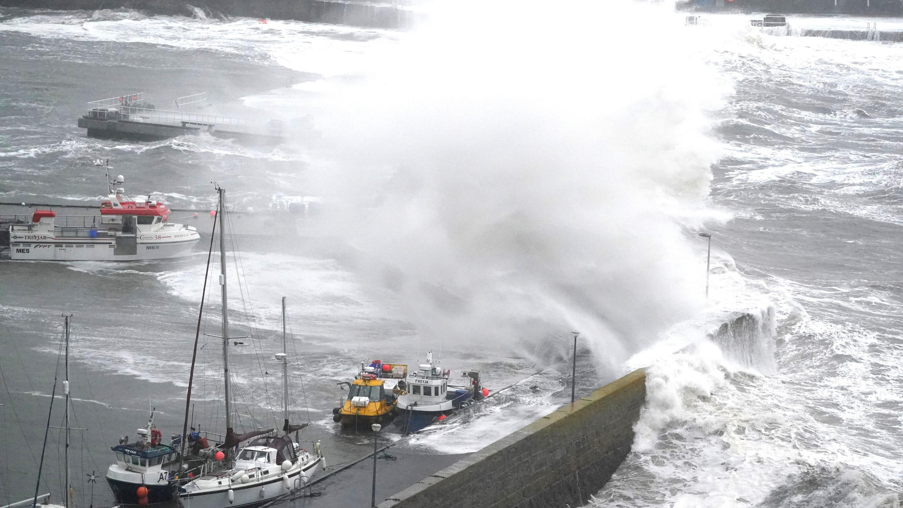
A yacht broke its moorings in high winds and beached at Broughty Ferry in Dundee
Most of Scotland's major road bridges have been closed to high-sided vehicles, while the Forth Road Bridge was also closed to motorbikes and pedestrians.
The Tay Road Bridge was fully closed with a diversion via Perth.
The Met Office said wind speeds of 82mph had been recorded in Wick, Caithness, 80mph on South Uist, and 79mph in Kinloss in Moray.
On the 1,130m summit of Aonach Mor in the Highlands gusts were recorded at 106mph.
The SQA warned that the weather could delay the delivery of exam results letters on Tuesday, particularly for pupils on Scottish islands.
What travel is disrupted by Storm Floris?

Part of a damaged tree balancing on power lines above a rail line at Cornton in Stirling
The storm brought cancellations throughout Scotland's transport system.
Ferry operator CalMac issued an suspended a number of services, external while Loganair cancelled morning flights from Glasgow to Tiree, Benbecula and Barra.
On the trains, ScotRail said speed restrictions would be in place across the network and advised passengers to check the status of their journeys.
Fallen trees caused disruption on a number of routes with damage to overhead wires.
Trains from Glasgow Queen Street to Edinburgh and Stirling were stopped after a large polythene sheet was caught on wires near Bishopbriggs.
Storm Floris is bringing high winds and heavy rain moving across Scotland
Network Rail closed several lines and said all others would have a reduced timetable and longer journey times. The closed lines are:
Edinburgh – Fife/Perth/Dundee
Perth – Dundee/Aberdeen/Inverness
Dunblane - Perth
Inverness – Aberdeen/Wick/Thurso/Kyle of Lochalsh
West Highland Line (Helensburgh Upper – Oban, Fort William and Mallaig
Ross Moran of Network Rail Scotland: "We appreciate passengers' patience while we get through this unprecedented summer storm."
LNER, which runs east coast services, cancelled services north of Newcastle. While Avanti West Coast said routes north of Preston would be "heavily affected".

Traffic Scotland shared a CCTV still of an overturned trailer on the Kingston Bridge in Glasgow
Police Scotland urged people to avoid travel and said that several campervans had been blown over on the A87 in Skye.
The force said campervans should remain parked in sheltered areas.
In Glasgow, the Kingston Bridge was blocked for 30 minutes after a trailer was blown over at 12:40.
The A96 Forres Road in Nairn was closed due to a fallen power line.
And in Fort William two streets were closed after a large section of copper roof became unstable.
The AA urged drivers to be cautious. The organisation's Shaun Jones said: "Be mindful of high-sided vehicles and cyclists who may be more affected by gusts.
"Watch out for fallen branches or debris, particularly in rural areas – this could be tell-tale signs of a fallen tree ahead."
What events are cancelled by Storm Floris?

People battle against the wind as they walk along the Royal Mile in Edinburgh
The Royal Edinburgh Military Tattoo in Edinburgh was cancelled on Monday night and refunds issued.
A spokesperson said: "We understand this will be disappointing, but the safety of our audience, performers and staff is our top priority."
The Fringe By The Sea, external festival in North Berwick was suspended until Tuesday. Pittenweem Arts Festival in Fife was also cancelled.

Monday's Fringe By the Sea events in North Berwick was cancelled
Edinburgh International Festival events, including the ceilidh sessions, were cancelled after Edinburgh City Council closed Princes Street Gardens.
The Pleasance closed its Courtyard and Plaza venues.
Edinburgh Fringe Festival said about 110 shows had been cancelled - mostly those in temporary structures.
Get in touch
How have you been affected by Storm Floris? Share your experiences and photographs of the stormy weather.
In Glasgow, filming for Spider-Man: Brand New Day, which began on Friday, has been suspended on city centre streets.
The Royal Botanic Garden Edinburgh and Benmore, Dawyck and Logan botanic gardens were closed as a safety precaution.
In football, Aberdeen said its Premiership match against Hearts at Tynecastle would still go ahead as scheduled at 20:00.
Where will Storm Floris hit hardest?

Network Rail were called to fallen trees on the Glasgow - Cumbernauld route
The amber warning, external covers a wide area from the central belt - including Glasgow and Edinburgh - to the Highlands.
Other parts of Scotland will be under a yellow warning until midnight.
Met Office chief meteorologist Matthew Lehnert said the strongest winds will most likely hit in the afternoon and night but "there remains some uncertainty in the depth and track of Floris".
Western coastal areas saw the highest early gusts, with the strongest winds moving to the north-east by the evening.
A further yellow wind warning is in place for Orkney and Shetland from midnight until 08:00 on Tuesday.

Part of a roof comes off an office building in Broadford, Skye
The Met Office said summer storms pose particular problems as trees are in full leaf and are more likely to be toppled with limbs broken off.
In winter, the wind can move through bare branches.
It has advised that flying debris could bring injuries and pose a danger to life.
People are advised to secure loose items such as garden furniture, trampolines and sheds.
What is an amber weather warning?
Weather warnings are divided into three colours, yellow, amber and red - the latter being the most severe.
Yellow warnings suggest people should start planning for some impact on travel, power or property.
When confidence in the forecast or the level of expected disruption increases, it is upgraded to amber - severe weather that will have a medium impact.
Transport Secretary Fiona Hyslop said a meeting was held on Friday to ensure Scotland was prepared.
She said: "This is a slightly unusual situation for August.
"However, the message is the same as winter - plan ahead, check your journey in advance, allow extra time, and don't take any unnecessary risks."

Get in touch
How are you still affected by Storm Floris? Get in touch.
Related topics
- Published1 August
- Published4 August