Summary

  • The first minister of Wales, Eluned Morgan, says the impact of Storm Bert is "absolutely devastating"

  • She tells the BBC the "severity and frequency of these events is something we need to be aware of"

  • A body has been found in the search for a missing 75-year-old dog walker in Trefriw, North Wales

  • More than 150 flood warnings are in place across the UK as Natural Resources Wales has issued two severe flood warnings in Monmouthshire, in the south-east of the country

  1. What should you do if your car gets stuck in snow or ice?published at 09:34 Greenwich Mean Time 23 November

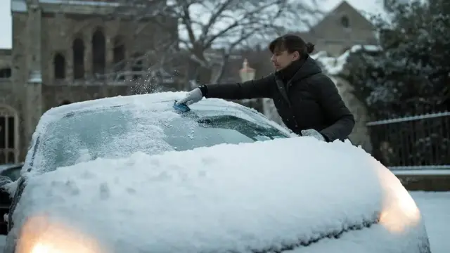
    A woman wipes snow off the windshield of a car.Image source, Getty Images

    If you get stuck in snow, don't try to keep moving if the wheels spin - it will only dig you in deeper.

    Use a shovel to clear snow from under your tyres. Pour cat litter, sand or gravel in front of the wheels to help them get traction.

    Shift from forward to reverse and back again. Give a light touch on the accelerator until the vehicle gets going.

    If you can't move your car, you can stay warm byrunning the engine. However, it's vital to ensure the exhaust pipe is not blocked by snow because highly toxic carbon monoxide gas could enter the car.

    If there's any risk of fumes coming into the vehicle, do not run the engine. Even if it's safe, don't run it for more than 10 or 15 minutes in each hour.

    Stay in or close to your car.

    In heavy snow, it is easy to get lost or separated from your vehicle. You can hang a piece of brightly coloured cloth on your car to let you or others find it.

    You can find more tips about driving in the snow and icy weather by reading our explainer.
  2. Rain, snow and wind warnings in place across Northern Irelandpublished at 09:30 Greenwich Mean Time 23 November

    As we’ve been reporting, a yellow weather warning is also in place across Northern Ireland because of the heavy rain and strong winds Storm Bert is bringing in.

    The TrafficWatchNI service says wind and rain are "starting to cause issues" for motorists on Saturday morning.

    In County Tyrone, the Dergbrough Road, Plumbridge, is fully closed due to a fallen tree.

    And the Coast Road in Ballygally is also shut because of a rock fall, which is believed to be related to Storm Bert.

  3. How should you drive in snow and ice?published at 09:27 Greenwich Mean Time 23 November

    Driving in snow and ice can pose many challenges. In very bad conditions, it may be best to avoid driving at all, but if you do need to use your car make sure you are well-prepared.

    First things first: Clear all snow and ice from the windscreen, windows and roof of the car before setting off.

    Don't use boiling water to de-ice windscreens - hot water can crack the glass, and the water will only freeze again on the screen, or on the ground where you are standing. Check your lights are clear of snow and are working.

    If you drive a manual vehicle, use second gear to pull away, lifting the clutch gently to avoid wheel spin. Stay in a higher gear for better control as you pick up speed. Many automatic cars have a "snow" or "winter" gearbox mode. Check your handbook for details.

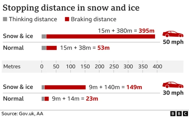
    Maintain the right speed: too fast and you risk losing control, but driving too slowly means you might lose momentum when you need it. Brake, steer and accelerate as smoothly as possible, and drive so that you do not rely on your brakes to be able to stop. Remember stopping distances are up to 10 times greater in snow and ice.

    Take some food such as chocolate and biscuits, as well as water and a hot drink if you can.

    Make sure you have a fully-charged mobile and any medication you need.

    Take a shovel to clear snow and some old bits of carpet, or cat litter, to put under the tyres if you get stuck.

    A graphic showing stopping distances in snow and ice. For 50mph, it's 395m versus 53m in normal weather. For 30mph, it's 149m versus 23m in normal conditions.
  4. Network Rail urges commuters in northern England to check timetablespublished at 09:17 Greenwich Mean Time 23 November

    Anyone planning to travel by train in the north of England this weekend should check for possible delays due to heavy rain and strong winds, NetworkRail says.

    "With the bad weather set to intensify, travel disruption is possible on the East Coast Main Line, Midland Main Line, and North East rail routes," it says.

    It adds that staff are on hand to deal with possible flash flooding or fallen trees on tracks.

    Network Rail says it's hard to know exactly when and where the bad weather will strike, so commuters should check the National Rail website, external for the most up-to-date timetables.

    People living near the railway line should also tie down loose garden items like trampolines and gazebos as they may blow onto the tracks and cause delays, it says.

  5. Strongest winds will be across western coasts of UKpublished at 09:07 Greenwich Mean Time 23 November

    Chris Fawkes
    BBC Weather presenter

    Some power cuts are quite likely today as the snow will come down in big wet chunky flakes – this type of snow is much more likely to stick to power cables and tree branches which may snap under the extra weight of the snow plunging some communities into darkness.

    Winds are an additional hazard with Bert, top gusts have already reached 67mph at St Mary’s, Scilly and also at Berry Head, Devon.

    The strongest winds will be across western coasts of the UK today and I would expect the winds to strengthen further through the day, reaching well into the 70s mph later.

    Meanwhile, gales will spread inland to affect many areas, these winds will be strong enough to bring down some tree branches, so could cause some localised disruption.

    Storm Bert will also bring extremely heavy rain to parts of Wales and southwest England, with up to 150mm over high ground.

    It's the build up of rain, incessant for many hours that will do the damage with some flooding impacts likely later today and into Sunday.

  6. In pictures: Snowy Scotlandpublished at 09:06 Greenwich Mean Time 23 November

    BBC Weather Watchers have been out and about taking pictures of where it has been snowing on Saturday morning.

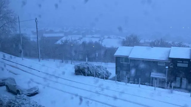
    A road, cars and a row of terraced houses are covered in snow. Snow is fallingImage source, JoanO/BBC Weather Watchers
    Image caption,

    Greenock has seen some heavy snowfall.

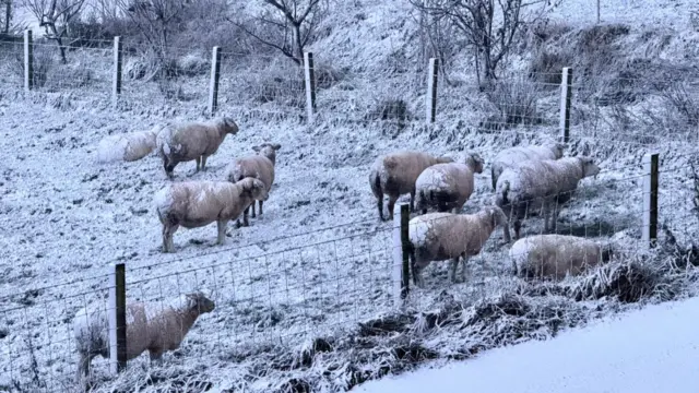
    A flock of sheep covered in snow in a snow covered field.Image source, Dustmote/BBC Weather Watchers
    Image caption,

    A wintry scene at Howwood, Renfrewshire.

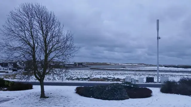
    Snow covers an area of grass and a field beyond. There is a tree and clumps of bushes.Image source, Merlin/BBC Weather Watchers
    Image caption,

    A chilly start to Saturday in Newburgh, Aberdeenshire.

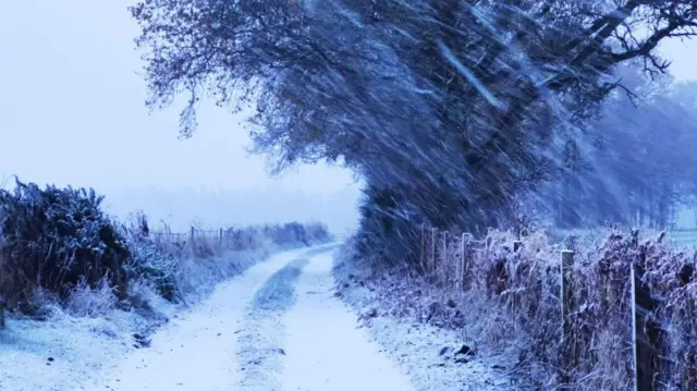
    Snow blows across a track, which is covered in snow. There is a hedge row and trees.Image source, Pia/BBC Weather Watchers
    Image caption,

    Wild wintry weather at Perth.

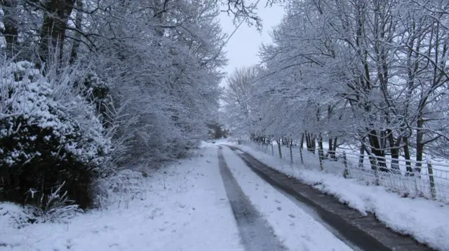
    A road with tracks in the snow. The road is lined by trees which are covered in snow.Image source, Derek B/BBC Weather Watchers
    Image caption,

    Stow in the Scottish Borders has also had snowy conditions.

  7. Threat of significant transport disruptionpublished at 09:01 Greenwich Mean Time 23 November

    Chris Fawkes
    BBC Weather presenter

    Storm Bert is bringing multiple weather hazards to the UK with snow, rain and windy bringing problems through the day.

    The Met Office has issued amber warnings for snow across the high ground in northern England valid until midday and for the hills of Scotland, with the warning valid until 17:00.

    Hills above 400m elevation could get 20 to 40cm of snow, with the snow coming down very quickly, it’s likely higher routes won’t be able to be kept clear and so there’s a threat of significant transport disruption.

    Snow is also affecting lower areas too, and we’ve already seen some heavy snow in the Vale of York and northeast England with snow coming down to low levels for a time in Scotland – so it’s not just high ground that will see impacts from snow.

    Major routes like the A1(M) look to be really struggling with the snow at the moment, and smaller roads may become completely impassable.

  8. Watch out for treacherous road conditions...published at 08:56 Greenwich Mean Time 23 November

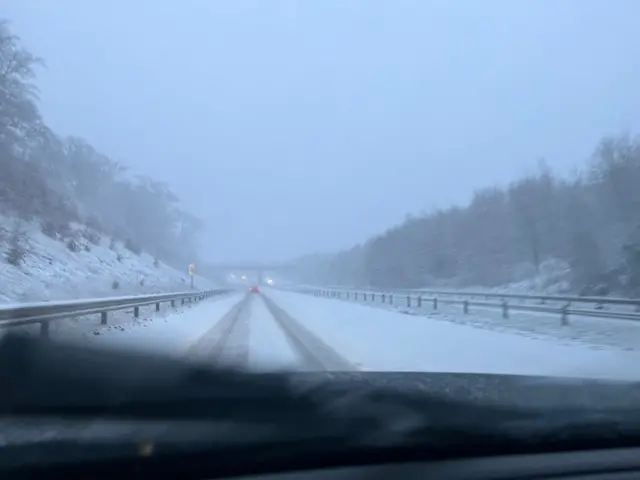
    Wintry conditions on M77 near Eaglesham. Heavy snow falling and lying.
    Image caption,

    Very wintry conditions on M77 near Eaglesham

    Storm Bert is having a varied impact across the UK as we've seen.

    The Met Office has described it as a multi-hazard event, with snow, high winds and rain all likely to bring challenges.

    Our colleague has sent in this picture from the M77 near Eaglesham in Scotland and the conditions already look treacherous.

  9. Amber alert in force in parts of Scotland and Englandpublished at 08:52 Greenwich Mean Time 23 November

    The Met Office , externalhas issued two amber warnings across the UK as Storm Bert has started to make an impact.

    • Scotland: an amber alert for heavy snow and ice will be in force between 07:00 GMT and 17:00 in areas across central Scotland, where a potential 20-40cm snow could fall on higher ground
    • England: an amber warning for snow will be in place between 07:00 and 12:00, covering parts of Yorkshire and the north-east and north-west of England. That alert also extends into parts of southern Scotland.

    Amber warnings mean there is an increased likelihood of impacts from severe weather, with the potential for risk to life and property.

  10. No snow yet in Pitlochry but amber warning remainspublished at 08:41 Greenwich Mean Time 23 November

    Paul Ward
    BBC Scotland journalist in Pitlochry

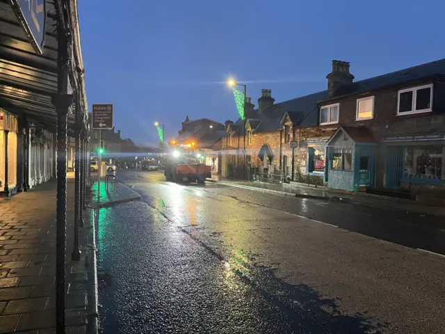
    Gritter on wet road in Pitlochry
    Image caption,

    The gritter is working already in Pitlochry, but the snow has yet to make an appearance here.

    In Pitlochry, in the centre of one of the amber warning areas, the only snow visible early this morning was in the Christmas displays in the high street shop windows.

    A number of gritter trucks treated the roads and pavements in the town but the weather did not bring disruption to the morning as rain fell instead of snow.

    The amber warning for snow and ice covers parts of Perthshire, Aberdeenshire and the Highlands until 5pm.

  11. What about the impact on trains?published at 08:34 Greenwich Mean Time 23 November

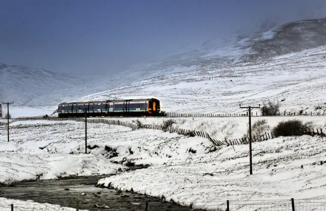
    A train near Aviemore after heavy snow falls covered ScotlandImage source, PA Media

    If people heed to police warning about not using the roads, there could be more attention on rail travel.

    ScotRail has already reported some rail disruption in the past 24 hours.

    And it has urged passengers to check if their routes are going to be affected throughout the weekend.

    Network Rail is in the process of fixing a fault with the overhead lines at Drumgelloch which is affecting trains that run through this area - that's causing disruption to Helensburgh to Edinburgh services.

  12. Where has it been snowing?published at 08:29 Greenwich Mean Time 23 November

    Judith Ralston
    BBC Scotland Weather

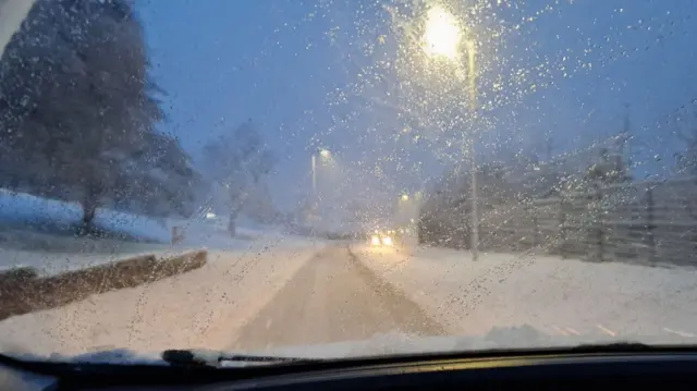
    A view of snow on a road at GreenockImage source, Farm outlook/BBC Weather Watchers
    Image caption,

    A BBC Weather Watcher's picture of driving conditions in Greenock

    Snow has been falling widely across central and southern Scotland, and falling as rain or sleet for coastal areas.

    The snow will extend into northern Scotland over the next few hours.

    There are some dangerous conditions over high ground with significant accumulations here - also drifting of the snow due to the strong winds.

    We're already seeing gales along the west coast and over high ground.

    There are Met Office weather warnings still in force and all higher routes are expected to be severely affected by these atrocious conditions.

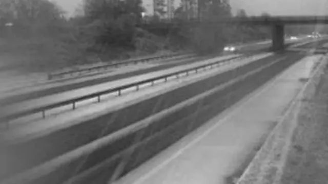
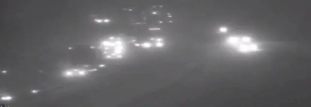
    The black and white image shows carriageways of the M9. Snow is falling at there is snow at the side of the road.Image source, Traffic Scotland
    Image caption,

    A Traffic Scotland camera image showing the M9 at Bannockburn at about 08:00

  13. True Grit!published at 08:28 Greenwich Mean Time 23 November

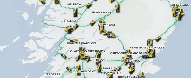
    Gritters with funny names across ScotlandImage source, Traffic Scotland

    Gritters have now taken to roads across Scotland to clear the snow, and they have some funny names as has become the norm.

    Here's a couple that caught our eye:

    • Thistle Do Nicely
    • Ready Spready Go
    • Gritty Gritty Bang Bang
    • Grittalica
    • Sled Zeplin

    For more puns and information on gritters across the country near you, just click on Traffic Scotland's Trunk Road Gritter Tracker., external

  14. Crash brings motorway traffic to a standstillpublished at 08:17 Greenwich Mean Time 23 November

    traffic on M74Image source, Traffic Scotland

    Traffic Scotland says the M74 has been closed southbound at J14 in South Lanarkshire after a collision.

    Weather in the area is said to be particularly poor, with the crash bringing traffic to a standstill.

    Police are at the scene, with vehicles being taken off the exit slip at J14.

  15. Early avalanche warnings ahead of stormpublished at 08:13 Greenwich Mean Time 23 November

    Steven McKenzie
    BBC Scotland Highlands and Islands reporter

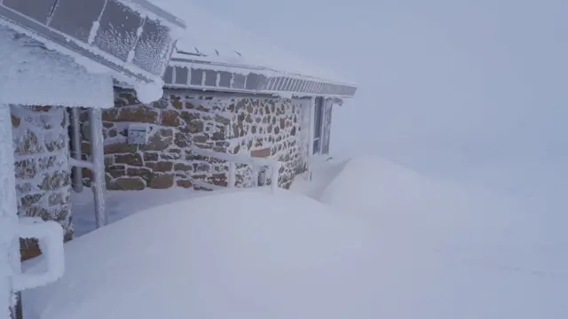
    Drifts of deep snow outside the building. The walls and roof are also caked in ice.Image source, SAIS Northern Cairngorms
    Image caption,

    Drifts of snow at the Ptarmigan Restaurant 1,100m up in the Cairngorms on Friday

    The Scottish Avalanche Information Service (SAIS) has issued early warnings of potential avalanche hazards on some of Scotland's mountains.

    The service, used by climbers and skiers, does not fully launch its latest forecast season until 12 December.

    But it has been monitoring conditions and "moderate hazard" warnings are in place for Torridon and Lochaber and "considerable hazard" for the Northern Cairngorms.

    After days of heavy snowfall, SAIS forecasters warned of "wild weather" on Saturday and the possibility of winds gusting to 80-110mph across all summits.

    SAIS Torridon said: "Looks like a day for the café or DIY job you've been putting off."

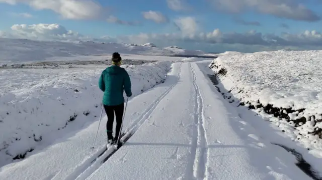
    A person skis down a track. There is deep snow on the ground and snow-covered mountains in the distance.Image source, SAIS Torridon
    Image caption,

    Calmer conditions - and deep snow - in Torridon on Wednesday

  16. How will Storm Bert affect the UK?published at 08:01 Greenwich Mean Time 23 November

    Media caption,

    BBC Weather's Darren Bett explains how Storm Bert will hit the UK

    Storm Bert has begun to make an impact across the UK with snow closing roads, while strong rains and winds are expected to cause further travel disruption and potential flooding.

    Weather warnings and 16 flood alerts came into effect across the UK on Saturday morning after the Met Office warned of a "multi-hazard weather event".

    Rail companies urged passengers to avoid travelling to certain areas while National Highways issued a "severe weather alert" for snow affecting Yorkshire and north-east England.

    Storm Bert follows a cold snap earlier this week which caused some schools to close in several parts of the UK.

    Stick with us throughout the day as we'll bring you the latest developments and analysis.

    Read more about the impact of Storm Bert here.

  17. It's not going to be all about the snow, though...published at 07:54 Greenwich Mean Time 23 November

    Storm Bert is expected to be a "multi-hazard event" due to the combined potential impact of rain and wind as well as snow.

    Gust of 40-60mph (65-96km/h) are forecast in Scotland over the weekend.

    Meanwhile, Scotland's environment agency Sepa has issued four flood alerts covering Aberdeenshire, Dundee and Angus, Tayside, and Dumfries and Galloway.

  18. Where has been worst affected so far?published at 07:43 Greenwich Mean Time 23 November

    A snow flurry in Kingussie in the Highlands on Thursday afternoonImage source, Dunlorn/BBC Weather Watchers
    Image caption,

    A snow flurry in Kingussie in the Highlands on Thursday afternoon

    The UK's lowest November temperature in 14 years has been recorded at Kinbrace, a small village in Sutherland in the Highlands.

    BBC Weather Centre said a temperature of -12.2C was recorded at 02:00 - the coldest since 30 November 2010.

    It follows a week of weather-related disruption.

    On Thursday, schools across the Highlands, Moray and Aberdeenshire were closed due to poor road conditions.

    Then on Friday, about 30 schools were closed in Aberdeenshire, as well as 10 in the Highlands.

    Moray Council closed nine of its schools due to the weather conditions.

  19. The latest weather warningspublished at 07:36 Greenwich Mean Time 23 November

    A Met Office amber warning has been in place for parts of the Highlands, Aberdeenshire, Perth and Kinross and Angus since early on Friday.

    It runs until 17:00 on Saturday, external when there will be an increased likelihood of severe weather affecting travel and power supplies.

    There is also an amber warning until 12:00 on Saturday, external that covers the Borders, Dumfries and Galloway, East Ayrshire and South Lanarkshire.

    On top of that, a number of yellow "be aware" warnings for snow, high winds and heavy rain have also been issued for Scotland over the weekend.

    Here is the latest list for weather warnings affecting Scotland:

    • 05:00 Saturday to 19:00 Saturday, external - Yellow - wind gusting to 60mph over the Western Isles, as well as parts of the Highlands, north east Scotland and south west Scotland. Gusts of up to 70mph in some coastal areas
    • 07:00 Saturday to 17:00 Saturday, external - Amber - heavy snow for parts of Highlands, Aberdeenshire, Perth and Kinross and Angus. Accumulations of up 20cm on ground above 200m, with potentially as much as 40cm on hills above 400m
    • 07:00 Saturday to 12:00 Saturday, external - Amber - the Borders, Dumfries and Galloway, East Ayrshire and South Lanarkshire. Accumulations of up 20cm on ground above 200m, with potentially as much as 40cm on hills above 400m
    • 04:00 Saturday to 09:00 Sunday, external - Yellow - for mainland Scotland, Skye and Inner Hebrides, temporary snow accumulations of 10-20 cm on ground above 150m, with perhaps as much as 20-40 cm above 300m. Upland areas could see 20-40 mm of rain during Saturday night
  20. What is the warning from police?published at 07:21 Greenwich Mean Time 23 November

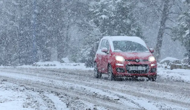
    a red car drives through snow on a road in AviemoreImage source, Reuters

    Police are urging people not to travel on Scotland's roads on Saturday.

    The warning covers all routes north of the central belt.

    Supt Vinnie Fisher, deputy head of road policing, says all road users should consider if they really need to travel in adverse weather.

    Scottish government agency Transport Scotland has also said roads may be affected by deep snow, particularly over higher routes, and some rural communities might be cut off.