Sentinel satellite reveals Nepal quake movement
- Published

Europe's Sentinel-1a satellite has got its first good look at the aftermath of Saturday's big quake in Nepal.
The radar spacecraft is able to sense ground movement by comparing before and after imagery acquired from orbit.
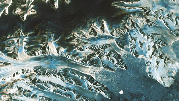
Scientists turn this information into an interferogram - a colourful, but highly technical, representation of the displacement that occurs on a fault.
The new data confirms an area of 120km by 50km around Kathmandu lifted up, with a maximum of at least 1m.
"There's a peak of slip just to the northeast of Kathmandu. Basically, what we do is count the coloured 'fringes' in this interferogram and there are about 34, so that translates to more than a metre of uplift," explained Prof Tim Wright from the UK's Nerc Centre for the Observation and Modelling of Earthquakes, Volcanoes and Tectonics (COMET).
Further to the north of the capital, the interferogram indicates that the ground subsided, which is exactly what would be expected following a shallow thrust.
Researchers can also see how the fault ruptured east from the epicentre, and did not break the surface.
This may indicate that not all the strain built up in the rocks prior to the earthquake was released in the magnitude-7.8 event and its subsequent aftershocks.
The interferogram has been produced as part of a European Space Agency study called INSARAP, external.
This is led by Norut in Norway, and includes Dutch-based PPO.labs, Leeds University, UK, the Polish Geological Institute and the Geological Survey of Norway.
The interferogram will be refined in the coming days. It will be used to map damage and landslides.
INSARAP will also derive a model to interpret the quake's "anatomy". This will help scientists understand Saturday's tremor in the context of historic events.
The hope is that such analysis can point to areas at greatest risk from future ruptures - information that can assist with disaster planning.
"We want to know which parts of the fault slipped," said Prof Wright, who is based at Leeds University.
"And that's important because it tells us those parts that did not, and which are still primed and ready to go in a future earthquake.
"Many of us are involved in a project called Earthquakes Without Frontiers, external, which has as its aim to use the latest scientific information to improve resilience."
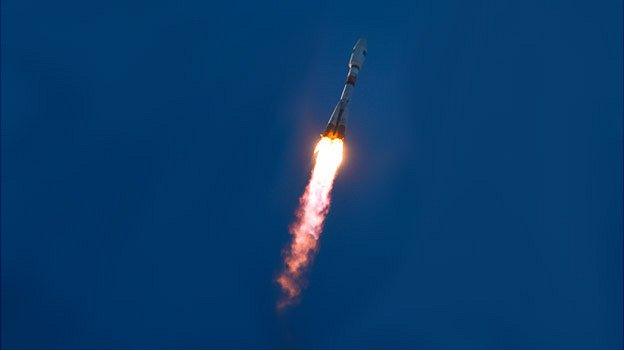
Sentinel-1a, external is the first in a new fleet of spacecraft being launched by the European Union to monitor the Earth. Next year, it will be joined by a sister satellite, Sentinel-1b, and this will cut the time taken to acquire the after-quake images, as the pair will be able to map the entire planet every six days.
In anticipation, researchers have been working on speeding up the production of the interferograms themselves. In this case, Sentinel-1a passed over Nepal shortly after midnight, Tuesday into Wednesday. The data was then downlinked and put in the hands of scientists within a matter of hours.

Sentinel radar analysis of Nepal quake

Interferogram produced by Synthetic Aperture Radar Interferometry (InSAR)
Finds differences in "before" and "after" radar pictures taken from space
Permits earthquake scientists to detect even quite subtle ground movements
Amount of deformation is depicted in coloured contours, or "fringes"
Each contour shows 2.8cm of ground movement with respect to Sentinel-1a
34 fringes in this image equates to a peak ground deformation of about 1m
Quake ruptured east from the epicentre; fault did not break the surface

Sentinel-1a is among a fleet of new sensors being launched by the European Union
The interferogram on this page is copyrighted: Copernicus data (2015)/ESA/PPO.labs-Norut-COMET-SEOM Insarap study
Jonathan.Amos-INTERNET@bbc.co.uk and follow me on Twitter: @BBCAmos, external
- Published2 September 2014
- Published16 April 2014
- Published3 April 2014
- Published2 April 2014

