Flights probe jet stream role in floods
- Published

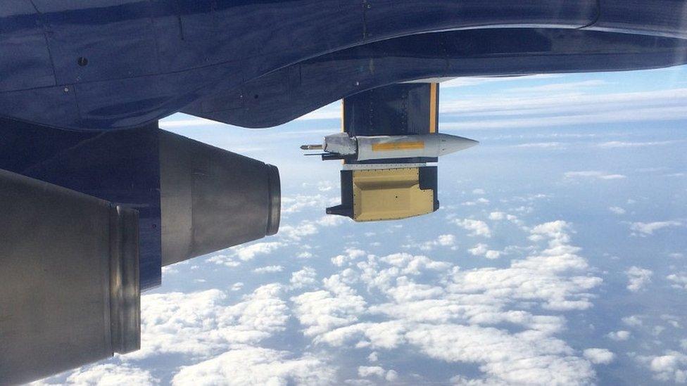
One of the instruments clusters hangs beneath a wing on the FAAM plane
A major international effort is under way to research one of the greatest unknowns in weather forecasting - the influence of the jet stream.
For the first time, a fleet of drones and planes is being deployed from the United States, Iceland and Britain to investigate the flow of air crossing the Atlantic.
Jet streams are powerful currents of high-altitude wind that govern the patterns of weather down on the surface.
The one over the Atlantic has frequently driven storms over Britain, most recently last winter, causing devastating floods.
Early results indicate that the jet stream is narrower, stronger and more sharply defined than predicted by computer models - which could have implications for weather forecasts.
Although forecasting has improved massively in recent years, a particular kind of disturbance in the jet stream over America is blamed for about 100 late or inaccurate forecasts of extreme rainfall over Europe in the past decade.
The research project, known as Nawdex, external, involves scientists from more than 30 institutes and organisations from more than half a dozen countries.
Pioneering flight
Britain's FAAM research plane, external - a passenger jet converted to carry instruments - joined the operation earlier this week flying to the skies above the Faroe Islands where it entered the jet stream.
It is believed to be one of the first times that an aircraft has deliberately been flown across the band of wind to measure key characteristics including temperature, humidity and speed.
I joined the flight and witnessed the moment that the plane passed through the most intense winds which reached speeds of 180 mph.
In the clear air typical of a jet stream, turbulence had been expected and everyone was ordered to remain fastened to their seats but in the event the ride was surprisingly smooth.

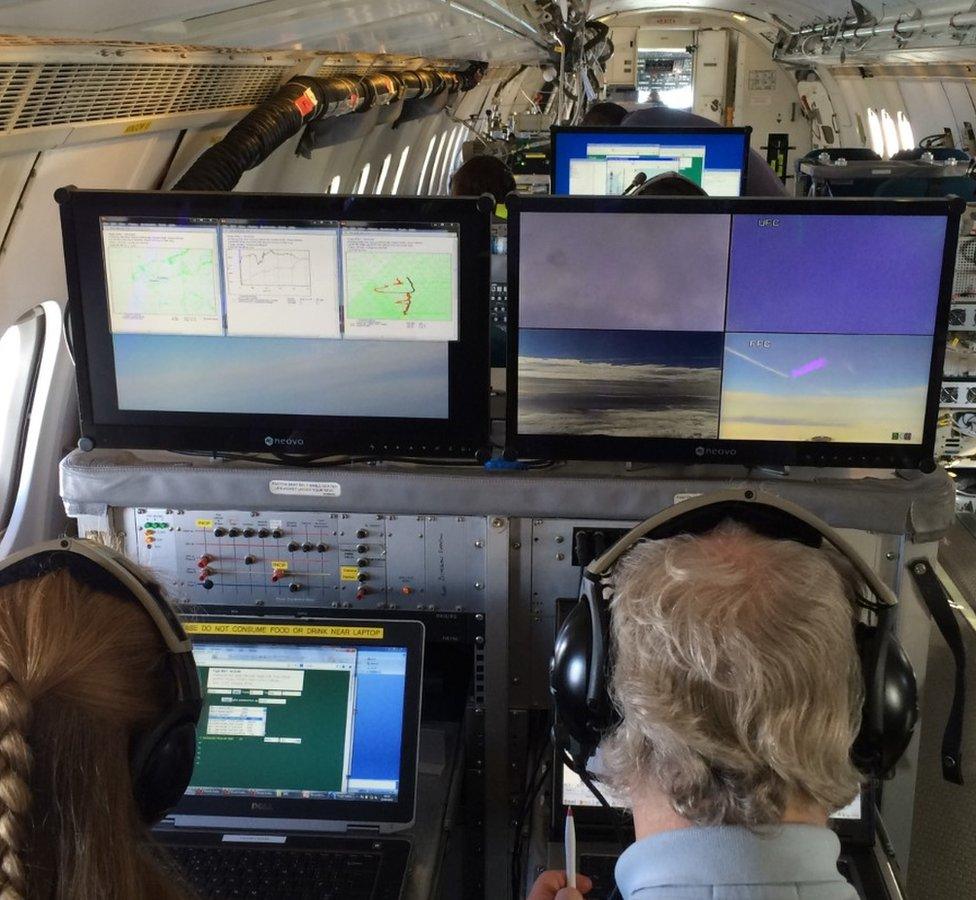
The plane is a converted commercial plane with instrument consoles installed in the cabin
The lead scientist on board, Prof John Methven of the University of Reading, said the objective was to learn more about the jet stream in order to improve forecasting.
"What we're trying to do here is a real challenge, to predict the weather five days ahead so we don't just need to know that the jet stream exists and that it's here - we also need to know how its fine-scale structure looks and how it evolves in detail."
Wobbling free
During the four-hour journey, the flight crew released 22 radiosondes - packages of instruments that take readings that are relayed back to the plane during a descent under parachute to the ocean surface.
Earlier in the week, American drones had been deployed off the east coast of the US to monitor a tropical storm, Karl, as the jet stream began to push it across the Atlantic.
The storm is thought to have been strong enough to nudge the jet stream, altering its course and creating a weather pattern that then worked its way eastwards.
According to one of the scientists on board the British plane, Prof Sue Gray of the University of Reading, the jetstream "wobbles around the globe" in a series of big meanders.

The researchers have discovered that the jet stream is a lot sharper and stronger than expected
"And if you tickle the jet stream over America, like with tropical storm Karl over the western Atlantic, a few days later that part of the jet stream has evolved and reached us over Europe."
This scenario can lead to what are called "jet streaks" - sections of exceptionally fast winds - which are linked to severe and hard-to-forecast weather downstream in Europe.
Prof Gray said: "We know that if we don't get the jetstream right at the start point of a forecast then that could affect the evolution of that forecast, and we could end up with a weather event that is not forecast or forecast at the wrong time or wrong place."
During the week, as the weather system reached the mid-Atlantic, it was the turn of a pair of German aircraft, based in Iceland, to pick up the research baton.
Sharper and stronger
Most recently, the British plane lent a hand to the operation - which is the largest of its kind and the first to be co-ordinated with so many partners.
The aim is to build up the most detailed picture ever of the interaction of a storm and the jet stream as they traverse the ocean together.
During the UK flight, one of the German planes travelled to the same area above the Faroe Islands, flying along a similar track but at a higher altitude.
During the return to base, Prof Methven said one surprise had been the sharpness of the divide between the edge of the jetstream and the surrounding air.
Another had been that the increase in wind speed from the edge to the centre had been steeper than forecast, meaning that the stream was "tighter" than had been assumed.
"We've learned that the jet stream is a lot sharper and stronger than we expected.
"That's really important for the development of meanders on the jet stream and for weather systems coming into Europe - in fact, if it's sharper, the disturbances travel quicker so they'd arrive faster in Europe than expected."
Further flights are planned while the operation runs for another fortnight, with the first analysis of the findings due next year.