Antarctica: Close-up view of crack that made mega-iceberg
- Published

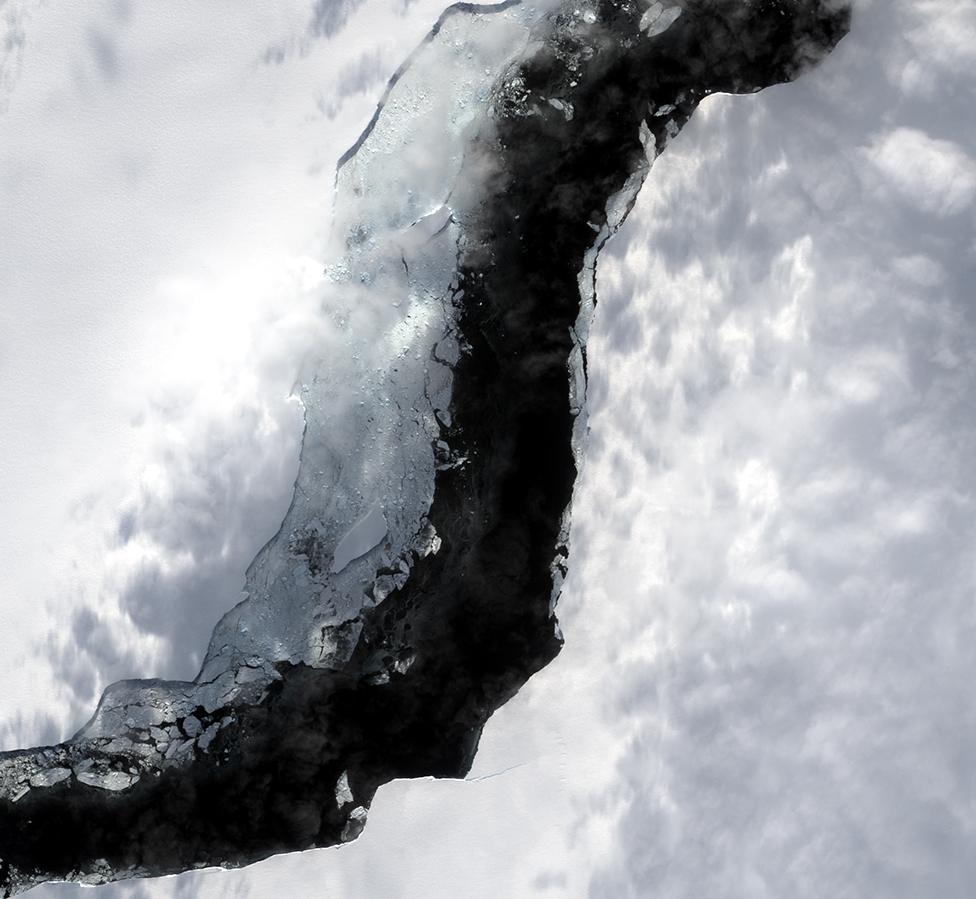
The North Rift pictured last Saturday. The gap is about 2km wide
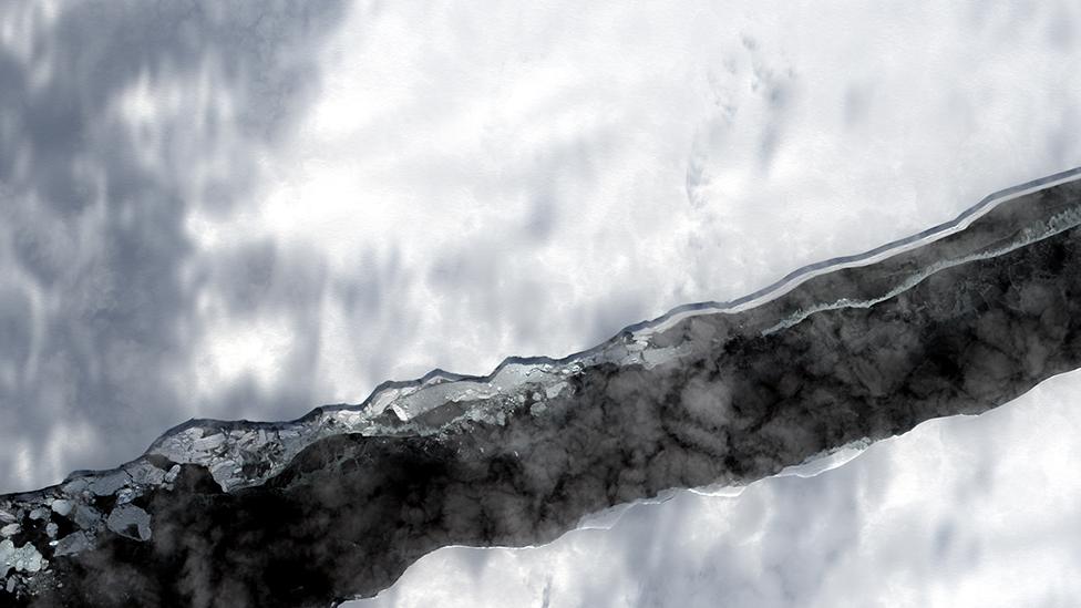
Very high resolution imagery has been released of the crack that resulted in the calving of Antarctica's latest mega-iceberg.
A74, as the 1,290-sq-km (500-sq-mile) block is known, broke away from the Brunt Ice Shelf exactly a week ago.
The new pictures from last Saturday show the widening "North Rift" a day after calving.
They were acquired by the UK satellite Vision-1 for the British Antarctic Survey.
BAS has its Halley Research Station on the Brunt, positioned about 23km from the rift.
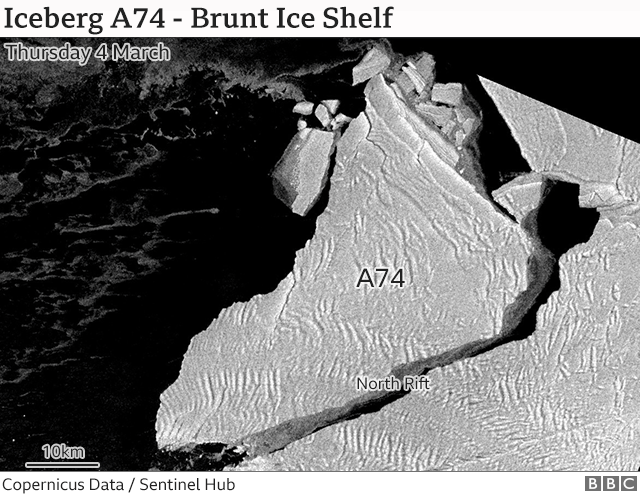
Also in the hands of BAS is new radar imagery captured on Thursday by the EU's Sentinel-1 spacecraft. This gives a wider view of the 150m-thick A74 pushing out into Antarctica's Weddell Sea.

The Vision-1 system resolves details less than a metre across
BAS is using all these space pictures to monitor events. The Cambridge-based agency wants to see if A74 might collide with the western part of the Brunt and initiate a second calving even closer to Halley.
The base is currently unoccupied. In part, that's because of Covid; very little Antarctic science is being undertaken at present. But it's also because BAS needs to be sure the Brunt Ice Shelf - a vast floating platform of ice - will remain stable into the future.
Halley would be 17km from the most likely site of a second calving.
GPS sensors around Halley reported no reaction in the ice directly under the base in the days following the production of A74. BAS is confident the same would be true from a second breakaway, but the agency would obviously like the certainty that comes with the data.
The Vision-1 satellite was built by Surrey Satellite Technology Ltd of Guildford. The Surrey company is a subsidiary of the European aerospace giant Airbus.
Vision-1 can resolve details at the surface of the Earth that are less than a metre across.

Halley is just off the bottom of this radar image
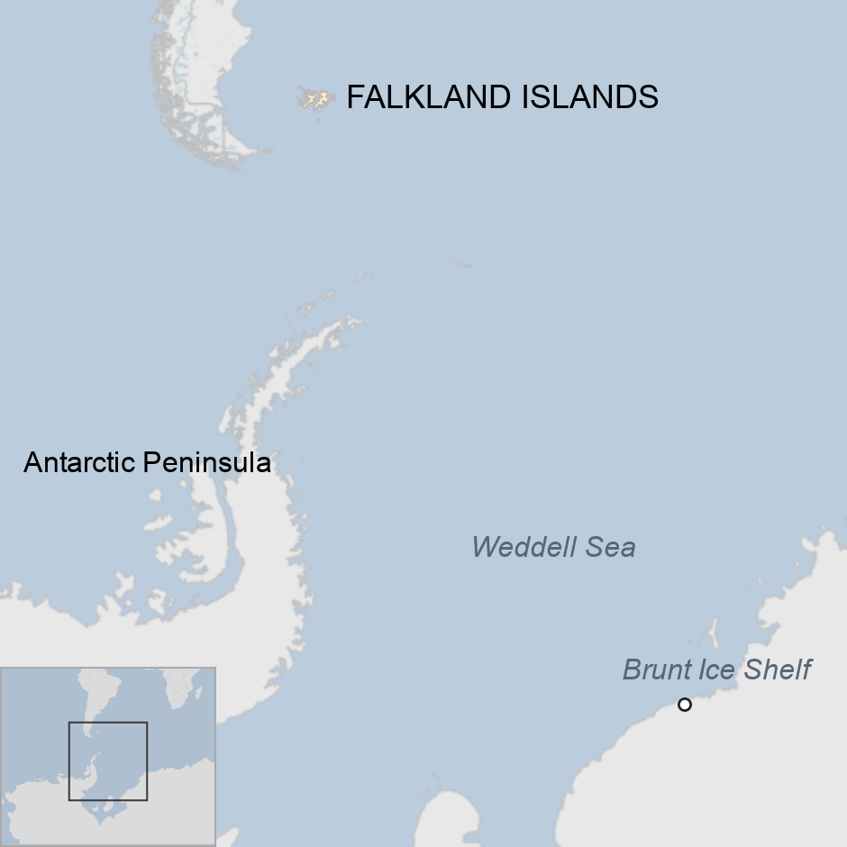
Where exactly is this?
It is on the Brunt Ice Shelf, which is the floating protrusion of glaciers that have flowed off the land into the Weddell Sea. On a map, the Weddell Sea is that sector of Antarctica directly to the south of the Atlantic Ocean. The Brunt is on the eastern side of the sea. Like all ice shelves, it will periodically calve icebergs.
Just how big is the new berg?
Satellite measurement puts it at around 1,290 sq km. Greater London is roughly 1,500 sq km; the Welsh county of Monmouthshire is about 1,300 sq km. That's big by any measure, although not as large as the monster A68 berg which calved in July 2017 from the Larsen C Ice Shelf on the western side of the Weddell Sea. That was originally some 5,800 sq km but has since shattered into many small pieces.

Jonathan.Amos-INTERNET@bbc.co.uk, external and follow me on Twitter: @BBCAmos, external
