Google Street View maps Greenland
- Published
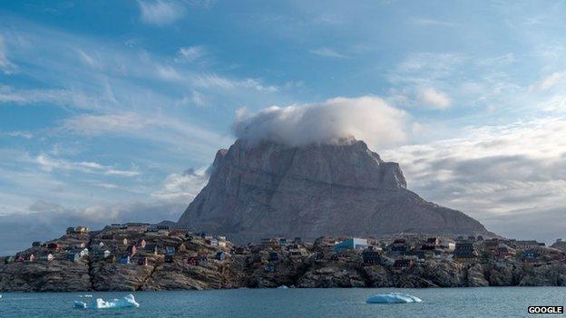
Google Street View has added some of Greenland's breathtaking scenery
Google has extended its Street View feature to take in the scenes of sparsely populated Greenland.
The internet giant has published immersive images of some of the island's most impressive landscapes, including the Ilulissat Icefjord and the Nuutoqaq harbour.
The country is the 66th to be incorporated into the feature.
One of the images was taken from the top of a hill in Kujalleq, southern Greenland.
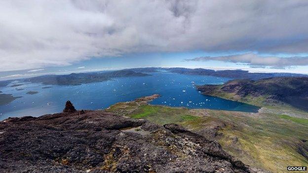
The view from on high: Kujalleq, southern Greenland
The images are immersive, meaning the user can rotate them in any direction. Another was of Brattahlid, the settlement founded by Erik the Red, who set up the first Viking colony on Greenland.
Erik the Red was a Norwegian, who discovered Greenland after being banished from Iceland.
He is said to have spread word of "the green land" among people living in Iceland on his return there in 985. Some Icelanders subsequently made the trip and decided to settle in Greenland.
His son Leif Eriksson later voyaged to North America - 500 years before Christopher Columbus.
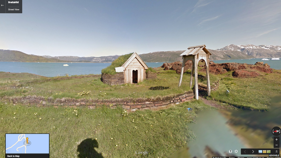
The site of what is believed to be the first Norse settlement on Greenland was documented by Google Street View's cameras
Another centuries-old human site to be documented was the Hvalsey church, in the south of Greenland.
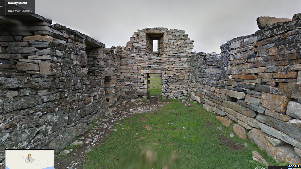
The abandoned Hvalsey church, which is linked to the last written record of the Greenland Norse
Alex Starns, Street View's technical program manager, wrote in a blog post: "At the abandoned settlement Hvalsey, you can visit Hvalsey church, the best preserved Norse ruins in Greenland. The church was also the location of the last written record of the Greenlandic Norse in 1408."
The Street View team also used boats to capture images of Ilulissat Icefjord.
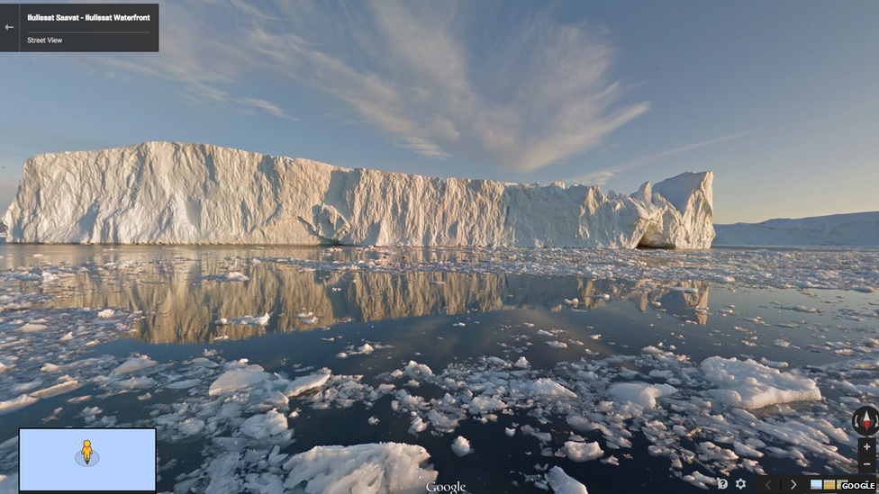
Ilulissat icefjord is one of the most impressive scenes added to Google Street View coverage of Greenland
"Floating by Ilulissat, you can see why the breathtaking Ilulissat Icefjord is the country's most popular tourist destination. Also an Unesco World Heritage site, the stunning ice wall seems to defy gravity as it reaches up into the clear, blue sky," wrote Mr Starns.
Another image was of the statue of Hans Egede, the Danish-Norwegian explorer who founded the town of Nuuk.
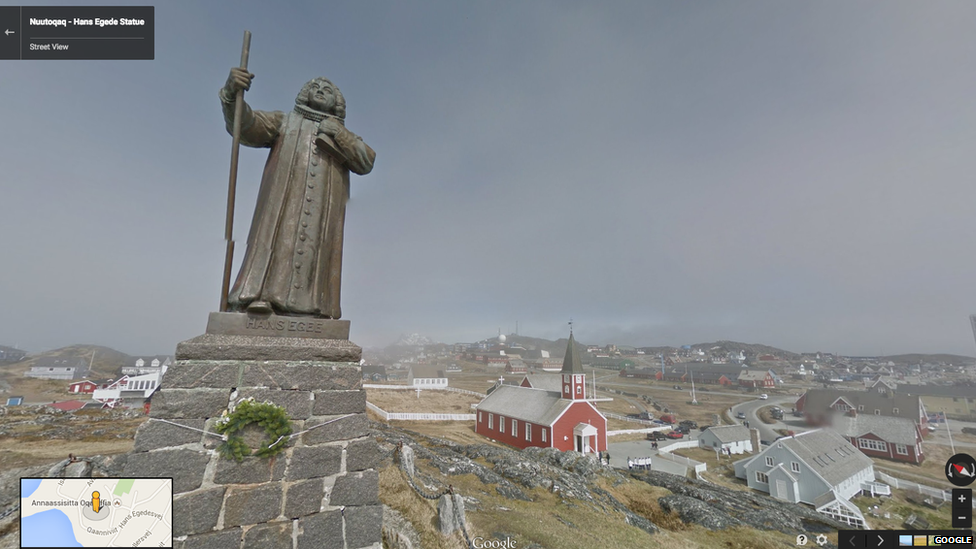
Hans Egede was a Lutheran missionary, who came to be called the "Apostle of Greenland"
- Published6 November 2014
- Published3 June 2014
- Published10 December 2013
