Sat-nav maps update aims to prevent stuck lorries
- Published

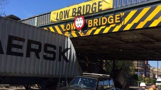
Lorry drivers sometimes ignore large warning signs
A multi-million pound sat-nav project aims to stop lorries and other vehicles getting stuck in narrow lanes and under low-lying bridges on UK routes.
Ordnance Survey is creating a database that will contain information about 200,000 miles (321,869km) of roadways to prevent such accidents.
Transport Minister Andrew Jones said, external the digital facility would launch before the end of the year.
But sat-nav makers will need to pay to get access to the full data.
"The new database will provide the sat-nav manufacturers with the ability to make journeys for HGV [heavy goods vehicle] drivers safer and more cost-efficient and that's a big issue for us," Richard Burnett, the chief executive of the Road Haulage Association, told the BBC.

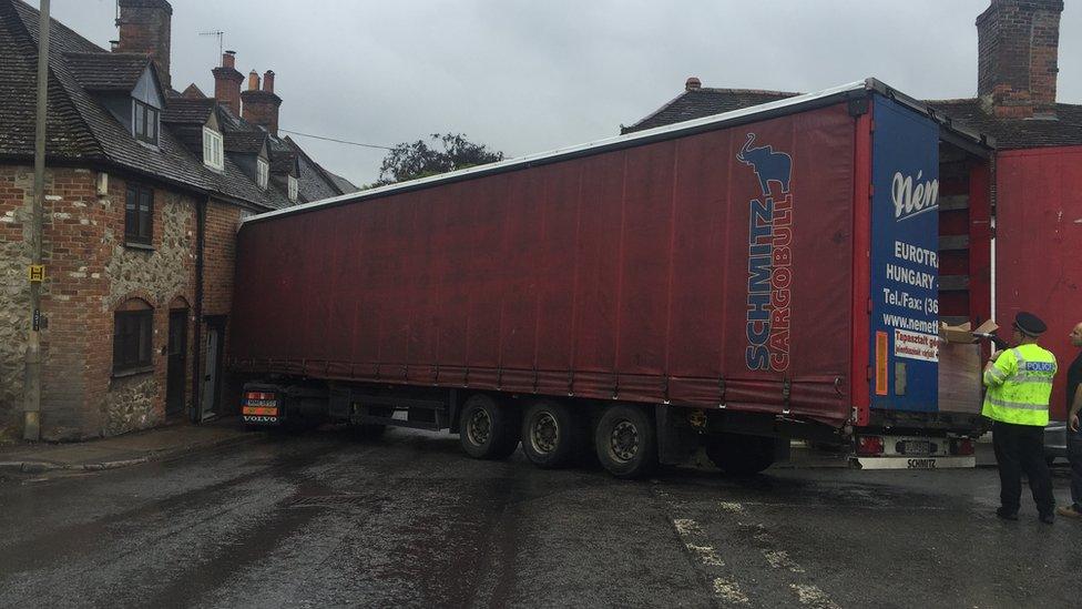
This lorry caused three-mile tailbacks when it became wedged against a house in Marlborough in June
"However, the new technology can only be considered a real success if each of the sat-nav providers sign up to the new system."
Details of the effort were first reported by The Times, external.
Commercial product
The National Digital Road Map database will include information about:
Road widths
Weight restrictions
Bridge heights
Restrictions on left or right turns at junctions

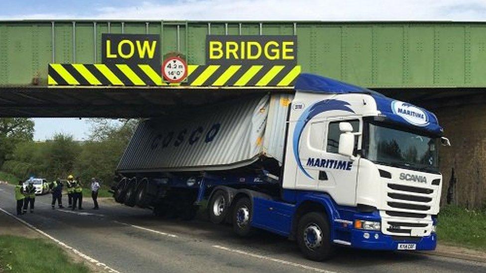
A fuel tanker was stuck for three days in Wiltshire in 2014 after getting stuck in a narrow country lane
It will be offered as a commercial product by Ordnance Survey to cover its running costs. There will also be a free-to-use version, but it will strip out the information that might prevent lorry accidents.
Ordnance Survey says about 80% of sat-nav makers, including Garmin, already subscribe to some of its other data, for which it charges less than 1p per device.
The Department for Transport has also contributed £3m of taxpayers' money to the effort.

Police have voiced their frustration at drivers' overreliance on sat-navs
"The definitive data, which also includes information on speed limits and planned road maintenance, delivers a product which will enable more efficient routing for all road users, including HGVs [heavy goods vehicles]," Robert Andrews, a spokesman for Ordnance Survey, told the BBC.
"[It] will result in high-quality data being supplied to satellite navigation companies.
"We are confident that the product will deliver customer data needs in one central location, allowing more informed and confident decision-making."
He added that the plan was to start offering access to the database from 16 November, to coincide with a Highways UK event in Birmingham.
"We welcome this move [and] hopefully this will lay the foundations for potential future advancements in vehicle technology," commented Kevin Clinton, head of road safety at The Royal Society for the Prevention of Accidents.

This railway bridge crash disrupted both train passengers' and motorists' journeys
Ignored warnings
Road signs already warn motorists about potential problems.
But the widespread use of sat-nav screens and smartphone map apps has meant they are often ignored.
Many lorries on UK roads are also driven by overseas-based drivers who may misinterpret the signs.
The scheme will rely on local authorities to help keep the database up-to-date.
The Local Government Association welcomed the development but called for additional action.
"Councils are keen to play their part but need the powers to fine lorry drivers who ignore weight restrictions and blight rural communities," said a spokesman.

This Argos lorry became stuck in Colchester, Essex after following sat-nav directions
Recent examples of the problem include:
Train delays and a back-up of traffic when a lorry became trapped under a railway bridge over the A428 highway in Northamptonshire in May
A lorry causing long tailbacks in Marlborough, Wiltshire when it got wedged against a house on a road leading into the market town in June
The closure of the M20 motorway in Kent after a footbridge collapsed after being hit by a lorry carrying a digger in August
- Published28 June 2016
- Published9 May 2016
- Published4 May 2016