Snow and ice warnings in place as temperatures plummet
- Published

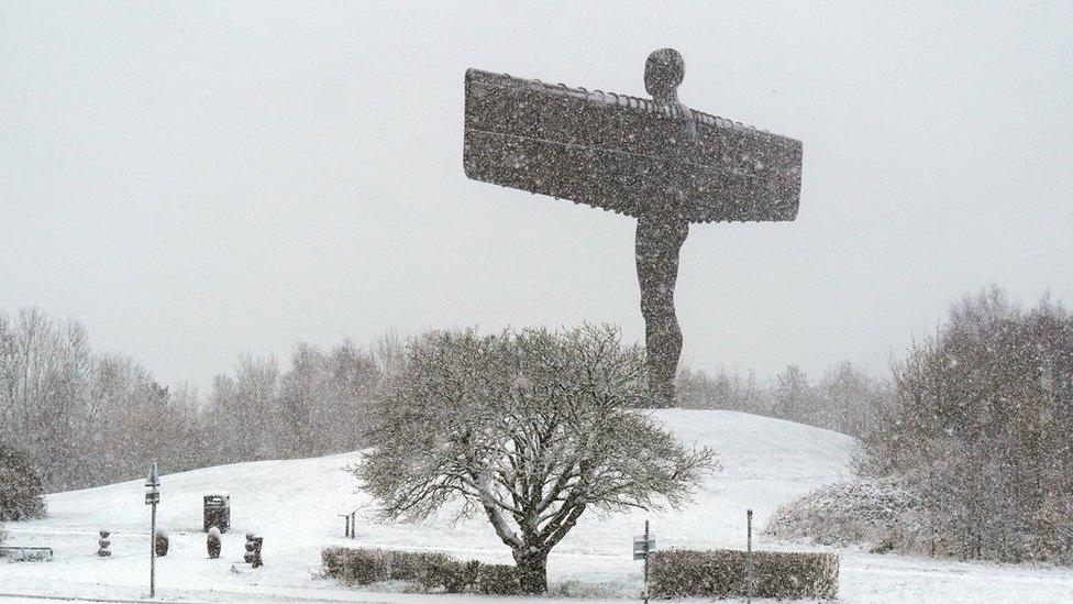
The Angel of the North statue in Gateshead covered in snow
Weather warnings for snow and ice have come into force for parts of England and Scotland as forecasters predicted freezing temperatures this weekend.
The yellow warnings cover northern and southern Scotland and the east of England, down to London and Kent.
Temperatures could fall as low as -10C in north-east Scotland and -4 to -8C across much of the UK overnight.
It comes as snow swept across parts of the UK on Friday, causing 30 schools in Cornwall to close or open late.
On Saturday morning Glasgow Airport had to ground all flights due to heavy snowfall overnight.
Two inbound flights had to be diverted to Prestwick and Edinburgh, as teams in Glasgow work to clear snow from the airfield.
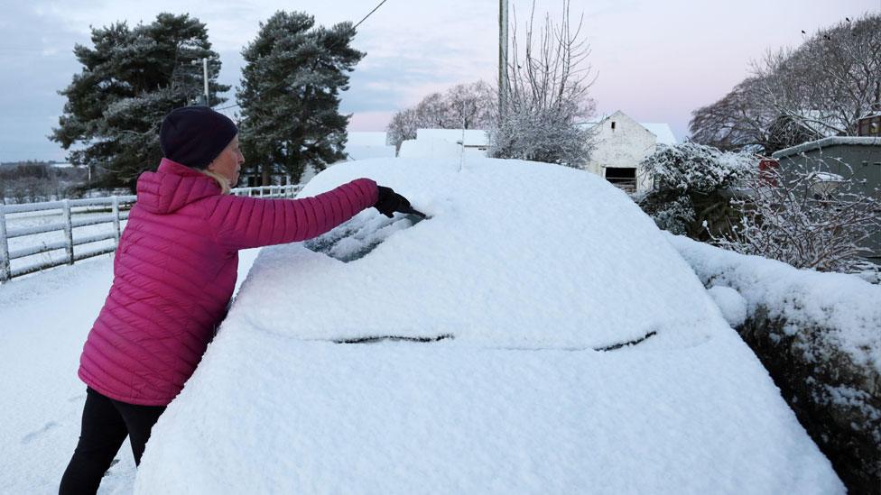
It comes after parts of the UK experienced the coldest night in the UK on Thursday since mid-March, with temperatures in Cumbria dipping to -9.4C (15F) overnight.

Flossie the Giant Schnauzer having fun in the snow in North Yorkshire
The Met's Office yellow warnings, which are in force from 17:00 on Friday until just before noon on Saturday, mean people could face hazardous conditions, with disruption and delays likely on roads and railways and icy patches on roads and pavements.
The weather agency has warned freezing rain, a rare type of precipitation which freezes on impact, could make driving dangerous.
In a post on X, the London Fire Brigade advised taking "extra care" while out and about "as conditions could be icy", warning people to "keep well away from water".
Many areas have seen temperatures of 0C (32F) throughout the day. But as the evening begins - with clear skies and light winds expected - temperatures will quickly drop to well below freezing.
The Met Office said there could be 2cm (0.79in) to 5cm (2in) of snow for areas 100m (328ft) to 200m (656ft) above sea level, particularly in Northern Ireland and western Scotland.
There will be further wintry downfalls of snow for a time around North Sea coasts but into the weekend some rain or sleet and snow showers will start coming in from the west.
There is the chance of some significant snow in Wales, the Midlands and parts of northern England by Sunday morning, even at low levels.

The Angel of the North statue covered in snow in Gateshead
Separately, the UK Health Security Agency has issued an amber cold-health alert for the health sector for a number of regions in England, meaning "significant impacts are probable".
The alert indicates that the cold weather is likely to affect the whole health service, with the potential for the entire population to be at risk, the agency says.
The alert is in place for the East Midlands, West Midlands, North West, North East and Yorkshire and the Humber until 5 December.
Temperatures of between -3C (27F) to -6C (21F) were widely seen across the UK on Friday, even in major towns and cities. It was -5C (23F) in Manchester and Edinburgh and -3C (27F) in south-west London and Birmingham.
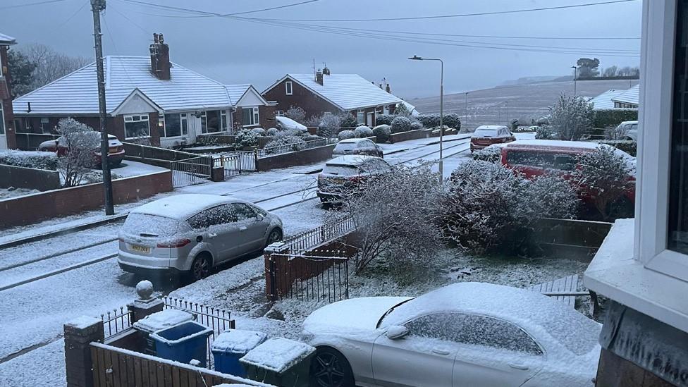
Snow swept across south-west England, parts of Yorkshire, the North East and Scotland, while hilly areas - including the North York Moors and parts of Scotland - will see more snow later, forecasters said.
The latest forecast in 60 seconds
Many areas of the North East woke up to a blanket of snow, causing delays for motorists and some schools to close.
In County Durham, police said snowy conditions led to some crashes on the roads, while North Yorkshire Police reported 100 cars stuck between Whitby and Scarborough.
Overnight from Thursday into Friday morning, some of the coldest places were:
England: Shap, Cumbria -9.4C (15F)
Scotland: Eskdalemuir, Dumfries and Galloway -8C (18F)
Northern Ireland: Katesbridge, Co Down -6.2C (21F)
Wales: Whitchurch, Pembrokeshire -6C (21F)

Souter Lighthouse in Whitburn, Tyne & Wear

People in the snow in Gateshead
Yellow warnings for ice for Northern Ireland and south-west England ended at 10:00, but in some central and south-eastern areas of England freezing fog posed an additional hazard on Friday morning.
By Friday lunchtime, large parts of the UK were experiencing crisp, cold and sunny weather.
Despite the alerts, this year has joined 2021 and 2022 as one of the warmest autumns on record in the UK, with the temperature for the past three months standing at 10.8C (51F) according to provisional data from the Met Office.

Have you been affected by the cold snap? You can share your experience by emailing haveyoursay@bbc.co.uk, external.
Please include a contact number if you are willing to speak to a BBC journalist. You can also get in touch in the following ways:
WhatsApp: +44 7756 165803
Tweet: @BBC_HaveYourSay, external
Please read our terms & conditions and privacy policy
If you are reading this page and can't see the form you will need to visit the mobile version of the BBC website to submit your question or comment or you can email us at HaveYourSay@bbc.co.uk, external. Please include your name, age and location with any submission.

Find out the weather forecast for your area, with an hourly breakdown and a 14-day lookahead, by downloading the BBC Weather app: Apple, external - Android, external - Amazon , external
The BBC Weather app is only available to download in the UK.

Related topics
- Published1 December 2023
- Published1 December 2023
- Published30 November 2023
- Published29 November 2023
- Published27 November 2023