Dunwich: The storms that destroyed 'lost town'
- Published

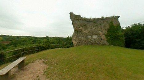
In the 11th Century Dunwich was the 10th largest town in England
Evidence of violent storms that destroyed a lost town known as Britain's Atlantis has been uncovered.
The finds were uncovered off the coast of Dunwich, Suffolk - a small village which in the 11th Century was one of the largest towns in England.
The town was hit by a succession of storms in the 13th and 14th centuries and is now largely below the sea.
Researchers said sediment gathered from the cliffs independently corroborated the historical record.
Live: Read more on this and other stories from Suffolk
Professor David Sear, of the University of Southampton, said Dunwich was hit by huge storms on an annual basis.
"[They were] like the south coast storms of 2013-14, at least once a year for decades," he said.

Researcher Bill Jenman said activity in Dunwich could be dated back to the Iron Age
The three-year research off Dunwich has been funded by Touching the Tide, a £900,000 Heritage Lottery Fund scheme to explore the changing Suffolk coast.
A diver used ultrasound to "illuminate" finds on the seabed, and the marshes and eroding cliffs were surveyed.
"It offers a marvellous history of climate change and coastal erosion," said Prof Sear with regards to the findings.
In the 11th Century, Dunwich was the 10th largest town in England, but now has about 120 residents.
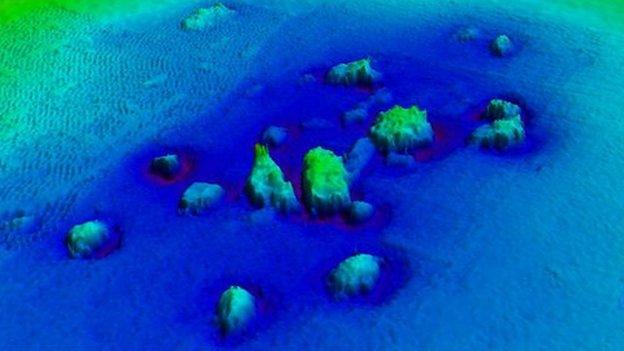
The secrets of a lost Suffolk town are being revealed with the help of ultrasound
Two great storms in 1286 and 1326 resulted in the loss of its harbour and started its decline.
Prof Sear said pollen analysis revealed how "people gave up on Dunwich" after 1338, when another great storm silted up the port for good, and food production declined.
Sediment gathered from the cliffs, he said, "independently confirmed the sequences of storms recorded in the historical record".
Dating of the old defensive town ditch produced a result which surprised the researchers - suggesting the town's origins date back to the Iron Age.

Underwater imaging techniques showed the Dunwich ruins through the murky water
The underwater research has been carried out using acoustic imaging technology, and has unearthed a series of buildings.
"We use sound to create a video image of the seabed and the reason we do that is because when you dive at Dunwich it's pitch black," Prof Sear said.
"We found the ruins of about four churches and we've also found ruins of what we think was a toll house. But we've also found shipwrecks for example, and there's some we've found with this Touching the Tide project, which no-one's known before."

The shipwreck was found on the seabed just north of the village.
The ribs of the 32m (105ft) ship are covered in a thin sheet of copper, dating it from after 1750.
Prof Sear, who has been researching Dunwich since 2008, said he did not yet know "the identity or type of wreck", but was working with local museums to source this information.
A dig in 2015 discovered evidence of Dunwich's prehistoric origins, as well as evidence it was "a substantial Saxon port, prior to its rapid growth following the Norman invasion".
Bill Jenman, from Touching the Tide, said: "We found loads of pottery, a lot more than we've found before, so sort of High Medieval - the peak of the affluence of Dunwich.
"We can push the story of Dunwich certainly back to the Iron Age, and we know people were here back into the Stone Age. We know it was a fairly major town in the Anglo-Saxon period."
You can watch the story of Britain's Atlantis on BBC Inside Out East, on Monday at 19:30 GMT on BBC One.
- Published9 September 2015

- Published10 May 2013
- Published30 July 2012