£3.4m Welsh and Irish coastal erosion study begins
- Published
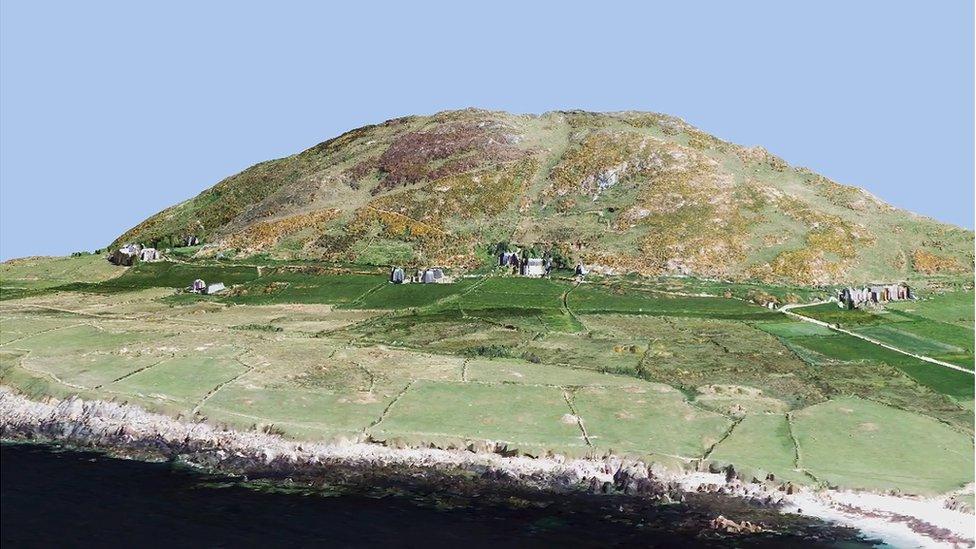
Taking to the air to map Wales' coast
A £3.4m project to map sections of the Welsh coastline in more detail than ever before has begun.
The five-year joint Welsh and Irish study aims to find out how quickly remote coastal areas in Wales are disappearing due to climate change.
Data from the project will help the Welsh Government to manage heritage sites and communities at risk.
Researchers said it would create a "better understanding of how to map this coastal erosion".
The EU-funded project will be led by the Royal Commission on the Ancient and Historical Monuments of Wales, along with Aberystwyth University, the Discovery Programme: Centre for Archaeology and Innovation Ireland and Geological Survey, Ireland.
It will focus on cultural heritage sites, such as pre-historic hill forts and ancient ruins along the coast, as well as the Welsh islands in the Irish Sea.
A 360 degree animation of Bardsey Island
To get the best view the team will fly over some of the most inaccessible parts of the coast to take photographs, which will be used to create 3D computer models of each area.
Researchers from Dublin will also scan the sea bed. The work will give a more accurate picture of the coastline along the Irish Sea than ever before.
Dr Toby Driver, a senior aerial investigator on the CHERISH project, said, in certain parts of Wales, they do not know what has already disappeared into the sea.
"That's what this new project hopes to address, to really get a good idea of what's been lost in the last few years and what's been lost over the last century and how fast is this coastal erosion happening," he said.
"We've got the best computer software we can get, the best experts we can get in this project, working together to get a better understanding of how to map this coastal erosion."
Geographers from Aberystwyth University will also analyse historical records of extreme weather to see how coastal communities coped in the past.

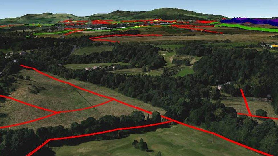
The study will see aerial investigators like Dr Toby Driver take to the sky
They will be looking for patterns in storm activity to see if understanding what happened in the past can increase resilience in the future.
Hywel Griffiths, a senior lecturer in physical geography at Aberystwyth University, said it was important to know how quickly things were changing.
"There are communities living on these coastlines which have to manage and adapt to a changing coast on a yearly basis," he said.
"But there are also important cultural and historically-significant sites right on the coastline which could potentially be under threat from increased stormy conditions in the future as a result of climate change."
The project will also look at how the coast could change over the next 100 years.
- Published1 April 2017
- Published30 March 2017
- Published24 December 2016
- Published21 October 2015