Welshman's 18th Century US map fetches $125k in New York
- Published

The map showing the early British colonies of America is said to be about 75% complete
A map hailed as "one of the most important" of the early British colonies in America has sold for $125,000 (£98,000) in New York.
The chart drawn in 1755 by surveyor Lewis Evans, from Caernarfonshire, is said to have set the standard for mapmaking for the next 50 years.
Swann Auction Galleries said it was "rarely, if ever" that such an 18th Century item had been preserved.
It had been estimated to only fetch between $30,000 and $50,000 at auction.
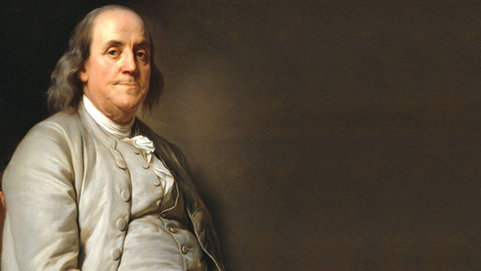
Evans travelled with his close friend Benjamin Franklin - one of the founding fathers of the United States - over vast areas of land to draw up the map.

Benjamin Franklin was a leading figure in the American struggle for independence
It showed Virginia, Maryland, Delaware, Pennsylvania, New Jersey, New York, Connecticut and Rhode Island, as well as Ohio and parts of what was to become Canada.
The descriptions of land beyond the British frontier included great amounts of new information for potential settlers.
Published in Evans's Geographical Essays, it was also used extensively by British authorities during the French and Indian War (1754-63).
Specialist Caleb Kiffer said it was 75% complete.
"Having the opportunity to bring the pre-production proof copy to auction has been a highlight of my many years in this business," he said.
"It jump-started my heart the moment the consignor presented it to me and continued beating at a fast pace up until the moment it hammered at $100,000 in auction.
"It truly is an artefact and having it double the estimate demonstrates its historical significance."
The final price, including a fee to the auctioneers, was $125,000.
- Published6 June 2019
- Published17 March 2019

- Published20 August 2018
- Published10 November 2017

- Published29 October 2015
- Published30 September 2015