New Zealand quake: The geological impact of a 'complex' tremor
- Published
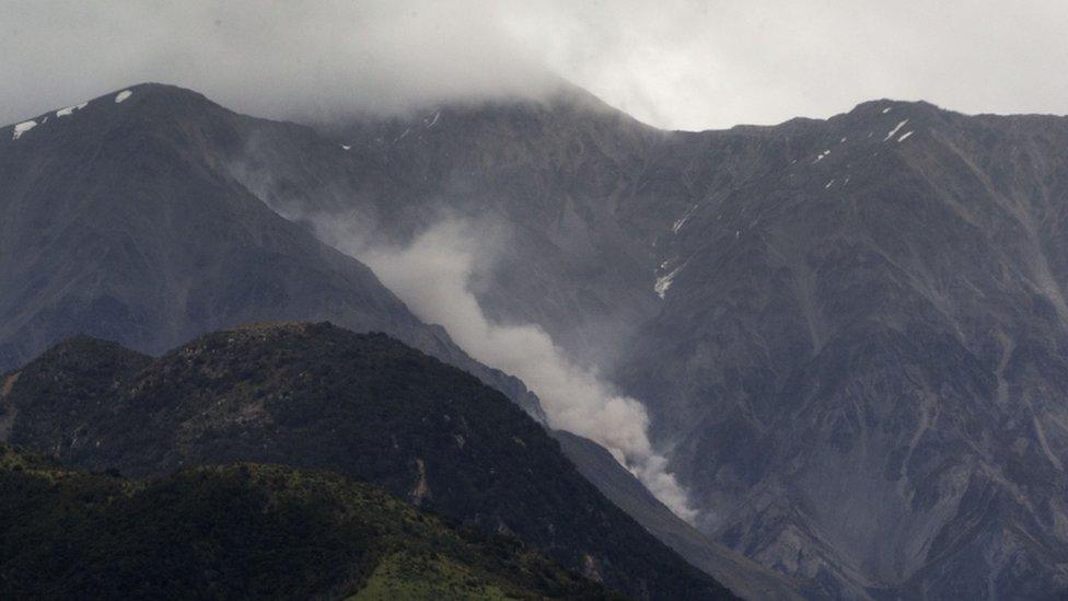
The earthquake, with a magnitude of 7.8, hit shortly after midnight on Monday close to Christchurch. Two people were killed.
Scientists studying it have said the initial tremor was actually two separate powerful quakes, which together lasted for two minutes. It was one of the most complex quakes ever recorded on land, said Geonet, the national quake-monitoring body.
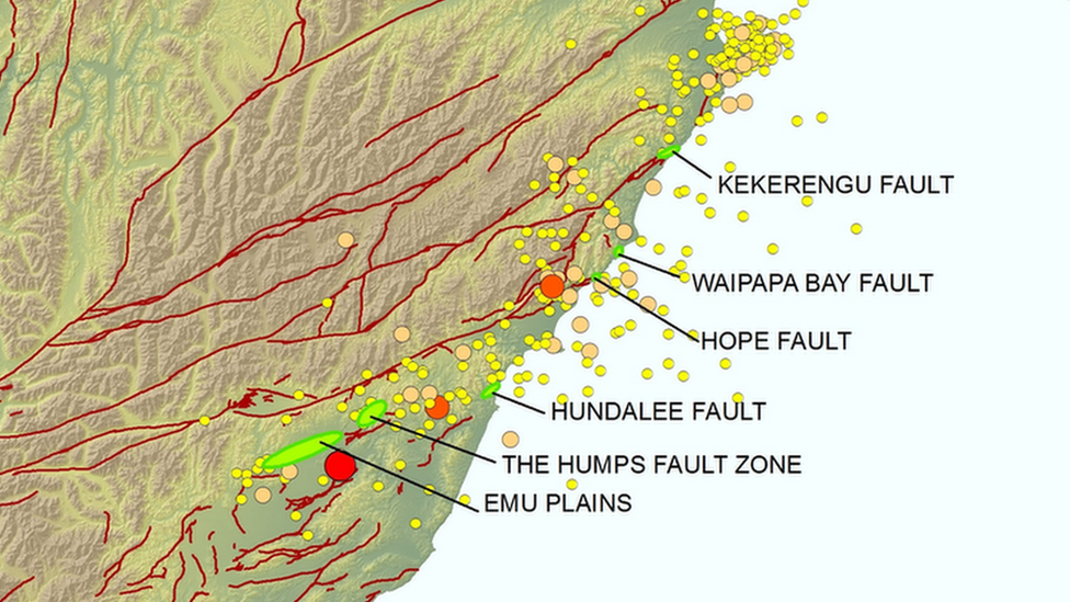
Most earthquakes are the result of rupture on a single fault plane. But the twin quakes led to the rupture of at least six faults, including a newly identified one at Waipapa Bay.
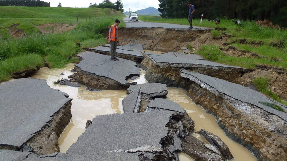
Prof Andy Nicol of New Zealand's University of Canterbury told the BBC the Kaikoura earthquake started in the south and travelled north. The largest seismic energies were released about 70km (44 miles) north of the epicentre at Culverden.
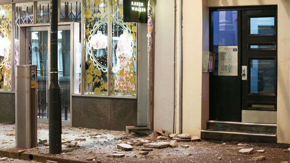
But the whole country was rattled, with the impact seen over a 7,000 sq km area. Roads and dozens of buildings in Wellington, the capital, sustained considerable damage.
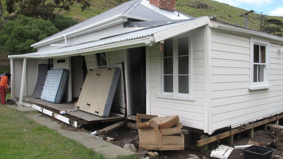
The quake generated a tsunami and an evacuation of coastal areas. The tsunami didn't cause serious damage, except to one area called Little Pigeon Bay on Banks Peninsula, said Geonet. This unoccupied house was wrenched off its foundations by waves up to 4.1m above sea level.
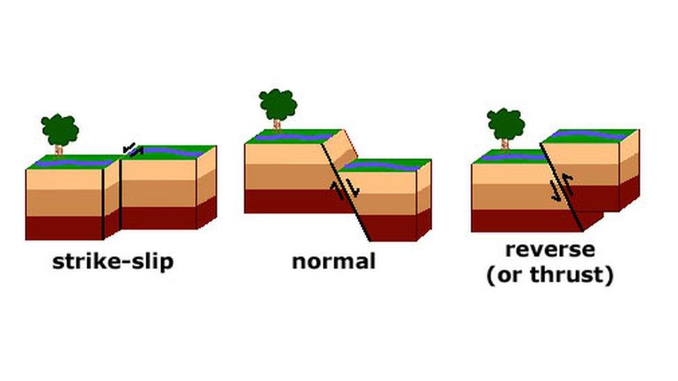
Earthquakes are caused by a sudden slip on a fault, the fractures in Earth's crust. There are three types of faults: strike-slip, normal and reverse faults. These faults indicate different movements of rocks.
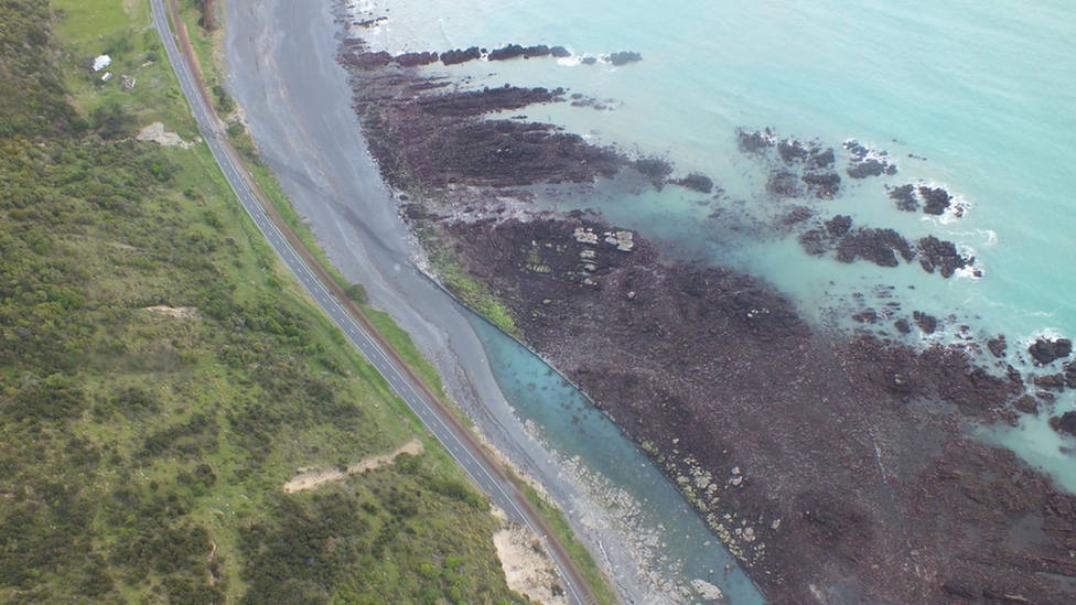
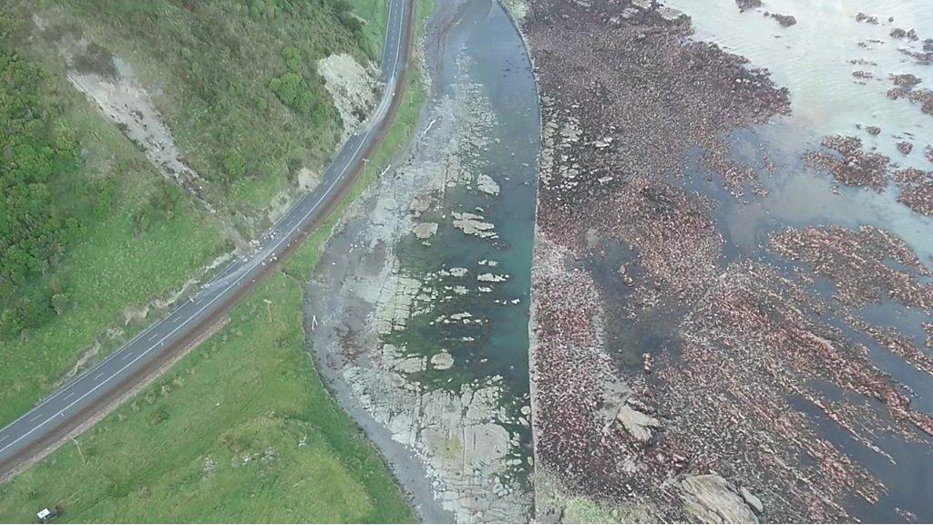
Tonkin and Taylor, an engineering firm surveying the damage, said a section of the seabed along a 110km stretch of coast north of Kaikoura was lifted by between 2-2.5m. Prof Nicol said this was likely due to "reverse faulting".
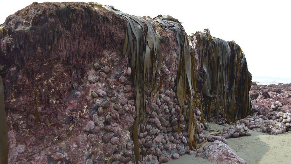
The seabed rise stranded huge amounts of marine life, including crayfish and paua - an edible sea snail harvested for its meat and shells. Experts say it could take years for the wildlife to recover, a serious concern for the fishing industry.
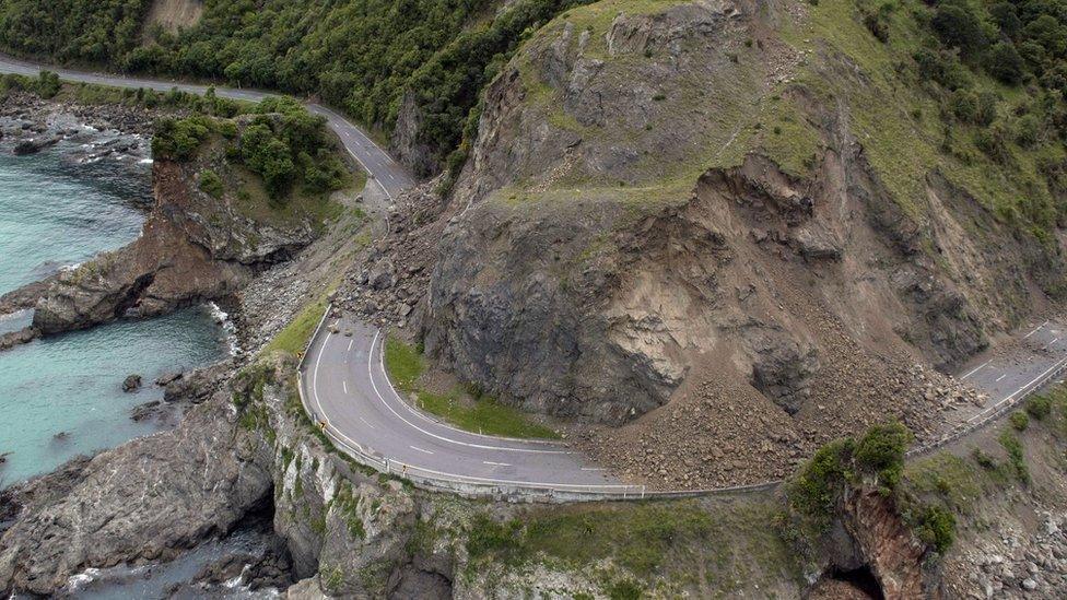
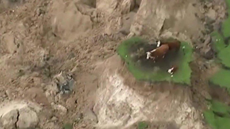
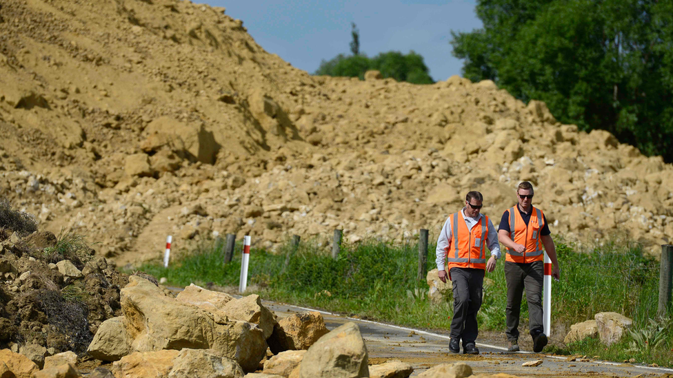
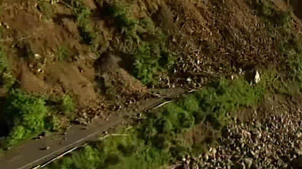
Up to 100,000 landslides were triggered by the quakes, blocking major road and railway routes. Prof Nicol said the landslides would lead to permanent changes in the landscape and a significant amount of sediment would be flushed down the river system.
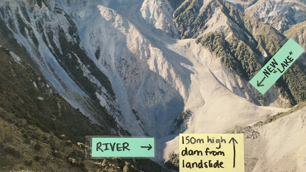
A 150m-high landslide dam has formed on the Hapuku River. Such dams pose great danger as they can collapse without warning, releasing vast amounts of water.
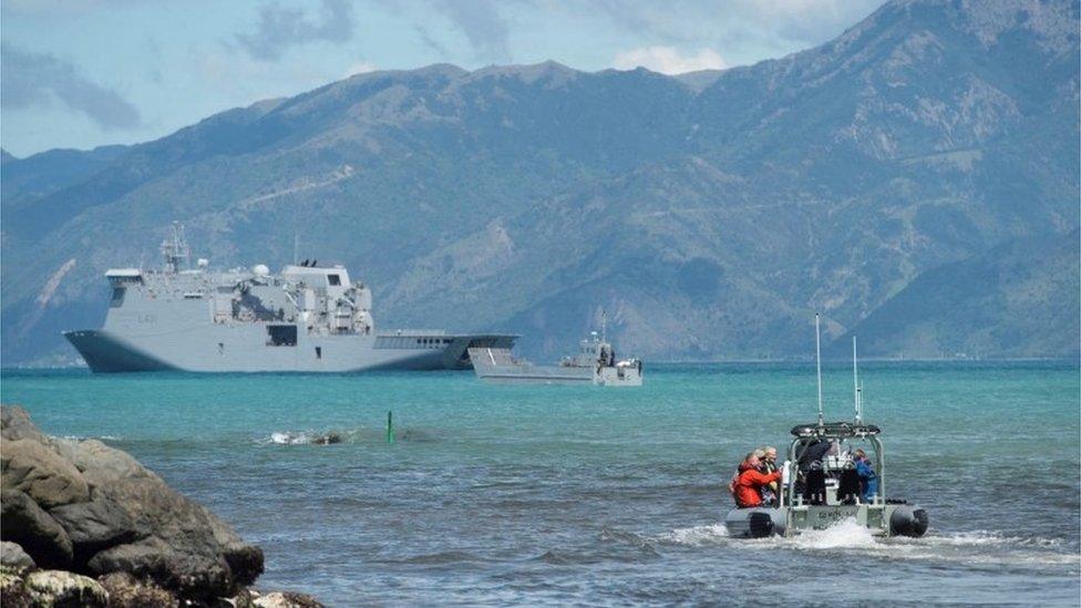
Kaikoura itself was completely cut off by landslides. About 1,000 tourists and locals have been evacuated by sea from the small town, which is famous for its whale-watching opportunities.
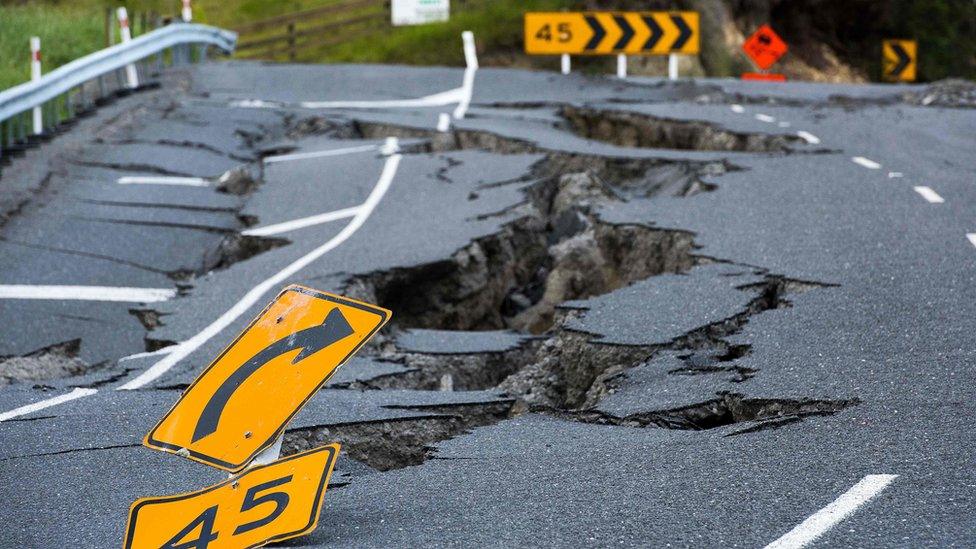
The total damage is estimated to be at least NZ$12bn ($8.4bn; £6.8bn), and emergency work is expected to continue for some time. Meanwhile aftershocks are continuing - there have been more than 2,000 since Monday - and scientists say more quakes are likely.
- Published17 November 2016
- Published16 November 2016
- Published14 November 2016

- Published14 November 2016
- Published15 November 2016
