Hurricane Florence: 'Disaster' still feared as storm's winds weaken
- Published
Why do people ignore hurricane warnings?
Hurricane Florence has been downgraded to a category two storm as it approaches the US but officials still warn of a "disaster at the doorstep".
Florence's winds may have dropped to 110mph (175km/h) but its slow-moving nature could mean it lingers for days, bringing catastrophic flooding.
Some 10 million people are now under some form of storm watch.
Florence may now be heading further south, and Georgia is the latest state to declare an emergency.
It joins North and South Carolina, Virginia, Maryland and Washington DC.
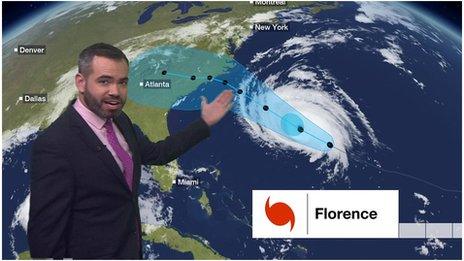
Where is the hurricane now?
As of 05:00 Eastern Daylight Time on Thursday (09:00 GMT), Florence was 205 miles (330km) south-east of Wilmington in North Carolina, the latest National Hurricane Centre advisory says., external
Forecasters have adjusted the predicted path of Florence. It is now expected to make landfall a little further south, on the Carolinas border on Thursday.
The hurricane's wind speeds have fallen from a category 3 level of 111-129 mph to a category 2 level of 96-110 mph.
However, they are not expected to weaken further and the forward speed of the hurricane is also dropping, meaning it could linger near the coastline through to Saturday.


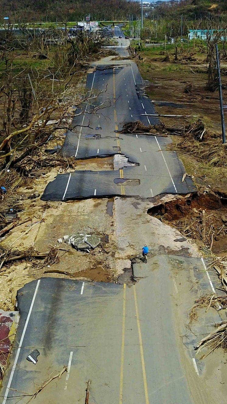
This means that torrential rainfall could last for significant periods and cause catastrophic flooding, including in inland areas such as Alabama, Tennessee, Kentucky and West Virginia.
North Carolina Governor Roy Cooper said: "The time to prepare is almost over, Disaster is at the doorstep and it's coming in."
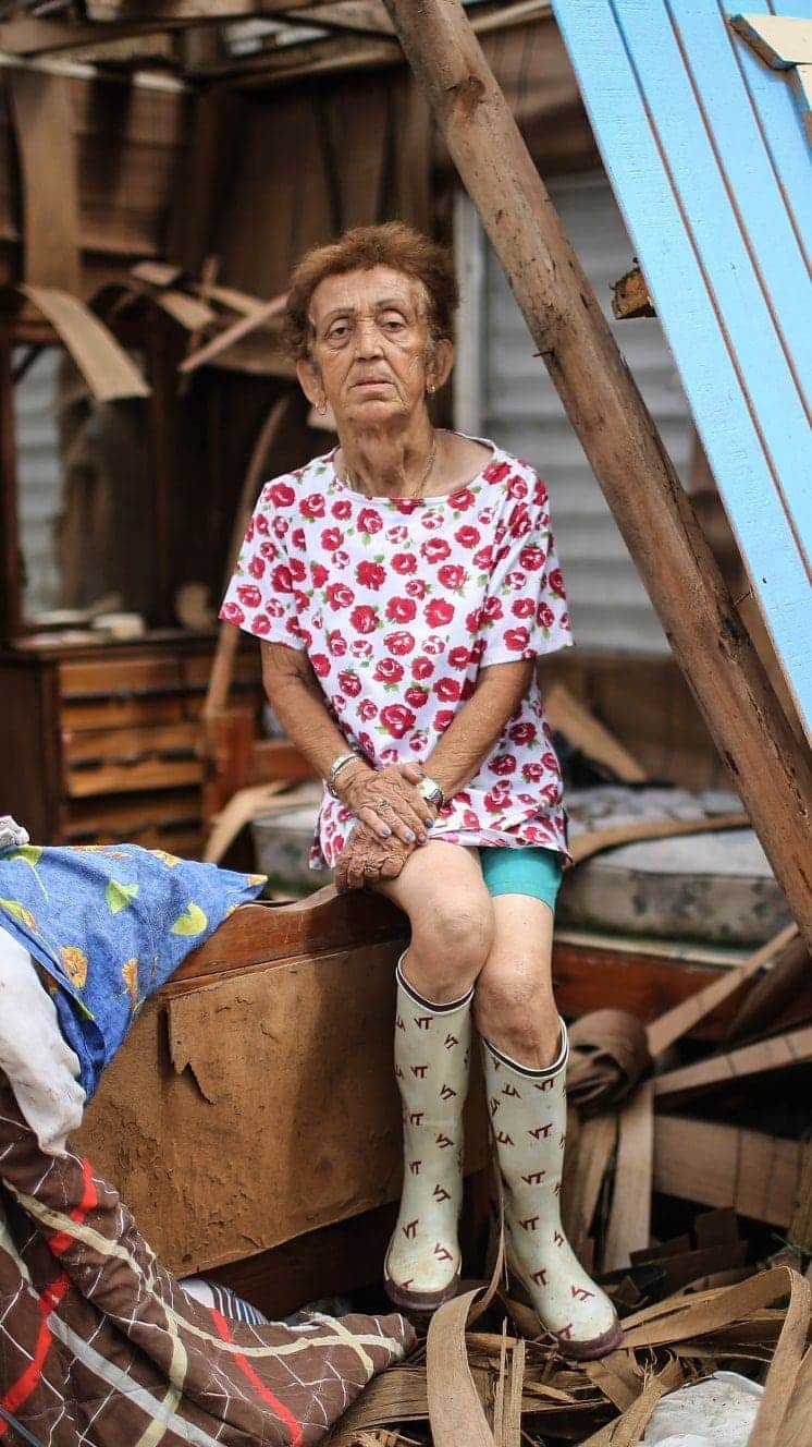
People have left homes and taken precautions ahead of the hurricane
Up to 1.7 million people have been ordered to evacuate across South Carolina, North Carolina and Virginia.
Some 5.25 million people are under hurricane warning or watch, and another 4.9 million people are under storm warning or watch, Associated Press reported.
What makes Florence so dangerous?
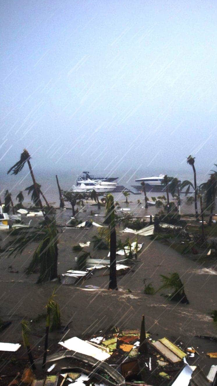
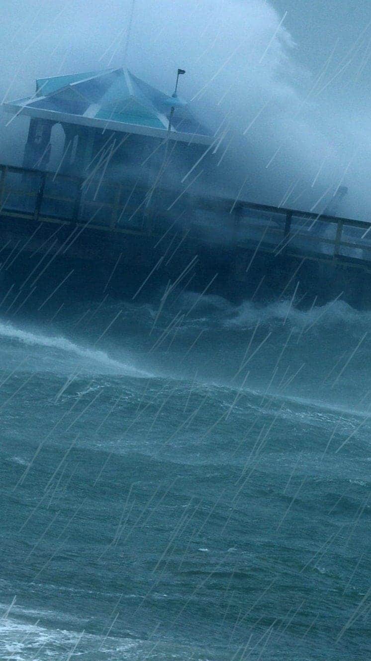
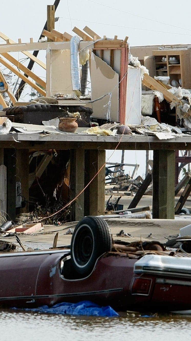
The biggest danger to life could be from storm surges, which are still predicted to be as high as 13ft (4m) between Cape Fear and Cape Lookout in North Carolina, areas that could also see up to 40in (101cm) of rain.
There will be hurricane-force winds up to 80 miles from the centre of the storm, meteorologists say.
President Donald Trump issued a video message saying: "This is going to be one of the biggest ones to ever hit our country... Protection of life is the absolute highest priority."
A National Weather Service forecaster said: "This will likely be the storm of a lifetime for portions of the Carolina coast.
"And that's saying a lot given the impacts we've seen from Hurricanes Diana, Hugo, Fran, Bonnie, Floyd and Matthew.

"I can't emphasise enough the potential for unbelievable damage from wind, storm surge and inland flooding with this storm."
Jeff Byard, of the Federal Emergency Management Agency, said: "This is going to be a Mike Tyson punch to the Carolina coast."
What damage could it cause?
Florence could wreak more than $170bn (£130bn) of havoc and damage nearly 759,000 homes and businesses, says analytics firm CoreLogic.
Energy companies warned Florence could knock out power in some areas for weeks
Waves 83ft (25m) tall were recorded at sea on Wednesday morning.
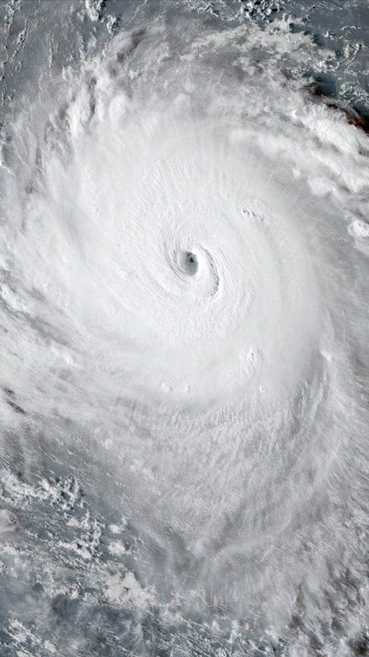
European astronaut Alexander Gerst shared images of Florence's eye wall from space, calling the storm a "no-kidding nightmare".
Allow X content?
This article contains content provided by X. We ask for your permission before anything is loaded, as they may be using cookies and other technologies. You may want to read X’s cookie policy, external and privacy policy, external before accepting. To view this content choose ‘accept and continue’.
Is anyone refusing to evacuate?
But while many coastal residents have complied with mandatory evacuation orders, others are boarding up their homes and vowing to ride out the storm.
Delicatessen owner in Wilmington, Brad Corpening, told Reuters he would stay, saying: "I'm not approaching Florence from fear or panic. It's going to happen. We just need to figure out how to make it through."
The US Air Force team was gathering information about the storm
Restaurant owner in the town, Solange Iliou Thompson, told AFP news agency: "I'm staying. The building's solid and Buddha will protect us.
"What can you do? You can't stop Mother Nature."
Hurricanes
A guide to the world's deadliest storms
Hurricanes are violent storms that can bring devastation to coastal areas, threatening lives, homes and businesses.

Hurricanes develop from thunderstorms, fuelled by warm, moist air as they cross sub-tropical waters.
Warm air rises into the storm.
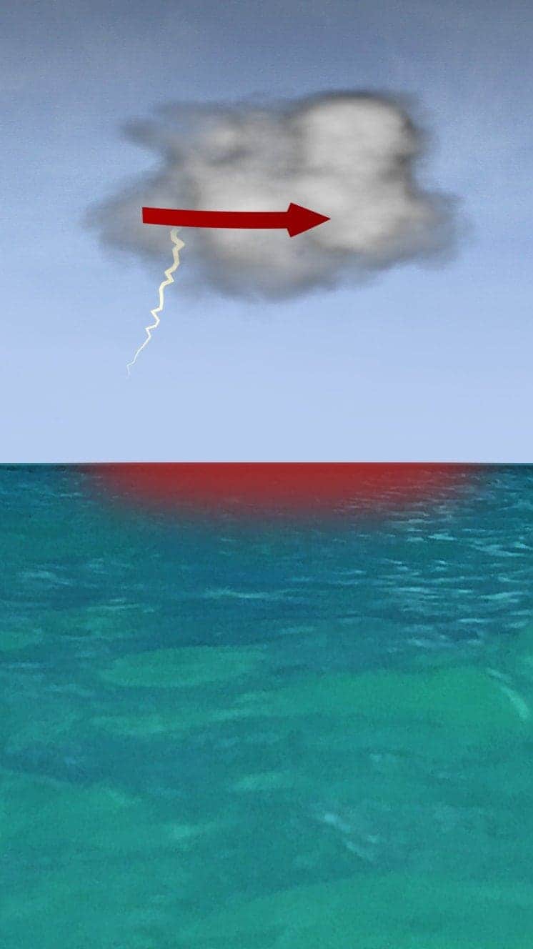
Air swirls in to fill the low pressure in the storm, sucking air in and upwards, reinforcing the low pressure.
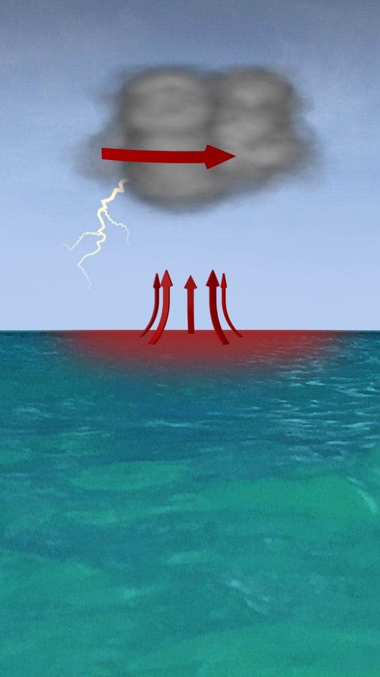
The storm rotates due to the spin of the earth and energy from the warm ocean increases wind speeds as it builds.
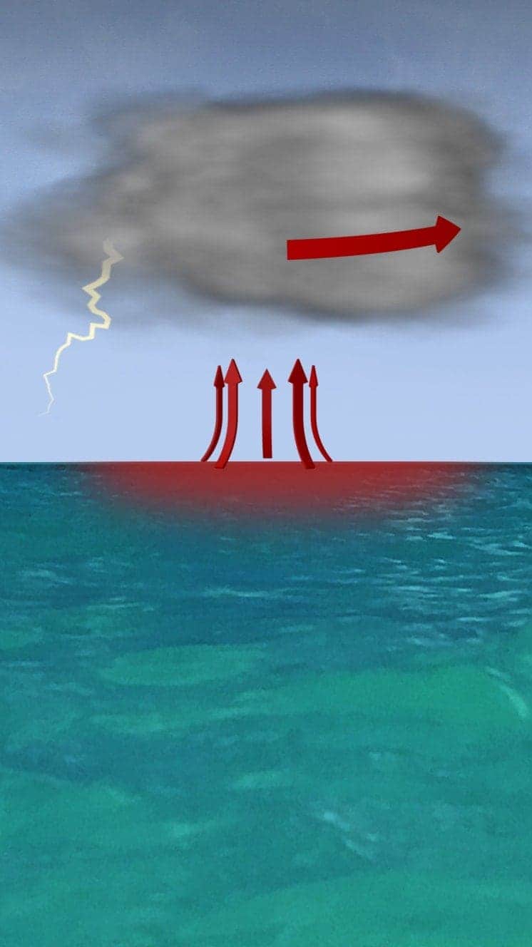
When winds reach 119km/h (74mph), it is known as a hurricane - in the Atlantic and Eastern Pacific - or a typhoon in the Western Pacific.

"Everybody has a plan until they get punched in the face. Well, we're about to get punched in the face."
Florida Mayor Bob Buckhorn, ahead of Hurricane Irma (2017)
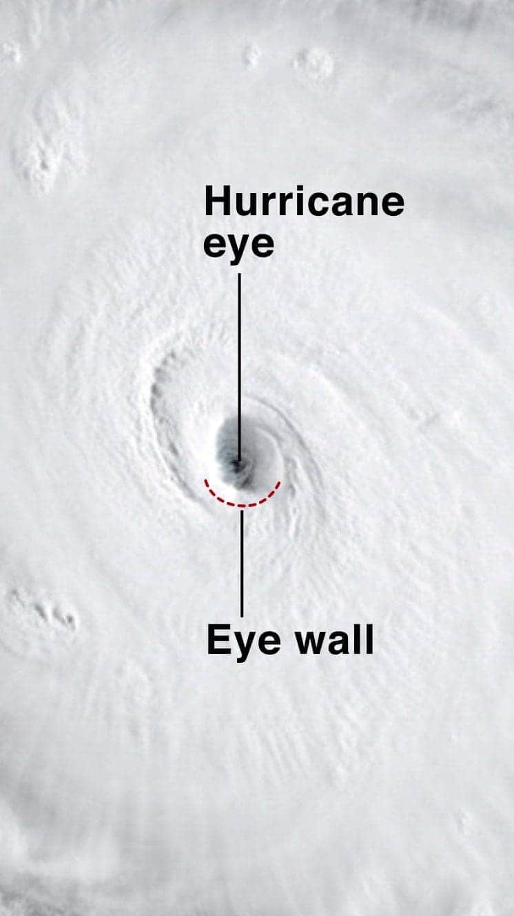
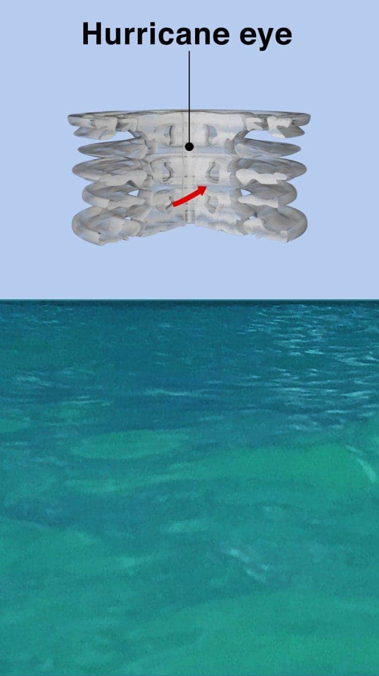
The central eye of calmer weather is surrounded by a wall of rainstorms.
This eyewall has the fastest winds below it and violent currents of air rising through it.
A mound of water piles up below the eye which is unleashed as the storm reaches land.
These storm surges can cause more damage from flooding than the winds.

"Urgent warning about the rapid rise of water on the SW FL coast with the passage of #Irma's eye. MOVE AWAY FROM THE WATER!"
Tweet from the National Hurricane Center
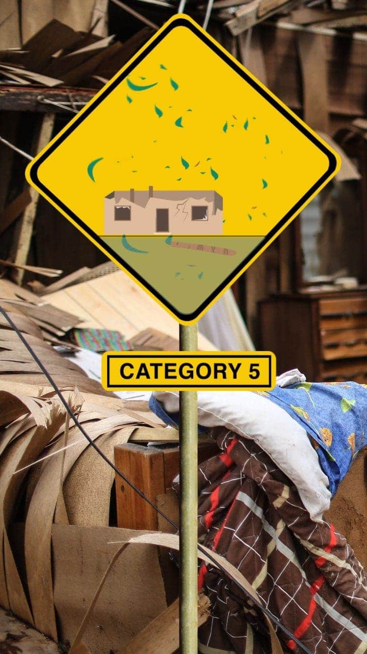
The size of hurricanes is mainly measured by the Saffir-Simpson scale - other scales are used in Asia Pacific and Australia.
Winds 119-153km/h
Some minor flooding, little structural damage.
Storm surge +1.2m-1.5m
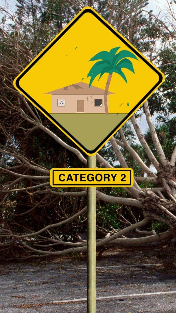
Winds 154-177km/h
Roofs and trees could be damaged.
Storm surge +1.8m-2.4m
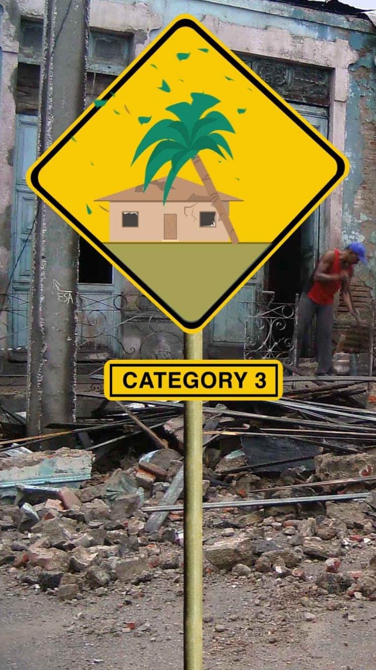
Winds 178-208km/h
Houses suffer damage, severe flooding
Storm surge +2.7m-3.7m
Hurricane Sandy (2012) caused $71bn damage in the Caribbean and New York
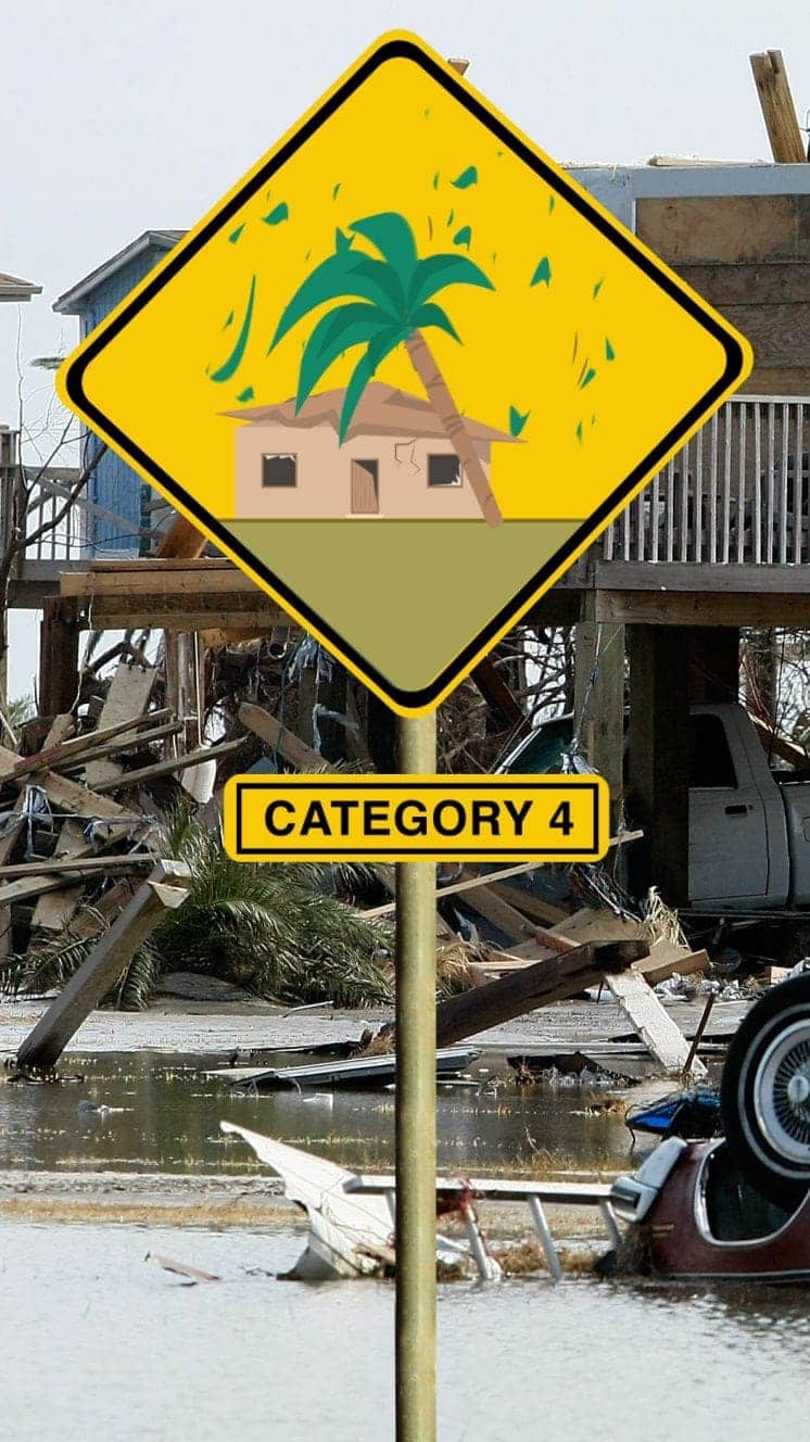
Winds 209-251km/h
Some roofs destroyed and major structural damage to houses.
Storm surge +4m-5.5m
Hurricane Ike (2008) hit Caribbean islands and Louisiana and was blamed for at least 195 deaths
Winds 252km/h+
Serious damage to buildings, severe flooding further inland.
Storm surge +5.5m
Hurricane Irma (2017) caused devastation in Caribbean islands, leaving thousands homeless
"For everyone thinking they can ride this storm out, I have news for you: that will be one of the biggest mistakes you can make in your life."
Mayor of New Orleans Ray Nagin ahead of Hurricane Gustav, 2008
Is global warming to blame?
The relationship between climate change and hurricanes is a complex one.
Warmer seas power hurricanes. So as the temperature of ocean water goes up, we might expect the intensity of hurricanes to increase in future.
A hotter atmosphere can also hold more water, so this should allow hurricanes to dump more water on affected areas.
But there are so many factors that contribute to these rare events, it has been difficult to tease out clear trends from the data.
- Attribution
- Published12 September 2018