Data to expose 'sleeping ice giant'
- Published
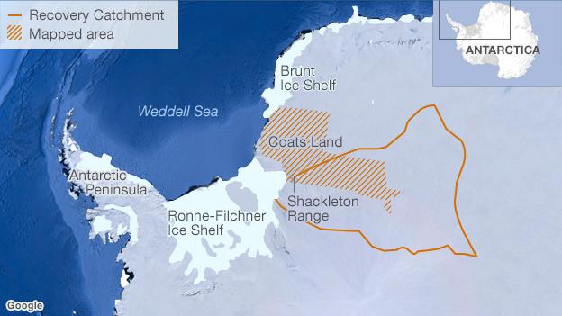
The Recovery Catchment is a large section of the East Antarctic Ice Sheet
Scientists have finally begun mapping one of the least explored regions of Antarctica - the Recovery Catchment.
The new survey data should reveal how this vast tract of ice in the east of the continent is likely to respond to a warming world.
Recovery is currently perfectly stable, but any change could have significant global impact because it contains the equivalent of 2.5-3m of sea-level rise.
The ICEGRAV project is trying to determine its vulnerabilities.
"In some senses, this huge Antarctic feature is a sleeping giant," said Dr Fausto Ferraccioli from the British Antarctic Survey.
Dr Fausto Ferraccioli: "The ice sheet is in excess of 3km thick"
"We want to understand the circumstances that might disturb it," he told BBC News.
Dr Ferraccioli was speaking here in San Francisco at the American Geophysical Union Fall Meeting together with Prof Rene Forsberg, of the Danish National Space Institute, and Dr Kenichi Matsuoka, of the Norwegian Polar Institute.
They were using the event to give a progress report on ICEGRAV, an international collaboration that also includes Argentina, and has partial economic support from the US.
The project has flown a plane packed with instruments over a large section of the Recovery Catchment, which extends from a point known as Dome A, deep in the ice sheet's interior, all the way to the coast, where glaciers feed the Filchner and Ronne ice shelves in the Weddell Sea.
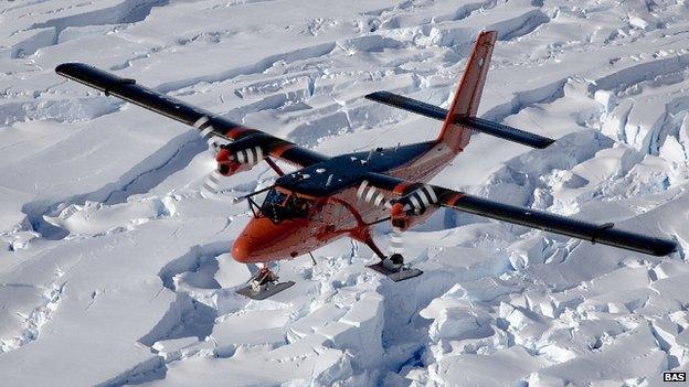
The Recovery Catchment would have significant global impact if it were to melt
The aerogeophysical campaign's first data products, presented to AGU, are maps showing variations in gravity, magnetism and ice thickness across the region. The data provides details not possible to observe from satellites. The European Space Agency's Goce mission, falling from the skies only a few weeks ago, has left a big gap in Antarctica, only possible to observe from aircraft.
Taken all together, this data will provide a profile of Recovery from the top of the ice right down to the crust. Like a doctor using a sophisticated medical scanner, the ICEGRAV scientists will then attempt to diagnose the future health prospects for the catchment.
A key quest is to describe the shape of the underlying rock bed, as this will influence how Recovery responds to any melting at the coast.
Under some global warming scenarios for the end of the century, warm water from the Southern Ocean is expected to penetrate deep into the Weddell Sea, eroding the base of its ice shelves.
This could accelerate ice discharge from the Recovery catchment and potentially affect the stability of the East Antarctic Ice Sheet.
"If we then find the rock bed dips away from the grounding line at the coast towards the interior, we could get something called marine ice-sheet instability," explained Dr Ferraccioli.
"What this means is that once you have warm water getting into the system, there is little to stop further retreat of the ice sheet.
"This is one of the most critical questions we have about Recovery: what is the shape of the bed near the ice sheet's grounding line?"
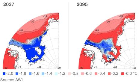
Modelling suggests warm water could push deep into the Weddell Sea
The ICEGRAV Twin Otter aircraft that mapped part of the region during the last Antarctic summer season flew a total of 30,000km from an inland camp supported by the Norwegian Polar Institute.
"Satellite techniques found many subglacial lakes in this region and the new ICEGRAV dataset is crucial to reveal their characteristics and impact on ice flow," said Dr Matsuoka.
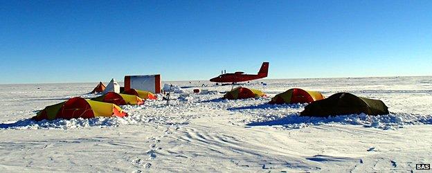
The survey work required a field camp be established deep in the ice sheet’s interior
The Germans are extending the coverage this season with a Baseler plane operated by the Alfred Wegener Institute. And the Americans will complete the work using their instrumented LC130 Hercules, flying a two-season campaign, starting perhaps the season after next.
Prof Robin Bell, from the Lamont-Doherty Earth Observatory, at Columbia University, New York, will lead the US effort.
"On our existing bed maps, [Recovery Catchment] looks - as I like to say - like 'pancake land' because we don't know much about it. But it's one of those places where warm water could reach fairly far into the ice sheet. Some of the other pancake lands we haven't mapped on the continent appear to be pretty high, so they're not so much of a concern.
"I've always thought this area is an Achilles heel for East Antarctica, but until we have the data we won't know that for sure," she told BBC News.
More knowledge than just the potential ice dynamics of Recovery will come out of the survey.
It will also help scientists interpret geology near the coast that is thought to be a record of the ancient supercontinents.
On the northern edge of Recovery Glacier, close to the coast, is the Shackleton mountain range, which contains scraps of ocean floor that have been lifted and exposed. These rocks represent a major suture - an imprint of when the land masses came together to form the giant continent Gondwana about 500 million years ago.
And further north still, in so-called Coats Land, there are rocks that probably pinned together East Antarctica and North America when they were joined in the supercontinent Rodinia some one billion years in the past.
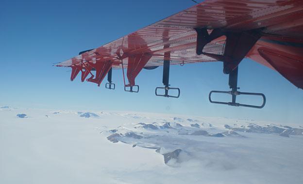
The Shackleton mountain range holds clues to the evolution of the continents
Jonathan.Amos-INTERNET@bbc.co.uk and follow me on Twitter: @BBCAmos, external
- Published8 March 2013
- Published5 December 2011
- Published17 November 2011
- Published3 March 2011