Latest EU Sentinel satellite debuts ocean and land images
- Published

On the cusp of darkness: Svalbard is to the right; a mass of sea-ice to the left. Sentinel-3a's altimeter will help monitor sea-ice conditions in the far north
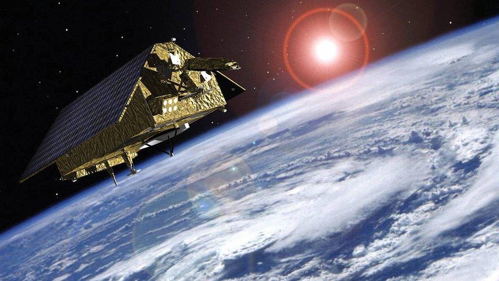
The EU's latest Earth observer has returned its first pictures.
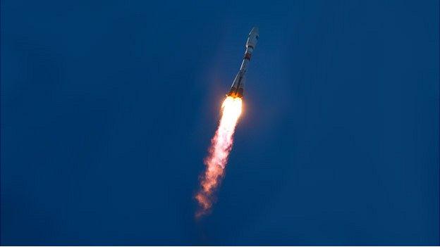
Sentinel-3a, which was launched two weeks ago, external, will have a special focus on the oceans, measuring the colour, temperature and height of sea surfaces.
The information will be invaluable to weather forecasters, and to marine biologists trying to understand the health of global waters.
The first images show the Strait of Gibraltar, the Californian coast, and an ice-covered Svalbard archipelago.
They were acquired by the spacecraft's Ocean and Land Colour Instrument, OLCI.
As the name suggests, this sensor is not solely devoted to ocean work, and will gather data about land surfaces as well, monitoring the state of vegetation across the planet, for example.
"We received the first images on 29 February, but we've had to spend a bit of time working on them to get the calibration right," said Volker Liebig, the director of Earth observation at the European Space Agency (Esa).
"We're not ready with everything onboard the satellite yet, that's clear; but we thought it important to get the pictures out there," he told BBC News.
A few months of testing still lie ahead before the spacecraft begins routine observations.

Strait of Gibraltar: See the sediment in the seawater along the southwest coast of Spain. Marine biologists will use 3a's data to study the productivity of the oceans
Sentinel-3a is one in a series of satellites being procured for the European Union's Copernicus programme, external.
The data from this multi-billion-euro project is expected to drive myriad applications, ranging from air quality updates to crop-performance monitoring, from water-resource management to transport infrastructure planning.
Esa acts as the technical agent, scoping the design of the satellites and then getting industry to build them.
For Sentinel-3, all the follow-on models - b, c and d - have already been contracted, meaning there should be operational continuity in orbit extending through to at least 2030.
As well as OLCI, the new satellite has a radiometer to measure the temperature of ocean and land surfaces, and an altimeter to measure ocean height.
Together, these two instruments will be useful for tracking phenomena such as El Nino, which sees warm waters bulge in the eastern Pacific every few years. The current event - one of the largest on record - has triggered a disruption in weather patterns worldwide.
It is no surprise then that Europe's national meteorological agencies, external are particularly keen to get their hands on Sentinel-3 data, to use in their numerical forecasting models.
"Yes, Sentinel-3 is an ocean workhorse, but it's also a global workhorse," said Esa senior scientist Dr Craig Donlon.
"The vegetation products we'll get from OLCI in 21 bands will be really excellent, so there will be a huge amount we'll get out of it just looking at land surfaces. And then there's all the work it will do measuring ice surfaces, and rivers and lakes using its altimeter," he told BBC News.

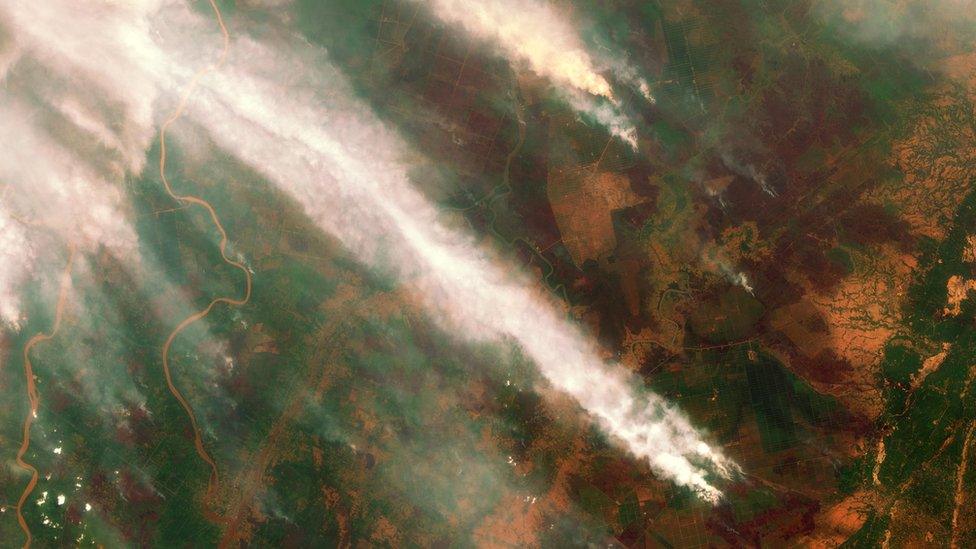
Southern California and the Baja Peninsula: Sentinel-3a will also track vegetation states, and even land fires using its temperature sensor
Sentinel-3a joins two other series satellites already in orbit.
Sentinel-1a was launched in 2014 and is equipped with a radar to measure the shape of the Earth's surface; Sentinel-2a, which went up last year, has a colour camera to record how the land surface is being used and how that changes over time.
More Sentinels are coming, and the European Commission and Esa have even started to think about extending the initial suite of sensors.
There is a desire for Europe to have some kind of space-borne carbon-monitoring capability - a tool to check that countries are implementing policies to reduce emissions of carbon dioxide and other greenhouse gases.
"This would be a multi-satellite mission," said Prof Liebig.
"The idea would be to have a first prototype satellite by 2025, let's say; and then a full system around 2030. But if we want to achieve this we have to start in this (EU) financial perspective."

The European-funded Sentinel series

Four Sentinel-3 satellites have been ordered, assuring operational continuity in orbit extending through to at least 2030
The Sentinels represent the world's most ambitious Earth observation project
Sentinel-1: Radar satellite that can see the Earth's surface in all weathers
Sentinel-2: Colour camera dedicated to study principally land changes
Sentinel-3: Multi-wavelength detectors tuned to observe ocean behaviour
Sentinel-4: High-orbiting sensor to measure atmospheric gases
Sentinel-5: Low-orbiting atmospheric sensor to help monitor air quality
Sentinel-6: Future version of the long-running Jason sea-surface height series
What is the Copernicus programme?
EU project that is being procured with European Space Agency help
Pulls together all Earth-monitoring data, from space and the ground
Will use a range of spacecraft - some already up there, others yet to fly
Expected to be invaluable to scientists studying climate change
Important for disaster response - earthquakes, floods, fires etc
Data will also help design and enforce EU policies: fishing quotas etc

OCLI has 21 distinct bands, a spatial resolution of 300m and a swath width of 1,270km
Jonathan.Amos-INTERNET@bbc.co.uk, external and follow me on Twitter: @BBCAmos, external
- Published25 February 2016
- Published3 December 2015
- Published11 May 2015
- Published3 April 2014
- Published2 April 2014


