Weathering the rain and shine of 2012
- Published
BBC Scotland weather presenter Christopher Blanchett looks back at the last twelve months
It has been a year to remember weather-wise, but for all the wrong reasons.
We started January with a storm. 102mph winds were recorded in the capital on 3 January with disruption across the central belt and north east.
The most damaging winds were thanks to a phenomenon called a "sting jet". A mechanism within the atmosphere that develops at a height of about 3 miles.
It is associated with rapidly deepening areas of low pressure - or explosive lows. Rare and difficult to forecast, it is characterised by a sting "tip" of cloud (the cloud head) that can be seen on satellite imagery. The tip is where the air comes from, much like the bullet from a gun.
The winter on the whole was much less cold compared with the previous two. Less disruption on the road and rail network, although the ski centres were left a little disappointed after the previous two bumper seasons.

Temperatures reached record highs in March
In fact they switched to their "summer mode" a month early. Great for walking, but the skis were quickly packed away.
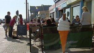
The spring ushered in a mini heatwave. The mercury soared to 23.6C in March across parts of Aberdeenshire. For a time, we were hotter than Greece.
It was thanks to a large high pressure system scooping up heat in Africa and delivering it to us here in Scotland. We broke the record for the hottest March day ever recorded in Scotland.
A week later though, Aboyne had snow.
And of course, the heat didn't last and April showers soon followed. Some fairly potent too.
Low pressure
There was always the hope though that summer would deliver. It delivered rain, wind and floods.
Early on in the season the jet stream was much further south than usual. This ribbon of fast flowing air up in the atmosphere helped guide low pressure systems full of rain and wind, right across the country.

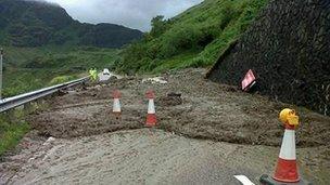
A summer landslip closed the A83 at the Rest and Be Thankful in Argyll
There were landslips, transport disruptions and frustration from thousands of families - who just wanted to enjoy the summer holidays.
For some though it was a golden summer. The Highlands and Islands were in drought. Dry, balmy days great for tourism, but less so for the environment. Parched land led to wildfires, some whisky distilleries struggled to produce, with dried up water supplies.
For most of Scotland it was a summer to forget. No more so than for the farmers who were left with water-logged fields and rotting crops.
The statistics show it was only the 7th wettest summer on record in Scotland. No comfort to those who flooded, with some areas seeing 250% of their normal rainfall.
The wet conditions also had an impact on the native wildlife, although wild flowers thrived.
Wintry flurries
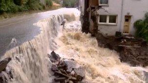
The autumn was no better. Rain and floods became too regular for comfort. There were some astonishing pictures of homes almost washed away and streets turned to rivers.

Streets turned to rivers during flooding in Dura Den in Fife in October
Even now, the end of the year is far from calm. We've seen sea defences damaged in high winds and even higher waves.
This weekend, there is still plenty of wind rain and warnings as several weather fronts sweep in, running up against a massive area of high pressure over Russia, stagnating the rain overhead and whipping up the wind.
And what about Christmas? White or rain? Well it looks like average temperatures, some rain in the west but drier in the east. Thankfully the rain shouldn't be too heavy and persistent.
There is though the chance of a few wintry flurries in the north west, as colder air feeds in. Perhaps a white Christmas for some after all?