Sentinels in constant watch on mighty polar glaciers
- Published

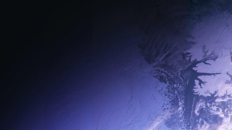
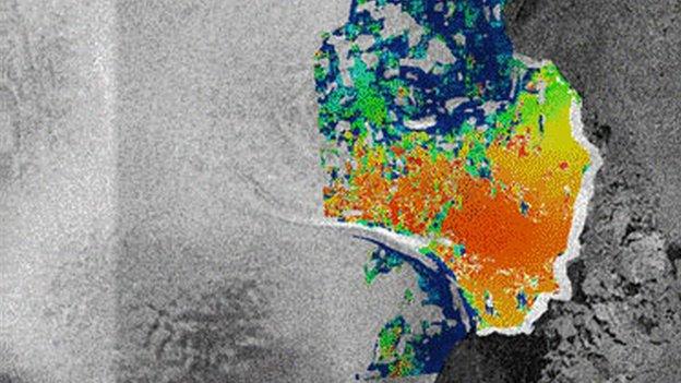
Nioghalvfjerdsfjorden flows off northeast Greenland
The EU's Sentinel satellite system has begun monitoring six mighty polar glaciers in near real-time.
The sextet - Pine Island and Thwaites in Antarctica; and Jakobshavn, Nioghalvfjerdsfjorden, Zacharae Isstrom and Petermann in Greenland - are major contributors to ongoing sea-level rise.
They are thinning and flowing faster, and scientists believe some of them have become unstable.
Routine observation should pick up any sudden changes in behaviour.
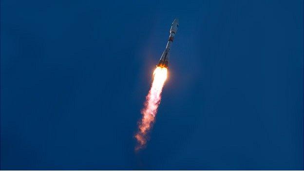
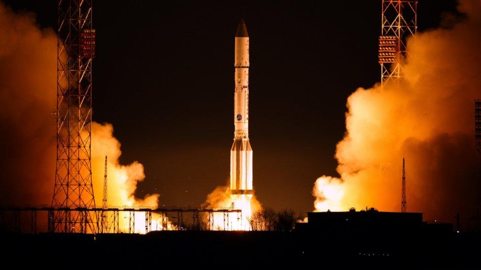
The data is currently being gathered by the Sentinel-1a spacecraft, but it will be assisted soon by a sister platform, Sentinel-1b, which the European Space Agency will launch on Friday.
Both have radar instruments that are able to see the glaciers' surfaces day or night, and in all weathers.
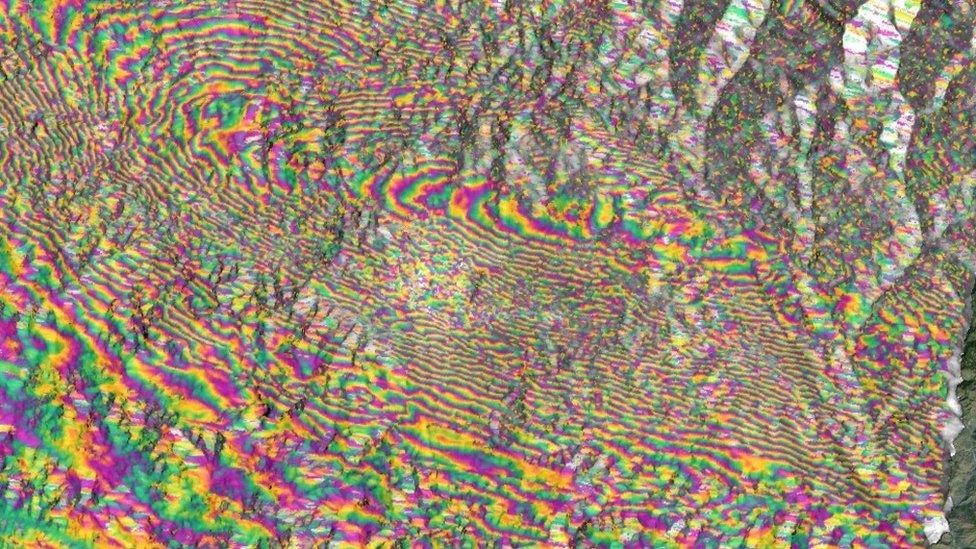
They can track activity by keeping a watch on the velocities of crevasses as they move towards the ocean.
The UK's NERC Centre for Polar Observation and Modelling, external (CPOM) has just sent live a new web portal, external that all researchers can access.

Pine Island Glacier is vast, covering an area about two-thirds the size of the UK
Using only Sentinel-1a data for the time being, the service will provide a snapshot of behaviour at least every 12 days. When Sentinel-1b comes online in a few months, the image cycle should improve to once every six days.
"The widespread coverage and short repeat period of Sentinel-1a has revolutionised the way we can observe glaciers around the world," said Dr Anna Hogg from Leeds University.
"This first satellite in Europe's Copernicus programme is a fantastic new resource, and is proving to be a critical tool for monitoring changes in Antarctic and Greenland ice flow. Things will only get better when Sentinel-1b joins the fray."
The intention is to bring more glaciers into the programme over time. This will be easier when 1b is up and working following a period of commissioning.
"The first step is to focus on areas of known dynamical imbalance - and, certainly, these six glaciers are key contributors to sea-level rise," explained CPOM colleague Prof Andrew Shepherd.
"The next step is to expand the service. Future sea-level projections really only allow for imbalance in places we know about today. There are ice streams that may not have activated yet, and that's why we'd like to routinely monitor perhaps 20 to 30 other sectors of Antarctica and Greenland.
"That's our intention, together with Esa as part of their climate change initiative, external."

Jakobshavn flows right to left in this image. It sheds some spectacular icebergs
An Austrian team is developing a similar service, and here at the European Geosciences Union General Assembly this group, known as ENVEO, external, showcased some of its own ice velocity maps, external. It has some very impressive static (averaged over time) renderings of Antarctica and Greenland.
One important difference with ENVEO's near-real-time service when it goes live will be the tools provided to users.
"The amount of data from Sentinel even now is overwhelming, and it makes it quite hard to get the information out that you want," explained Dr Jan Wuite.
"It never used to be a problem but with these maps being produced every 12 days, and soon every six days - it is. That makes it very necessary to get hold of this data with special tools and that's what we're developing."

The radar observations build velocity maps by tracking the progress of crevasses
Nioghalvfjerdsfjorden and Zacharae Isstrom are two big glaciers that enter the ocean next to each other in the northeast of Greenland. Together they make up 12% of the Greenland ice sheet. Zacharae Isstrom hit the headlines in November last year. A report said it had broken loose from a stable position held in 2012 and was now in an accelerated retreat. The northeast of Greenland has only recently attracted attention because the most vulnerable regions of the ice sheet were always considered to be much further south.
Jakobshavn is sited in southwest Greenland. Not only does it move very fast (at times over 17km a year), but it is also retreating rapidly inland, at a rate of many hundreds of metres per year. Periodically, it displays spectacular calving behaviour. Billions of tonnes of icebergs are shed from its front every year and move out of the fjord towards the Atlantic. Jakobshavn is thought to have spawned the big block of ice that sank the Titanic.
Petermann is in the northwest of Greenland. It is another producer of spectacular icebergs. Some are so big they are referred to as "ice islands". In 2010 it produced a block 260 sq km in area. In 2012, a 130-sq-km piece came away. Calving is part of the natural life cycle of ocean-terminating glacier. But ongoing monitoring and in-situ research will establish if any of the drivers are changing, and how.
Pine Island Glacier in West Antarctica is contributing more to sea-level rise than any other ice stream on the planet. It drains an area of 160,000 sq km, which is roughly two-thirds the size of the United Kingdom. The geometry of the rock bed under Pine Island makes it unstable, and scientists believe it is now in a self-sustaining retreat that could contribute on the order of perhaps 3.5-10mm to global ocean rise in the next 20 years.
Thwaites Glacier is in the same part of West Antarctica as Pine Island and of similar size. It too has experienced significant retreat since the early 1990s. Its grounding line - the point where its leading front lifts off the bed and floats - has gone backwards some 15km. Continuing retreat will eventually take this line over a sill, which would then expose the deep-seated interior mass of the glacier to a potential runaway collapse.

ENVEO's "static" map of Greenland: Its portal will have tools to help navigate the data

Sentinel-1a is about to be joined by its sister satellite, Sentinel-1b
Jonathan.Amos-INTERNET@bbc.co.uk, external and follow me on Twitter: @BBCAmos, external
- Published30 January 2016
- Published29 April 2015
- Published2 March 2016
- Published8 May 2014
- Published3 April 2014