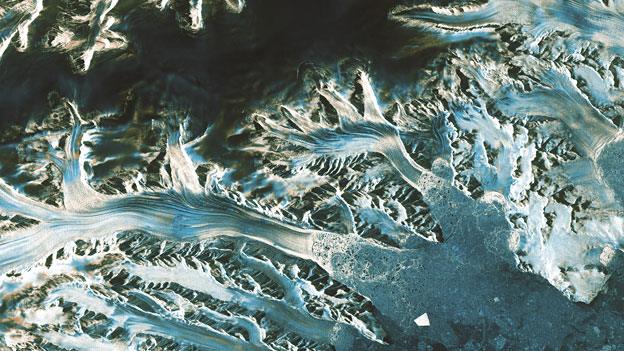
Cryosat spacecraft's ice vision is boosted
- Published
The new method delivers much more detail, at much greater speed
European scientists have found a way to super-charge their study of the ice sheets in Antarctica and Greenland.
The novel technique boosts the data about height changes that are gathered by radar instruments on satellites.
Known as swath altimetry, it permits researchers to see broader regions of the ice sheets in any one pass overhead, and at a much finer scale.
Areas of melting or accumulation can now be investigated with 100 times more information.
The new approach has so far been applied only to a small set of data acquired by the Cryosat spacecraft.
But the intention eventually is to go back and reprocess the entire six-year archive of observations made by this European Space Agency (Esa) mission.
Swath altimetry will totally change the way scientists are able to study some phenomena, says Dr Noel Gourmelen from Edinburgh University, UK.
"The temporal and spatial improvements mean that if we have a surge in a glacier, it now makes it much easier to look at where that event initiated. Did the whole glacier start moving at once? Or did the change start at the ocean, meaning the ocean was having an impact on the glacier? Or perhaps it was further back, meaning different processes were involved. Now, we're better able to trace the history and the causes of the surge," he told BBC News.
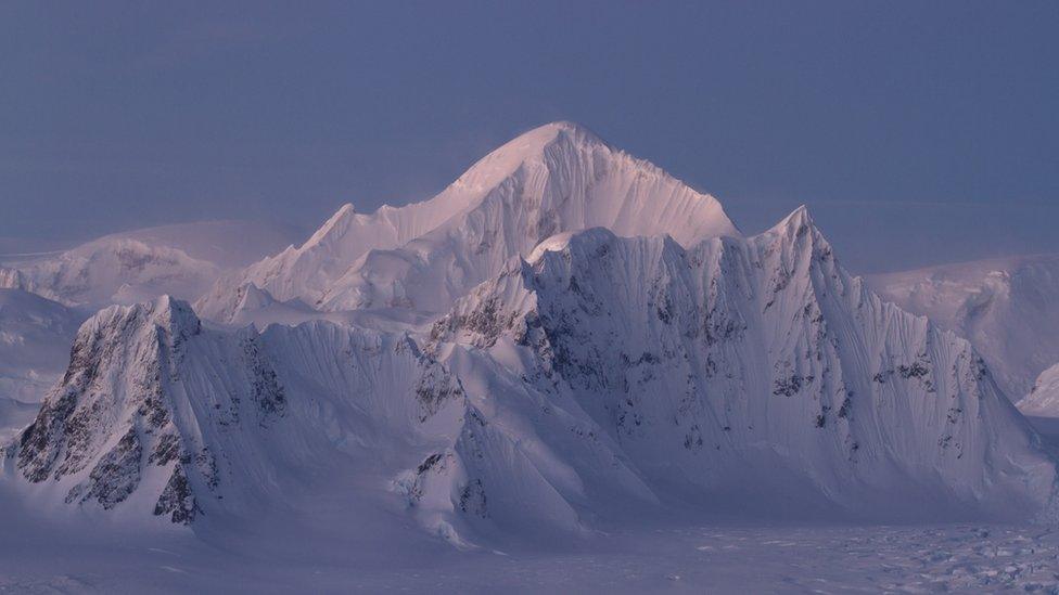
Radar missions have traditionally struggled to map the rugged terrain at the edges of the ice sheets
To be clear, swath altimetry changes nothing about how Cryosat operates - only in the way its data is processed.
The spacecraft already has a special radar designed to meet the peculiar challenges of observing ice sheets.
With its twin antennas, the instrument can work in an interferometric mode, detecting not just the distance to a spot below it on the ice but also the angle to that location.
Without this ability, it would struggle to map effectively the steep slopes and ridges found at the edges of the ice sheets - the very locations where recent melting and thinning have been most pronounced.
Broader brush
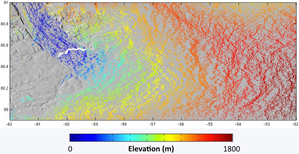
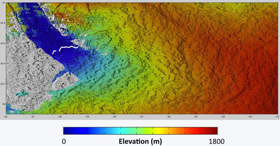
But even in this improved mode, standard data processing concentrates on the nearest radar echo return point and ignores much of the energy in the rest of the signal. Swath processing, on the other hand, unpacks it all, revealing a line of additional elevation points.
It is now possible to see more of the shape of a depression or valley, not simply the rim or ridge that surrounds it. And because the "brush" of detection is much broader, it takes less time to "paint" the map of an ice sheet.
"We can now see detail that was simply not possible before," said Cryosat's principal scientific advisor from Leeds University, Prof Andy Shepherd.
"We can now map with about 500m spatial resolution the elevation and elevation change of Antarctica and Greenland, and other ice caps and glaciers across the globe."

The power of swath altimetry
The images below of the Petermann Glacier in northwest Greenland show the effect of standard processing versus the new swath approach. The latter pulls out far more elevation information from the radar signal.

The new swath mode has been a major talking point here in Prague at the European Space Agency's Living Planet Symposium, external, as has the the future of Cryosat itself.
Its radar measurements are highly valued, and are credited with having transformed studies of the Arctic, the Antarctic and Greenland.
But the mission is now operating beyond its design lifetime and could die in orbit at any time.
Researchers have urged Esa and the European Commission to find the means to fund a follow on.
Dr Andrew Fleming from the British Antarctic Survey said if its strand of information was lost with no suitable replacement, it would send many researchers "to bed in tears".
Outgoing Esa Earth observation director, Prof Volker Liebig, said there was no plan for a direct successor, and there was insufficient time to build one even if the money was available.
But the idea that the commission could launch a similar satellite in its Sentinel series of spacecraft in the 2020s was now being discussed, he added.
Prof Liebig said there was no denying the importance of a Cryosat capability, particularly in studying Arctic sea-ice.
"[Cryosat] is a mission that has a geopolitical meaning because the Arctic is the place that will change most in our lifetime as a result of climate change," he told the symposium.
"Plus two degrees [in temperature increase] worldwide means plus six degrees or even 10 degrees at the poles. I've even seen some statements of plus 15 degrees. And this means that by mid-century, in only 30 years from now, Arctic sea-ice will have disappeared completely in summertime."
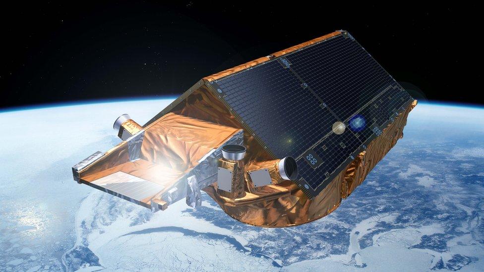
Artist's impression: Cryosat, with its radar altimeter, was launched into orbit in 2010
Jonathan.Amos-INTERNET@bbc.co.uk, external and follow me on Twitter: @BBCAmos, external
- Published22 April 2016
- Published24 March 2016
- Published17 December 2015
- Published26 October 2015
- Published19 May 2014
