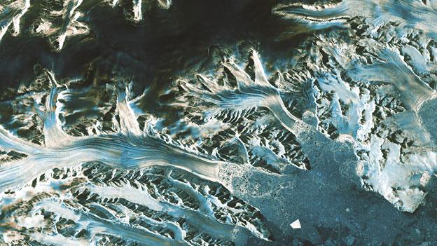
Call for dedicated polar Sentinel satellite
- Published
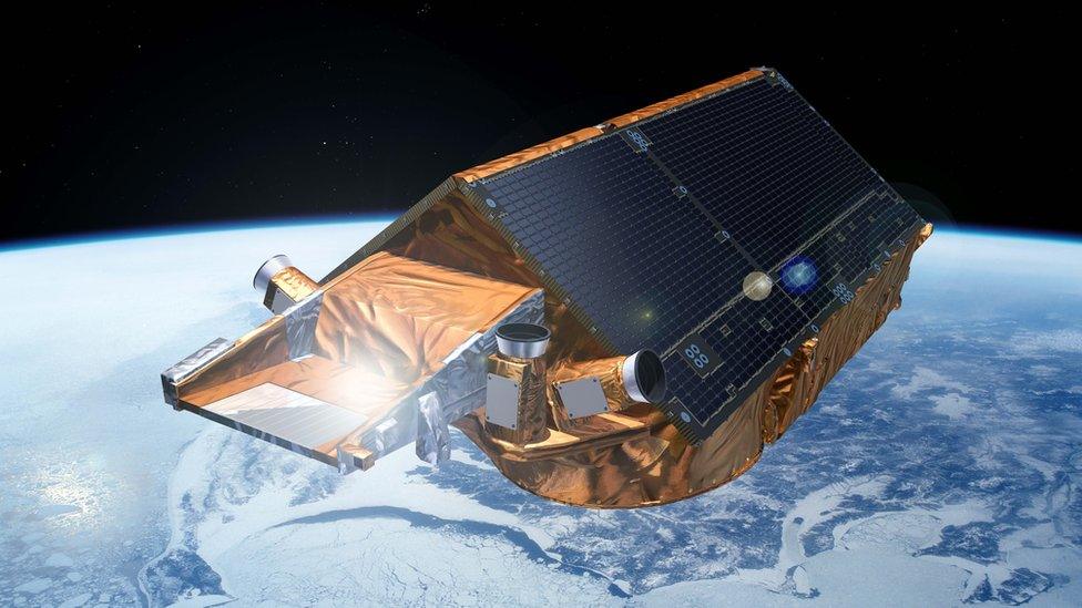
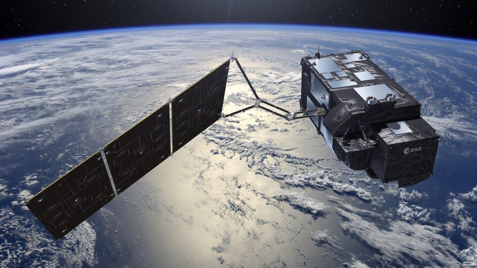
Artist's impression: Cryosat is the only satellite in the world dedicated to the study of Earth's major ice fields
European scientists are worried they could soon lose a vital tool for monitoring Earth's ice fields.
The Cryosat-2 radar spacecraft has transformed studies of the Arctic, the Antarctic and Greenland, but is now operating beyond its design lifetime.
A group of 179 researchers is concerned the ageing mission could die in orbit at any time.
They have urged the European Commission (EC) and the European Space Agency (Esa) to start planning a replacement.
"The mission is now central to international efforts to monitor the state of the cryosphere," they write in a letter to top officials at the EC and Esa.
Cryosat-2 was launched in 2010 on what was initially supposed to be just a one-off, three-and-half-year observation of marine and land ice - to get a snapshot of any gains and losses.
But the performance of the spacecraft's mapping instrument - its SAR/Interferometric Radar Altimeter (Siral) - has exceeded all expectations, and made for some compelling data-sets.
The satellite has delivered the first complete assessment of Arctic sea-ice thickness and volume, as well as the most precise measurements yet of the volume and mass of the great ice sheets covering Antarctica and Greenland.
It is a capability the scientists are loath to give up.
"Over recent years, the Esa Cryosat-2 satellite has significantly improved our understanding of how polar ice sheets - in particular, the West Antarctic Ice Sheet (WAIS) - are changing and contributing to current global sea-level rise," said letter signatory Prof David Vaughan, the director of science at the British Antarctic Survey.
"Many of the recent improvements in the models we use to predict the future of the WAIS were driven by the requirement to accurately simulate Cryosat's observations. So maintaining the record of ice-sheet change in future decades will be vital if we are to achieve the most rapid possible improvements in future projections of sea-level rise," he told BBC News.
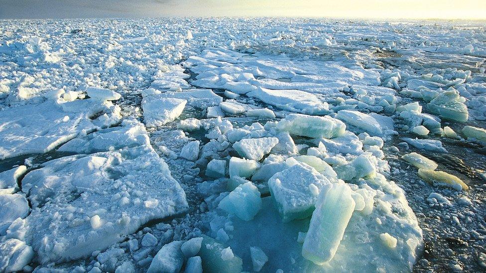
Cryosat produces a constantly updated assessment of the thickness/volume of Arctic sea-ice
How long Cryosat-2 can keep working is anyone's guess. It has enough fuel to sustain itself into the early 2020s but component failure in the harsh environment of its orbit, 720km above the Earth, is an ever-present risk.
If there is to be a Cryosat-3, it will not come directly out of the Esa stable. The agency's job is to develop new technologies; its remit does not extend to funding ongoing, repeat missions.
This means a successor would fit better within the Copernicus series of satellites - known as the Sentinels - which are currently being rolled out by the European Commission, paid for by EU member states; Esa participates only as the technical advisor.
One of these new platforms, Sentinel-3, can do some work in polar regions: it has a radar altimeter to sense ice surfaces, too. But the spacecraft's orbit does not reach the same heights, meaning its data contains a 1,860km-wide "hole" at northernmost and southernmost latitudes. This makes it blind to most Arctic sea-ice, for example.
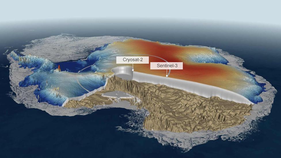
"Data hole": Satellites do not fly directly over the pole, but Cryosat-2 gets closest
Additionally, Sentinel-3's radar does not operate in a so-called interferometric mode. This is the capability that allows Cryosat to measure the slopes and ridges at the edges of the ice sheets, where losses in Antarctica and Greenland have been most pronounced.
"The Copernicus programme is a phenomenal achievement for Europe and Sentinel-3 will be doing vital work, especially over the oceans, but we'd really like to see Copernicus incorporate a proper polar Sentinel," said Prof Andy Shepherd, the principal scientific advisor to the Cryosat mission.
The EC has so far procured a total of six Sentinels. Sufficient numbers of satellites have been ordered to maintain continuous observations of a range of environmental indicators on Earth through to 2030.
The Commission had also initiated an "evolution" programme to consider how the initial fleet could be broadened, said Dr Josef Aschbacher, the head of programme planning and coordination in Esa's Earth observation directorate.
He is helping to shape the agency's response to the scientists' letter.
"We have been working with the Commission on defining an extension of the current family of Sentinels, beyond the first six missions - towards a Sentinel-7, 8 and 9, and so on," he told BBC News.
Prof Andy Shepherd explains the changes seen by CryoSat since 2010
"On the Esa side, we have prepared a list of possible candidates and one of them is a continuation of Cryosat measurements. I should stress this is purely from an Esa perspective; it is the Commission that is in charge of prioritisation.
"At some point in time, which is not yet defined, they will make a decision on that list having consulted users and evaluated their policy priorities."
The scientists are hoping for a swift process with a positive outcome. They want to avoid the gap in observations that would arise if Cryosat-2 fails and a successor is not ready.
"A continuation assures a consistency in the estimates of the contribution of ice sheets to sea level change using altimetry," explained Prof Angelika Humbert from the Alfred Wegener Institute for Polar and Marine Research, Germany.
"The highly sophisticated processing scheme and the error estimates are established already. In short, we know the sensor well; we've already got quite far with whatever we can squeeze out from its signals and the most benefit, with most efficiency, would come from continuing the mission."

The EU-funded Sentinel series
Sentinel-3 will do a job in polar regions but its observations are not optimised for these observations
The Sentinels represent the world's most ambitious Earth observation project
Sentinel-1: Radar satellite that can see the Earth's surface in all weathers
Sentinel-2: Colour camera dedicated to study principally land changes
Sentinel-3: Multi-wavelength detectors tuned to observe ocean behaviour
Sentinel-4: High-orbiting sensor to measure atmospheric gases
Sentinel-5: Low-orbiting atmospheric sensor to help monitor air quality
Sentinel-6: Future version of the long-running Jason sea-surface height series
What is the Copernicus programme?
EU project that is being procured with European Space Agency help
Pulls together all Earth-monitoring data, from space and the ground
Will use a range of spacecraft - some already up there, others yet to fly
Expected to be invaluable to scientists studying climate change
Important for disaster response - earthquakes, floods, fires etc
Data will also help design and enforce EU policies: fishing quotas etc

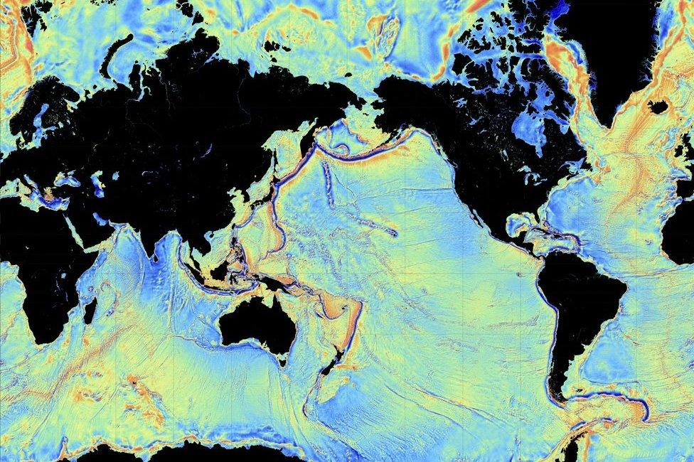
Cryosat's measurements of sea-surface height have produced our clearest view yet of the shape of the ocean floor
Jonathan.Amos-INTERNET@bbc.co.uk, external and follow me on Twitter: @BBCAmos, external
- Published2 March 2016
- Published17 December 2015
- Published26 October 2015
- Published19 May 2014
