Eighteenth century maps of Staffordshire digitised
- Published

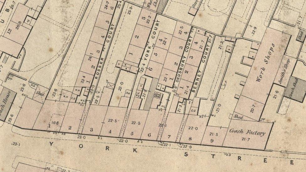
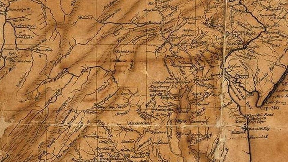
The enclosure maps depict the landscape of fields, roads and buildings
Hundreds of maps dating back to the 18th century have been digitised for online use under a history project.
Staffordshire County Council's Archives and Heritage Service was able to modernise the collection of maps after receiving a grant.
The large-scale items, from between 1738 and 1884, depict fields, roads and buildings.
Half of the 200 enclosure maps are now available to view online, external, with more set to be uploaded.
Enclosure was the process of dividing common land into enclosed fields.
The digitisation is part of a project in which a new £5.4m history centre will be built in Stafford.
The project was made possible by charity Friends of Staffordshire and Stoke on Trent Archive Service, external (FoSSA), and funded by a grant from the Midland Ancestors Society.

The surviving maps relate to enclosures in the 18th and 19th centuries
Richard Totty, chairman of FoSSA, had praised the quality of the digitisation and described the maps as an "excellent source" for local and family historians, which had previously been underused.
Councillor Julia Jessel, from Staffordshire County Council, added that the authority was "incredibly proud" of its heritage and the "fascinating" archive collection.
"This is an exciting development, giving access to our collections that will give us an even better insight into what life was like in Staffordshire during those centuries," she said.
"The fact that they are now available online means that for the first time they are available for everyone to see."

Follow BBC West Midlands on Facebook, external, Twitter, external and Instagram, external. Send your story ideas to: newsonline.westmidlands@bbc.co.uk, external
Related topics
- Published30 September 2015
- Published8 June 2019
- Published6 June 2019

- Published20 August 2018
- Published31 May 2018