Pictures: Tolkien's Middle-earth map goes on display
- Published
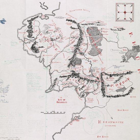
The map itself was drawn for in 1954 by Tolkien’s son Christopher. It was included at the back of the first two volumes of The Lord of the Rings. Most of the scribbles on it are from Tolkien himself.
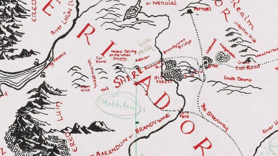
The Shire, home of the Hobbits, is located in the north-western part of Middle-earth on the map. It's where Frodo and Bilbo Baggins started both of their epic adventures.
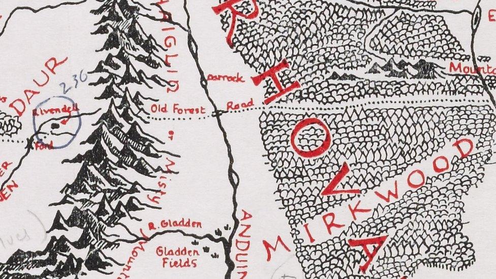
To the west of the Misty Mountains is Rivendell, the home of the elves. Mirkwood lies to the east. It's not for the faint hearted. Mirkwood is a forest full of monsters, including giant spiders.
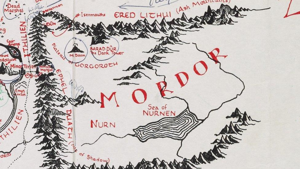
Mordor is where the Orcs, controlled by Sauron, were made. It is also where Mount Doom is located. The hobbits were trying to get to Mount Doom, in order to destroy the ring. Can you spot Mount Doom?
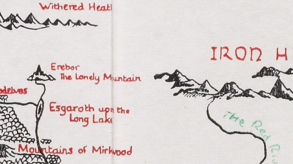
The Lonely Mountain was originally the home of Dwarves, but then Smaug the dragon moved in he kicked them all out. Smaug became obsessed with the Dwarves' gold.
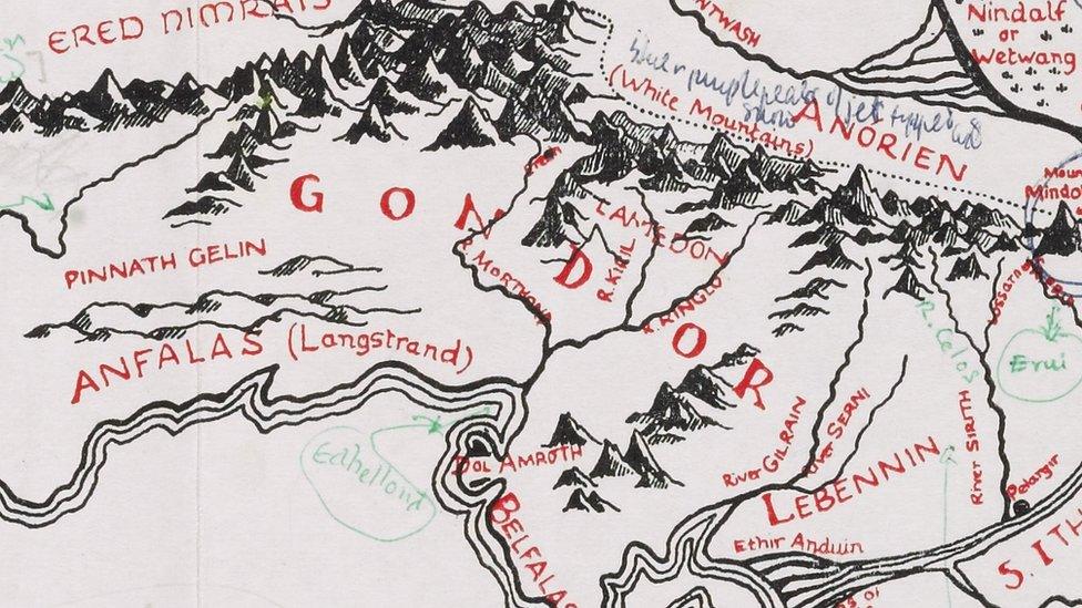
Aragon, who helped Frodo destroy the ring, was the ruler of Gondor. The kingdom where people live.
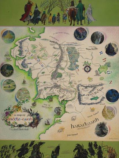
Illustrator, Pauline Baynes created this poster in 1970 based on the original map.
- Published2 December 2013
- Published3 April 2013
- Published22 September 2011
